
Appapara or Appappara is a small village in Wayanad district of Kerala state, India.

Appapara or Appappara is a small village in Wayanad district of Kerala state, India.
Appappara is located on the border between Kerala and Karnataka near to near Thirunelli Temple . [1] [2]
The nearest schools are Government Highschool Kattikkulam and Ashram school, Thirunelli.
Appapara is part of Thirunelli panchayath. The pin code for Appapara village is 670646 . [3]
There is one St. George Church in Appappara. It comes under the Syro Malabar church of Mananthavady. [4]

Brahmagiri, is a mountain range in the Western Ghats of south India. It is situated on the border between Kodagu district in Karnataka state in the north and Wayanad district of Kerala state on the south. Brahmagiri Hill, at 1608 m height, is a scenic tourist attraction. The top of Brahmagiri Hill is well forested and has much wildlife.
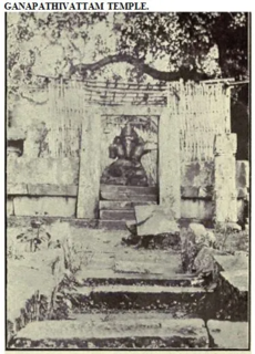
Sultan Bathery or Ganapathy Vattam is a town and municipality in Wayanad district of Kerala, India, near the borders with Tamil Nadu and Karnataka states. The largest town in Wayanad district, it is the headquarters of Sultan Bathery taluk.

Peravoor is a small town and Grama Panchayat in Kannur district of Kerala state in India. It is located 50 km (31 mi) east of Kannur and 40 km (25 mi) north east of Thalassery. And Iritty, the nearest municipality is 14 km (8.7 mi) north of Peravoor. Peravoor is situated in the Western Ghats mountain range.

Thirunelli Temple is an ancient temple dedicated to Lord Maha Vishnu on the side of Brahmagiri hill in Kerala, India, near the border with Karnataka state. The temple is at an altitude of about 900m in north Wayanad in a valley surrounded by mountains and beautiful forests. It is 32 km away from Manathavady.

Pulpally is a mid-sized town in Wayanad District of Kerala, India.Pulpally also known as 'The land of black gold'. Pulpally is also famous for its pure wild Wayanad honey. The only Seetha devi temple in Kerala is situated on Pulpally. Geographically a small town in Sultan Bathery Taluk and a "Grama Panchayath" under the local self governance system. It is about 24 km from Sultan Bathery, and is almost surrounded by forest. The main source of income is agriculture.
The Syro-Malabar Catholic Eparchy of Mananthavady is an Eastern Catholic eparchy in India, under the Syro-Malabar Catholic Church. It was established in 1973 by Pope Paul VI. It is a suffragan diocese of the Syro-Malabar Catholic Archdiocese of Tellicherry, the bishop of the diocese is Jose Porunnedom.
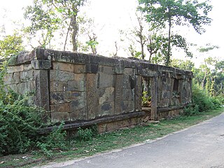
Nadavayal is a small village town near Panamaram in Wayanad district, Kerala, India. This small town hosted early migrants from Travancore (Thiruvithaamkoor).
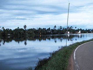
Muttar is a village in upper Kuttanad, Alappuzha district of Kerala, India. It is located 10 km west of Thiruvalla on the Kidangara Neerattupuram road, surrounded by Thalavady, Neerettupuram, Kunnamkary, Chathamkary & Mithrakary.

Kottathara or Venniyode is a gram panchayat of Wayanad district, Kerala State, India.

Edavaka is a Grama Panchayath in the Wayanad district of the Kerala State, India.

Thirunelly is a village in Wayanad district in the state of Kerala, India.

Kallody is a village in the Edavaka Grama panchayath of the Wayanad district, Kerala, India. This village falls under the Mananthavady Taluk. The Hill Highway (Kerala) SH-59 passes through this village town.
Karingari is a small serene village near Tharuvana in Vellamunda panchayath, Mananthavady area, Wayanad, Kerala, India.

St. George Forane Church Kallody is situated in Mananthavady taluk of Wayanad district. It is one of the important churches and pilgrim centers in the region, in communion with the Syro-Malabar Catholic Church.

Kattikkulam (Kartikulam) is a small town near Mananthavady in Wayanad district, Kerala, India.The office of the Thirunelly Gramapanchayath is located at Kartikulam.

Chettappalam is a small village on Mysore Road between Mananthavady and Kattikkulam in Wayanad district, Kerala state, India.

Neervaram Dasanakara is a village near Panamaram in Wayanad district of Kerala province, India.
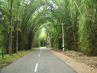
The Wayanad District of Kerala, India has a wide variety of tourist attractions ranging from religious sites to natural, and historical sites. This district is divided into three towns, Kalpetta, Sultan Bathery and Mananthavady. All Major Tourism destinations in the district are maintained by the District Tourism Promotion Council.
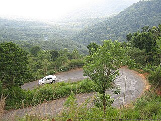
Palchuram or The Milky Mountain Road is mountain village and hairpin road near Mananthavady town in Wayanad district of Kerala state in India.
Coordinates: 11°54′17″N76°01′43″E / 11.904853°N 76.028561°E