Related Research Articles

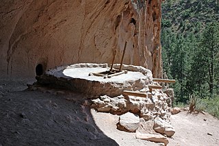
Bandelier National Monument is a 33,677-acre (13,629 ha) United States National Monument near Los Alamos in Sandoval and Los Alamos counties, New Mexico. The monument preserves the homes and territory of the Ancestral Puebloans of a later era in the Southwest. Most of the pueblo structures date to two eras, dating between 1150 and 1600 AD.

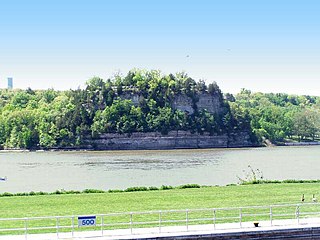
Starved Rock State Park is a state park in the U.S. state of Illinois, characterized by the many canyons within its 2,630 acres (1,064 ha). Located just southeast of the village of Utica, in Deer Park Township, LaSalle County, Illinois, along the south bank of the Illinois River, the park hosts over two million visitors annually, the most for any Illinois state park.

Champoeg is a former town in the U.S. state of Oregon. Now a ghost town, it was an important settlement in the Willamette Valley in the early 1840s. Located halfway between Oregon City and Salem, it was the site of the first provisional government of the Oregon Country.

This is a list of properties and districts in Illinois that are on the National Register of Historic Places. There are over 1,900 in total. Of these, 85 are National Historic Landmarks. There are listings in all of the state's 102 counties.
This National Park Service list is complete through NPS recent listings posted July 28, 2023.

This is a list of properties and historic districts in Missouri on the National Register of Historic Places. There are NRHP listings in all of Missouri's 114 counties and the one independent city of St. Louis.

The Nodena site is an archeological site east of Wilson, Arkansas, and northeast of Reverie, Tennessee, in Mississippi County, Arkansas, United States. Around 1400–1650 CE an aboriginal palisaded village existed in the Nodena area on a meander bend of the Mississippi River. The Nodena site was discovered and first documented by Dr. James K. Hampson, archaeologist and owner of the plantation on which the Nodena site is located. Artifacts from this site are on display in the Hampson Museum State Park in Wilson, Arkansas. The Nodena site is the type site for the Nodena phase, believed by many archaeologists to be the province of Pacaha visited by Spanish explorer Hernando de Soto in 1542.

Graham Cave is a Native American archeological site near Mineola, Missouri in Montgomery County in the hills above the Loutre River. It is located in the 356 acre Graham Cave State Park. The entrance of the sandstone cave forms a broad arch 120 feet (37 m) wide and 16 feet (5 m) high. Extending about 100 feet (30 m) into the hillside, the cave protects an historically important Pre-Columbian archaeological site from the ancient Dalton and Archaic period dating back to as early as 10,000 years ago.
Van Meter State Park is a public recreation area on the Missouri River in Saline County, Missouri. The state park consists of 1,105 acres (447 ha) of hills, ravines, fresh water marsh, fens, and bottomland and upland forests in an area known as "the Pinnacles." The park has several archaeological sites, a cultural center, and facilities for camping, hiking, and fishing. It is managed by the Missouri Department of Natural Resources.

Mummy Cave is a rock shelter and archeological site in Park County, Wyoming, United States, near the eastern entrance to Yellowstone National Park. The site is adjacent to the concurrent U.S. Routes 14/16/20, on the left bank of the North Fork of the Shoshone River at an altitude of 6,310 feet (1,920 m) in Shoshone National Forest.

The Rockrimmon Rockshelter is an archeological site in Stamford, Connecticut that was listed on the National Register of Historic Places in 1994. The site is significant as an early Native American shelter and is centered on a boulder about 60 feet high that was used as the shelter. Native American tools and points were discovered at the site during excavations in 1975 and 1980.
Franktown Cave is located 25 miles (40 km) south of Denver, Colorado on the north edge of the Palmer Divide. It is the largest rock shelter documented on the Palmer Divide, which contains artifacts from many prehistoric cultures. Prehistoric hunter-gatherers occupied Franktown Cave intermittently for 8,000 years beginning about 6400 BC The site held remarkable lithic and ceramic artifacts, but it is better known for its perishable artifacts, including animal hides, wood, fiber and corn. Material goods were produced for their comfort, task-simplification and religious celebration. There is evidence of the site being a campsite or dwelling as recently as AD 1725.
Durango Rock Shelters Archeology Site is also known as the Fall Creek Rock Shelters Site. An Ancient Pueblo People (Anasazi) archaeological site, it is located in Durango in La Plata County, Colorado. People from the Late Basketmaker II and Basketmaker III Eras inhabited the site between AD 1 and 1000.
Mantle's Cave is a cliff alcove in Dinosaur National Monument in Moffat County, Colorado. Located in the Castle Park region of the park, it is the largest rock shelter in the area. It was discovered before 1921 by local ranchers, Mr. and Mrs. Charles Mantle. Mrs. Mantle is reported to have done some excavation of the site, followed up by the Penrose-Taylor expedition of 1933 from Colorado College and the Fountain Valley School, which designated the site "Cave One." The site is a significant resource for the Fremont culture and is among the best resources in northwestern Colorado. Excavations in the 1930s and 1940s yielded significant material on the Fremont people and their relationship to the later Ancestral Puebloans.

Seminole Canyon State Park and Historic Site is a state park in the U.S. state of Texas. It is located off U.S. Route 90, east of the Pecos River High Bridge, 9 miles (14 km) west of Comstock in Val Verde County. The park is conducive to camping, biking, bird watching, back packing and archeological study. Cave art and archeological artifacts date back to the earliest human habitation in the area. The park is part of the larger Seminole Canyon Archeological District on the National Register of Historic Places.
Archeological Site No. 1WI50 is an archaeological site in the Sipsey Wilderness of the William B. Bankhead National Forest in Winston County, Alabama. It was added to the National Register of Historic Places on December 14, 1985.

Grand Mound is a prehistoric burial site in Koochiching County, Minnesota, United States. It is the largest surviving prehistoric structure in the upper Midwest, dating back to 200 BCE. The site was listed as a National Historic Landmark on June 23, 2011.
Indian Mound Reserve is a public country park near the village of Cedarville, Ohio, United States. Named for two different earthworks within its bounds — the Williamson Mound and the Pollock Works — the park straddles Massies Creek as it flows through a small canyon.
The LaGrange Rock Shelter is an archaeological site located on private property between Leighton and Muscle Shoals in Colbert County, Alabama, near the original campus of LaGrange College. The shelter measures 70 feet long by 15 feet deep and is located beneath a sandstone outcrop overlooking a dense series of Paleoindian sites in the valley below, which may have led to it being chosen for excavation.
The Slayton–Morgan Historic District, designated VT-WN-16 in the state archaeological inventory, encompasses a collection of archaeologically sensitive historic sites in Woodstock, Vermont. The 2.2-acre (0.89 ha) parcel includes an early root cellar, foundational remnants of a late 18th-century farmstead, and a marked stone that has been speculatively interpreted to have pre-Columbian Celtic markings. The district was listed on the National Register of Historic Places in 2010.

The West Oak Forest Earthlodge Site is a historic site located near Glenwood, Iowa, United States. It was discovered in 2009 by local archeologist Dennis Miller who found a depression of about 20 feet (6.1 m) in diameter, and a maximum depth of 24 inches (61 cm) below the surrounding area. It was authenticated by the Office of the State Archeologist the following year. This is one of 29 known earthlodges that exist from the Nebraska Phase of the Woodland period. The earthlodges were dwellings that were composed of four central support posts, surrounded by shorter outer wall posts, with wattle and daub walls and roof. The depression in the earth was caused by the natural decay and caving-in of the earthlodge itself. In addition to the depression there have been 231 artifacts found at the site that dates from sometime between 1250 and 1400 C.E. The site was listed on the National Register of Historic Places in 2010.
References
- 1 2 "National Register Information System". National Register of Historic Places . National Park Service. July 9, 2010. Retrieved January 21, 2015.
- ↑ Chase, David W. (April 26, 1985), "Archeological Site No. 1LA102", National Register of Historic Places Inventory-Nomination Form, National Park Service

