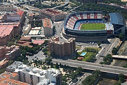
Arganzuela

Last updated
Arganzuela
(Vista parcial de Arganzuela y del Calceron) Aprobado el nuevo ambito Mahou-Calderon (01) (cropped).jpg
Arganzuela
Country Spain
Autonomous community Madrid
Municipality Madrid
Area
  Total6.55 km2 (2.53 sq mi)
Population
148,797
  Density27,700/km2 (72,000/sq mi)
Madrid district number2

Arganzuela is one of the 21 districts of the city of Madrid, Spain.

Contents

Geography

Position

Arganzuela is located in central-southern Madrid, separated from Latina, Carabanchel and Usera by the river Manzanares. The other bordering districts are Centro, Retiro and Puente de Vallecas.

Subdivision

The district is administratively divided into 7 wards (Barrios):

Sightseeing

Matadero Madrid, in Arganzuela, is a former slaughterhouse that is currently a free entrance area and cultural centre where many activities take place in daytime.

See also

Related Research Articles

<span class="mw-page-title-main">Madrid Atocha railway station</span> Railway station in Madrid, Spain

Madrid Atocha, also named Madrid Puerta de Atocha–Almudena Grandes, is the first major railway station in Madrid. It is the largest station serving commuter trains (Cercanías), regional trains from the south and southeast, intercity trains from Navarre, Cádiz and Huelva (Andalusia) and La Rioja, and the AVE high speed trains from Girona, Tarragona and Barcelona (Catalonia), Huesca and Zaragoza (Aragon), Sevilla, Córdoba, Málaga and Granada (Andalusia), Valencia, Castellón and Alicante. These train services are run by Spain's national rail company, Renfe. As of 2019, this station has daily services to Marseille, France.

Atocha may refer to:

<span class="mw-page-title-main">Cercanías Madrid</span> Commuter rail service serving Madrid, Spain

Cercanías Madrid is the commuter rail service that serves Madrid, the capital of Spain, and its metropolitan area. It is operated by Cercanías Renfe, the commuter rail division of Renfe, the former monopoly of rail services in Spain. Its total length is 370 km.

<span class="mw-page-title-main">Latina (Madrid)</span> District of Madrid in Community of Madrid, Spain

Latina is a district of Madrid located in the southwestern corner of the municipality.

<span class="mw-page-title-main">Retiro (Madrid)</span> District of Madrid in Spain

Retiro is a district located at the southeast of the city centre of Madrid, Spain. Its area is of 5.38 square kilometres (2.08 sq mi), the number of houses is 46,512 and the population, as of 2005, was of 126,058.

<span class="mw-page-title-main">Tetuán (Madrid)</span> City district in Community of Madrid, Spain

Tetuán is a district of Madrid, Spain.

<span class="mw-page-title-main">Plaza del Emperador Carlos V</span>

Plaza del Emperador Carlos V is a square in the city of Madrid. It is named after Charles V, Holy Roman Emperor, who also reigned in Spain as Charles I. However, it is referred to as Plaza de Atocha, because it is where Madrid Atocha railway station is located.

<span class="mw-page-title-main">Usera</span> District in Community of Madrid, Spain

Usera is a district of Madrid, Spain. It lies on the southern (right) bank of the Manzanares. It is home to about a 10% of the Chinese citizens in the whole Madrid region.

<span class="mw-page-title-main">Madrid–Levante high-speed rail network</span>

The Madrid–Levante high-speed network is a network of high-speed rail lines that connects Madrid with the Mediterranean coast of the Levante Region, specifically with Castilla-La Mancha, the Valencian Community and the Murcia Region autonomous communities.

<span class="mw-page-title-main">Las Acacias (Madrid)</span> City neighborhood in Madrid, Community of Madrid, Spain

Acacias or Las Acacias is an administrative neighborhood (barrio) of Madrid belonging to the district of Arganzuela. It has an area of 1.074172 km2 (0.414740 sq mi). As of 1 February 2020, it has a population of 37,049.

<span class="mw-page-title-main">Atocha (Madrid)</span> Ward of Madrid in Spain

Atocha is an administrative neighborhood of Madrid belonging to the district of Arganzuela.

<span class="mw-page-title-main">Estación del Arte (Madrid Metro)</span> Madrid Metro station

Estación del Arte is a station on Line 1 of the Madrid Metro and is located in Fare Zone A. It was opened to the public on 26 December 1926. The station is located beneath Charles V plaza, less than 500 meters from the Madrid Atocha railway station which serves commuter and long-distance trains. It is the nearest Metro station to the Paseo del Prado. It is located between the neighborhoods of Embajadores (Centro), Jerónimos (Retiro) and Atocha (Arganzuela).

<span class="mw-page-title-main">Puerta de Atocha (city gate)</span>

The Puerta de Atocha was a gate in the city walls of Madrid. It owed its name to be located in the vicinity of the old hermitage, later Convento de Nuestra Señora de Atocha. It was demolished in 1850. Its location must exit to Paseo de las Delicias

<span class="mw-page-title-main">Imperial (Madrid)</span> Neighborhood of Madrid in Spain

Imperial is an administrative neighborhood (barrio) of Madrid belonging to the district of Arganzuela. It is 0.967500 km² in size.

<span class="mw-page-title-main">La Chopera</span> City neighborhood in Madrid, Community of Madrid, Spain

La Chopera is an administrative neighborhood of Madrid belonging to the district of Arganzuela.

<span class="mw-page-title-main">Legazpi (Madrid)</span> City neighborhood in Madrid, Community of Madrid, Spain

Legazpi is an administrative neighborhood (barrio) of Madrid belonging to the district of Arganzuela. It has an area of 1.39 km2. As of 1 February 2020, it has a population of 19,820.

<span class="mw-page-title-main">Las Delicias (Madrid)</span> City neighborhood in Madrid, Community of Madrid, Spain

Las Delicias is a and administrative neighborhood of Madrid belonging to the district of Arganzuela.

<span class="mw-page-title-main">Palos de la Frontera (Madrid)</span> City neighborhood in Madrid, Community of Madrid, Spain

Palos de la Frontera is an administrative neighborhood (barrio) of Madrid belonging to the district of Arganzuela. It has an area of 0.643542 km2 (0.248473 sq mi).

<span class="mw-page-title-main">Embajadores</span> Ward of Madrid in Spain

Embajadores is an administrative neighborhood (barrio) of Madrid, belonging to the Centro District.

<span class="mw-page-title-main">Adelfas</span> City neighborhood in Madrid, Community of Madrid, Spain

Adelfas is an administrative neighborhood in Madrid of the Retiro district.. It is located in the extreme south of the district, so it only delimits with 3 of the 5 neighborhoods of the district: Pacífico to the west, Niño Jesús to the east and Estrella to the northeast. It is a middle class neighborhood, and it is also the neighborhood of the district with the newest architecture. This neighborhood was formerly known as "Las Californias". This name is attributed to the homonymous street that was the backbone of neighborhood.

References

    Commons-logo.svg Media related to Arganzuela at Wikimedia Commons

    40°24′10″N3°41′43″W / 40.402733°N 3.695403°W / 40.402733; -3.695403