
Canillejas is an administrative neighborhood (barrio) of Madrid, belonging to the San Blas-Canillejas district. It is named after the former namesake municipality, absorbed by Madrid in 1949. It has an area of 1.598075 km2 (0.617020 sq mi). As of 1 March 2020, it has a population of 29,288.
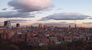
Tetuán is a district of Madrid, Spain.
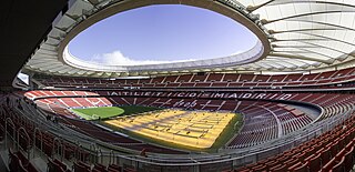
Metropolitano Stadium, also referred to as Cívitas Metropolitano for sponsorship reasons, is a stadium in Madrid, Spain. It has been the home stadium of Atlético Madrid since the 2017–18 season. It is located in the Rosas neighbourhood, in the San Blas-Canillejas district.

Vicálvaro is a district in the southeast of Madrid, Spain. It is named after the former municipality absorbed into the municipality of Madrid in 1951.

Usera is a district of Madrid, Spain. It lies on the southern (right) bank of the Manzanares. It is home to about a 10% of the Chinese citizens in the whole Madrid region.

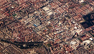
Guindalera or La Guindalera is an administrative neighborhood (barrio) of Madrid belonging to the district of Salamanca. It has an area of 1.598962 km2 (0.617363 sq mi). As of 1 March 2020, it has a population of 42,516.

Lista is an administrative neighborhood (barrio) of Madrid belonging to the district of Salamanca. It has an area of 0.520399 km2 (0.200927 sq mi). As of 1 March 2020, it has a population of 21,362. The Hospital Universitario de la Princesa is located in the neighborhood.

El Viso is a neighborhood of Madrid, part of the Chamartín District. Consisting mainly of residential detached houses, it is currently the wealthiest neighborhood of the Spanish capital, overtaking the Salamanca District. Aristocrats, businessmen, politicians and diplomats have inhabited this area for half a century. The neighborhood also hosts the main headquarters of the Spanish National Research Council (CSIC).

Ciudad Jardín is a neighborhood (barrio) of the Chamartín district, situated in the northeast part of the city of Madrid and adjacent to the Salamanca district. It is located between Calle Príncipe de Vergara, Avenida Ramón y Cajal and Calle López de Hoyos, the latter being one of the longest streets in the city and well known for its great commercial activity.

Bellas Vistas is an administrative neighborhood (barrio) of Madrid, part of the district of Tetuán. It has an area of 0.716261 km2 (0.276550 sq mi). As of 1 February 2020, it has a population of 29,993. It was created as slum of the north of the city, on the west side of the Road of France, currently the calle de Bravo Murillo.

Cuatro Caminos is a neighborhood (barrio) of Madrid belonging to the district of Tetuán. It has an area of 1.193509 km2 (0.460816 sq mi). As of 1 February 2020, it has a population of 35,395. It was created as slum of the north of the city, on the east side of the Road of France, currently the calle de Bravo Murillo.
Vallehermoso is an administrative neighborhood (barrio) of Madrid belonging to the district of Chamberí. It has an area of 1.068709 km2 (0.412631 sq mi). As of 1 February 2020, it has a population of 20,480. The Vallehermoso Stadium, the traditional venue in the city for athletics competitions, is located in the neighborhood. The stadium re-opened in 2019.
Puerta Bonita is an administrative neighborhood (barrio) of Madrid belonging to the district of Carabanchel. It has an area of 1.607994 km2 (0.620850 sq mi). With an area of 0.45 km2 (0.17 sq mi), the Quinta of Vistalegre, which is chiefly owned by the regional administration, spreads over much of the neighborhood. The name of the neighborhood comes from a former iron gate of the quinta, which was accidentally destroyed in 1982. As of 1 February 2020, it has a population of 36,157.
Simancas is an administrative neighborhood (barrio) of Madrid belonging to the district of San Blas-Canillejas. It has an area of 2.278418 km2 (0.879702 sq mi). As of 1 February 2020, it has a population of 28,799.

Hellín is an administrative neighborhood (barrio) of Madrid belonging to the district of San Blas-Canillejas.

Amposta is an administrative neighborhood (barrio) of Madrid belonging to the district of San Blas-Canillejas.

Arcos is an administrative neighborhood (barrio) of Madrid belonging to the district of San Blas-Canillejas.

Salvador is an administrative neighborhood (barrio) of Madrid belonging to the district of San Blas-Canillejas. It has an area of 1.881765 km2 (0.726554 sq mi). As of 1 February 2020, it has a population of 11,516.

Ensanche de Vallecas is an administrative neighborhood of Madrid, belonging to the district of Villa de Vallecas.
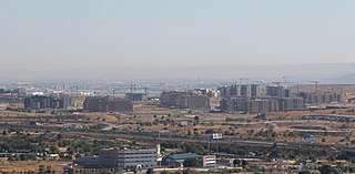
El Cañaveral is an administrative neighborhood of Madrid, belonging to the district of Vicálvaro. Created in November 2017 after the passing of the new internal organization of the district on 31 October 2017 by the plenary of the Madrid City Council, it is named after the PAU in the area, which unlike the administrative neighborhood does not extend to the east of the Cañada Real linear shanty town, as the administrative neighborhood also currently comprises the future development of Los Cerros, another PAU. The first neighbors of the PAU installed in 2016. As of 1 March 2020, the neighborhood has a population of 2,565.


