Districts of Madrid

Last updated

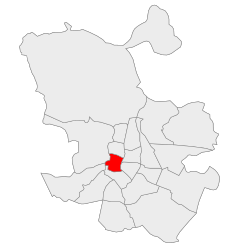
Madrid, the capital of Spain, is divided into 21 districts, which are further subdivided into 131 administrative wards. Additional neighborhoods exist outside the boundaries of administrative borders. Each district is governed by a body named Junta Municipal de Distrito. Residents of Madrid are typically called Madrileños.

Contents

Districts and wards

Data as of 1st January 2017. Source: Área de Gobierno de Economía, Hacienda. Subdirección General de Estadística. Padrón Municipal de Habitantes.[ citation needed ]

District NumberNameDistrict area [n 1]
(Ha.)
PopulationPopulation density
(Hab./Ha.)
LocationAdministrative wards
1 Centro 522.82131,928252.34
Centro District loc-map.svg
Palacio (11)
Embajadores (12)
Cortes (13)
Justicia (14)
Universidad (15)
Sol (16)
2 Arganzuela 646.22151,965235.16
Arganzuela District loc-map.svg
Imperial (21)
Acacias (22)
Chopera (23)
Legazpi (24)
Delicias (25)
Palos de Moguer (26)
Atocha (27)
3 Retiro 546.62118,516216.82
Retiro District loc-map.svg
Pacífico (31)
Adelfas (32)
Estrella (33)
Ibiza (34)
Jerónimos (35)
Niño Jesús (36)
4 Salamanca 539.24143,800266.67
Salamanca District loc-map.svg
Recoletos (41)
Goya (42)
Fuente del Berro (43)
Guindalera (44)
Lista (45)
Castellana (46)
5 Chamartín 917.55143,424156.31
Chamartin District loc-map.svg
El Viso (51)
Prosperidad (52)
Ciudad Jardín (53)
Hispanoamérica (54)
Nueva España (55)
Castilla (56)
6 Tetuán 537.47153,789286.13
Tetuan District loc-map.svg
Bellas Vistas (61)
Cuatro Caminos (62)
Castillejos (63)
Almenara (64)
Valdeacederas (65)
Berruguete (66)
7 Chamberí 467.92137,401293.64
Chamberi District loc-map.svg
Gaztambide (71)
Arapiles (72)
Trafalgar (73)
Almagro (74)
Ríos Rosas (75)
Vallehermoso (76)
8 Fuencarral-El Pardo 23,783.84238,75610.04
Fuencarral-El Pardo District loc-map.svg
El Pardo (81)
Fuentelarreina (82)
Peñagrande (83)
Pilar (84)
La Paz (85)
Valverde (86)
Mirasierra (87)
El Goloso (88)
9 Moncloa-Aravaca 4,653.11116,90325.12
Moncloa-Aravaca District loc-map.svg
Casa de Campo (91)
Argüelles (92)
Ciudad Universitaria (93)
Valdezarza (94)
Valdemarín (95)
El Plantío (96)
Aravaca (97)
10 Latina 2,542.72233,80891.95
Latina District loc-map.svg
Los Cármenes (101)
Puerta del Ángel (102)
Lucero (103)
Aluche (104)
Campamento (105)
Cuatro Vientos (106)
Las Águilas (107)
11 Carabanchel 1,404.83243,998173.68
Carabanchel District loc-map.svg
Comillas (111)
Opañel (112)
San Isidro (113)
Vista Alegre (114)
Puerta Bonita (115)
Buenavista (116)
Abrantes (117)
12 Usera 777.77134,791173.30
Usera District loc-map.svg
Orcasitas (121)
Orcasur (122)
San Fermín (123)
Almendrales (124)
Moscardó (125)
Zofío (126)
Pradolongo (127)
13 Puente de Vallecas 1,496.86227,595152.05
Puente de Vallecas District loc-map.svg
Entrevías (131)
San Diego (132)
Palomeras Bajas (133)
Palomeras Sureste (134)
Portazgo (135)
Numancia (136)
14 Moratalaz 610.3294,197154.34
Moratalaz District loc-map.svg
Pavones (141)
Horcajo (142)
Marroquina (143)
Media Legua (144)
Fontarrón (145)
Vinateros (146)
15 Ciudad Lineal 1,142.57212,529186.01
Ciudad Lineal District loc-map.svg
Ventas (151)
Pueblo Nuevo (152)
Quintana (153)
Concepción (154)
San Pascual (155)
San Juan Bautista (156)
Colina (157)
Atalaya (158)
Costillares (159)
16 Hortaleza 2,741.98180,46265.81
Hortaleza District loc-map.svg
Palomas (161)
Piovera (162)
Canillas (163)
Pinar del Rey (164)
Apóstol Santiago (165)
Valdefuentes (166)
17 Villaverde 2,018.76142,60870.64
Villaverde District loc-map.svg
Villaverde Alto (171)
San Cristóbal (172)
Butarque (173)
Los Rosales (174)
Los Ángeles (175)
18 Villa de Vallecas 5,146.72104,42119.86
Villa de Vallecas District loc-map.svg
Casco Histórico de Vallecas (181)
Santa Eugenia (182)
Ensanche de Vallecas (183)
19 Vicálvaro 3,526.6770,05119.86
Vicalvaro District loc-map.svg
Casco Histórico de Vicálvaro (191)
Valdebernardo (192)
Valderrivas (193)
El Cañaveral (194)
20 San Blas-Canillejas 2,229.24154,35769.24
San Blas District loc-map.svg
Simancas (201)
Hellín (202)
Amposta (203)
Arcos (204)
Rosas (205)
Rejas (206)
Canillejas (207)
Salvador (208)
21 Barajas 4,192.2846,87611.18
Barajas District loc-map.svg
Alameda de Osuna (211)
Aeropuerto (212)
Casco Histórico de Barajas (213)
Timón (214)
Corralejos (215)
TOTAL60,445.513,182,17552.65
Bank of Spain building (foreground) and Palacio de Comunicaciones Bancoporlatarde.jpg
Bank of Spain building (foreground) and Palacio de Comunicaciones

Contemporary Madrid came into its own after the death of general Francisco Franco. Reaction against the dictatorial bureaucracy centered in Madrid, and a history of centralism that predated Franco by centuries has resulted in the successful modern movement towards increased autonomy for the regions of Spain, considered autonomous regions under the umbrella of Spain. The modern metropolis is home to over three million people.

Alonso Martínez

This area contains the large Plaza de Colón. This plaza commemorates Christopher Columbus, who was responsible for ushering in the Spanish imperial golden age of the 16th and 17th centuries. It is within walking distance of the main cultural and commercial areas of the city, such as the Prado museum, the expansive Parque del Buen Retiro and the business center on the lower part of the Paseo de la Castellana.

Atocha

Atocha covers a large area and is bordered by the Huertas and Lavapiés neighbourhoods. It contains several notable cultural institutions, including the Reina Sofía Museum. Also located here is the central bus terminal and the Atocha Railway Station, one of two main train stations in Madrid, the other being located in Chamartín. This was the main site of the train bombings carried out on March 11, 2004. Atocha was also the site of the 1977 Massacre of Atocha.

AZCA / Nuevos Ministerios

Torre Picasso, designed by Minoru Yamasaki Torre Picasso - 01.jpg
Torre Picasso, designed by Minoru Yamasaki

Located in the Cuatro Caminos ward, AZCA is the financial center of Madrid. The area is populated by skyscrapers, among them Torre Picasso at 157 metres (515 ft), Edificio BBVA at 107 metres (351 ft) and Torre Europa at 115 metres (377 ft). The skyscraper Torre Windsor once stood here as well, until it burned completely on the night of 12 February 2005. A large El Corte Inglés department store consisting of three interconnected buildings is also located here. The area is directly linked to Barajas Airport by metro line 8 at the Nuevos Ministerios station. It is the Parkour centre of Madrid.

Cuatro Torres Business Area

The Cuatro Torres Business Area is composed of the four tallest skyscrapers in Madrid. The tallest is Torre Bankia, once known as the Torre Repsol, at 250 metres (820 ft). It was designed by Sir Norman Foster, and is the third tallest skyscraper in Europe. Torre de Cristal, or 'Crystal Tower', is only 0.6 metres (2 ft 0 in) lower than Torre Bankia, at 249.4 metres (818 ft), and was designed by Cesar Pelli. Torre PwC is the third tallest in Madrid, at 235 metres (771 ft), and was designed by Enrique Alvarez & Carlos Rubio. The fourth skyscraper is Torre Espacio, or 'Space Tower'. It is 223 metres (732 ft) tall and it was designed by I.M. Pei. [1] The four skyscrapers were finished in 2008.

Chueca

Chueca is well known as a centre of gay culture in Madrid. [2]

Las Cortes

This small area is notable for housing the Congress of Deputies, known as the Congreso de los diputados, the lower house of the Spanish parliament. Other notable sites include the Thyssen-Bornemisza Museum, the Banco de España, the Café del Círculo de Bellas Artes, the Zarzuela Theater and the Plaza de Cibeles.

Huertas

This neighbourhood, also known as Barrio de las Letras, is west of the Paseo del Prado and north of Calle Atocha. Once the home and popular hangout of writers such as Miguel de Cervantes and Calderon de la Barca, Huertas is now considered Madrid's literary neighbourhood. [2] One prominent landmark is the house where Cervantes died in 1616. [3] It is a popular nightlife spot and tourist destination.

Gran Vía

Gran Via Croisement Gan Via-Alcala.jpg
Gran Vía

As the name implies, the Gran Vía area contains one of Madrid's most important avenues, the Gran Vía (literally, "Great Way"). First and foremost it is a shopping street; however, it also contains a number of tourist accommodations, plenty of nightlife (including Madrid's large goth scene), many of Madrid's largest movie theaters and live musical shows. It is also a hub for Madrid's red-light district, as it links many side streets. One of these streets, calle Fuencarral, has become a link between the old shopping area of the center of the city, the Bohemian Malasaña, and the hip Chueca district, making of it one of the most cosmopolitan areas of the city.

Lavapiés

A historically poorer neighbourhood within the city center, Lavapiés has maintained much of true 'Madrileño' spirit of the past. Lavapiés has a high concentration of immigrants (mainly Bangladeshis), and also tends to attract Western European expats, artists and writers, adding to the cosmopolitan mix. It is changing rapidly under the pressures of gentrification.

La Latina

Edificio Espana Plaza de-Espana En Madrid.jpg
Edificio España

In and around La Latina are the origins of Madrid. Its difficult to put precise boundaries on La Latina, because, like its immediate neighbours, streets are narrow and winding. There are quite a few nightlife spots, though the neighbourhood is best known as having a concentration of tapas bars (particularly on the Cava Baja and Cava Alta). There are also a number of attractive churches, including the Church of San Andrés and the San Francisco el Grande Basilica. On Sundays and major holidays, the famous Rastro flea-market begins on the eastern edge, spilling out of the San Millan exit of the La Latina metro stop to the Plaza de Cascorro and all the way to the Ronda de Toledo to the south. Plaza de la Paja is another interesting location here. On its other side, La Latina borders Plaza Mayor and another ancient part of the town, El Madrid de los Austrias, where you can find the Palacio Real (Royal Palace).

Malasaña

Malasaña is famous for its nightlife, and for having been the main hub of the movida countercultural movement in the 1970s and 1980s. Considered very popular and one of the best´s Madrid´s neighbourhoods with available pubs and bars during night.

Ópera

As the name implies, this area around the Ópera metro stop is the location of Madrid's main Opera Theatre, the Teatro Real (Royal Theatre). In front of the theatre is the Palacio Real de Madrid, or Royal Palace. The Royal Palace is no longer used as a residence, but it has been kept intact, serving as a cultural monument that is occasionally used for state functions. It is one of largest palaces in Europe, surpassing even the Versailles Palace.

Retiro

Parque del buen Retiro Retiropark.jpg
Parque del buen Retiro

Barrio Retiro is a classic neighbourhood surrounding the famous Buen Retiro Park, to the east of the center of the city. It is demographically the oldest neighbourhood in the city, but over the past five years the increasing number of flats for rent has been attracting young people and students to the area in growing numbers. The neighbourhood can be characterized by the style of its three most important areas. In the north, centering on Calle Ibiza, streets are in a grid pattern and buildings, normally 6-10 storeys, are packed closely together, creating a bustling atmosphere of small shops, bars, and restaurants. This area is very similar to the neighbouring Salamanca district. In the south, called Niño Jesus, the area is quieter, more spacious, and residential. In the west, the Jerónimos area, with its 18th and 19th century buildings and many museums (including the Museo del Prado), has few private residences, its large flats that often surpass 200 m² (2,150 sq ft) being mainly used for offices.
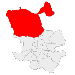
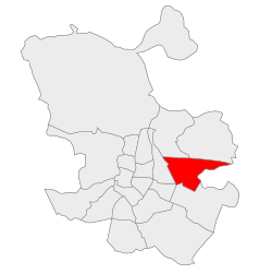
Hortaleza

A residential district in the north, Hortaleza includes the headquarters of the Spanish Olympic Committee, the IFEMA (Madrid's main trade fair centre) and Juan Carlos I Park, a park between Campo de las Naciones (commercial district) and Barajas. Mar de Cristal is a tube station in Hortaleza district with an airport connection.
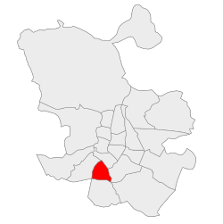
Vallecas

Vallecas is a working-class residential neighbourhood in the south of Madrid. It is also home to the Rayo Vallecano football team.
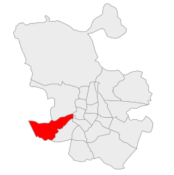
Aravaca

Aravaca is an upper-class residential suburb in the northwest of Madrid. During the Spanish Civil War the front was stabilized here for almost three years. Aravaca and its surroundings include parkland and wooded areas such as Casa de Campo.

Notes

  1. Superficie revisada según seccionado 2014

Related Research Articles

<span class="mw-page-title-main">Madrid Atocha railway station</span> Railway station in Madrid, Spain

Madrid Atocha, also named Madrid Puerta de Atocha–Almudena Grandes, is the first major railway station in Madrid. It is the largest station serving commuter trains (Cercanías), regional trains from the south and southeast, intercity trains from Navarre, Cádiz and Huelva (Andalusia) and La Rioja, and the AVE high speed trains from Girona, Tarragona and Barcelona (Catalonia), Huesca and Zaragoza (Aragon), Sevilla, Córdoba, Málaga and Granada (Andalusia), Valencia, Castellón and Alicante. These train services are run by Spain's national rail company, Renfe. As of 2019, this station has daily services to Marseille, France.

<span class="mw-page-title-main">Retiro, Buenos Aires</span> Neighborhood of Buenos Aires in C1, Argentina

Retiro is a barrio or neighborhood in Buenos Aires, Argentina. Located in the northeast end of the city, Retiro is bordered on the south by the Puerto Madero and San Nicolás, and on the west by the Recoleta.

<span class="mw-page-title-main">Centro (Madrid)</span> District of Madrid in Spain

Centro is a district of Madrid, Spain. It is approximately 5.23 km2 in size. It has a population of 149,718 people and a population density of 28,587/km2. It roughly corresponds to the bulk of the housing formerly enclosed by the so-called Walls of Philip IV. The district is made up of the neighbourhoods of Cortes, Embajadores, Justicia, Universidad, Palacio and Sol.

<span class="mw-page-title-main">Paseo de Recoletos</span> Boulevard in central Madrid, Spain

Paseo de Recoletos is a wide boulevard in central Madrid leading from Plaza de Cibeles to Plaza de Colón.

<span class="mw-page-title-main">Cuatro Torres Business Area</span> Office & Hotel (Torre PwC) in Comunidad de Madrid, Spain

Área de negocios de Cuatro Torres, Spanish for "Four Towers Business Area", is a business district located in the Paseo de la Castellana in Madrid, Spain, on the former Ciudad Deportiva of Real Madrid. The area contains the four tallest skyscrapers in Spain, and four of the ten tallest in the European Union: the Torre Emperador, Torre de Cristal, Torre PwC and Torre Cepsa. Construction of the buildings finished in 2008. Now, a fifth tower, Caleido, has already finished in 2021.

<span class="mw-page-title-main">Torre Cepsa</span> Skyscraper located in the Cuatro Torres Business Area in Madrid, Spain

The Torre Cepsa (English: Cepsa Tower) is a skyscraper located in the Cuatro Torres Business Area in Madrid, Spain. With a height of 248.3 m (815 ft) and 45 floors, it is the second tallest of the four buildings in the Cuatro Torres Business Area complex, surpassed by Torre de Cristal by less than a metre. It is the second tallest building in Spain and the 4th tallest building in the European Union.

<span class="mw-page-title-main">Lavapiés</span> Neighborhood in Madrid, Spain

Lavapiés is a historic neighbourhood in the city of Madrid, Spain. It is located in the administrative ward (barrio) of Embajadores in the downtown Centro District, southwest of neighbouring neighbourhood La Latina.

<span class="mw-page-title-main">Barrio de La Latina (Madrid)</span>

La Latina is a historic neighborhood in the Centro district of downtown Madrid, Spain. La Latina occupies the place of the oldest area in Madrid, the Islamic citadel inside the city walls, with narrow streets and large squares. It is administratively locked almost entirely within the district of Palacio in Centro. It was named after the old hospital, founded in 1499 by Beatriz Galindo "La Latina". It occupies a large part of what is known as El Madrid de los Austrias, and although its boundaries are subjective, it could be argued that it was essentially the vicinity of the San Francisco Racecourse - that continues from the Plaza de la Cebada up to the San Francisco el Grande Basilica. These limits are: to the north, Segovia street - a deep ravine formerly occupied by the San Pedro Stream which empties into the Manzanares River, to the south there is la Ronda and Puerta de Toledo, on the east there is Toledo street - bordering Rastro and the district of Lavapiés - and to the west, Bailen street.

<span class="mw-page-title-main">Plaza del Emperador Carlos V</span>

Plaza del Emperador Carlos V is a square in the city of Madrid. It is named after Charles V, Holy Roman Emperor, who also reigned in Spain as Charles I. However, it is referred to as Plaza de Atocha, because it is where Madrid Atocha railway station is located.

<span class="mw-page-title-main">Cybele Palace</span> Cultural property in Madrid, Spain

Cibeles Palace, formally known as Palacio de Comunicaciones and Palacio de Telecomunicaciones until 2011, is a complex composed of two buildings with white facades and is located in one of the historical centres of Madrid, Spain. Formerly the city's main post office and telegraph and telephone headquarters, it is now occupied by Madrid City Council, serving as the city hall, and the public cultural centre CentroCentro.

<span class="mw-page-title-main">Atocha (Madrid)</span> Ward of Madrid in Spain

Atocha is an administrative neighborhood of Madrid belonging to the district of Arganzuela.

<span class="mw-page-title-main">Madrid</span> Capital and largest city of Spain

Madrid is the capital and most populous city of Spain. The city has almost 3.6 million inhabitants and a metropolitan area population of approximately 6.7 million. It is the second-largest city in the European Union (EU), and its monocentric metropolitan area is the second-largest in the EU. The municipality covers 604.3 km2 (233.3 sq mi) geographical area.

<span class="mw-page-title-main">Architecture of Madrid</span>

The architecture of Madrid has preserved the look and feel of many of its historic neighbourhoods and streets, even though Madrid possesses a modern infrastructure. Its landmarks include the Royal Palace of Madrid, the Royal Theatre with its restored 1850 Opera House, the Buen Retiro Park, the 19th-century National Library building containing some of Spain's historical archives, a large number of national museums, and the Golden Triangle of Art located along the Paseo del Prado and comprising three art museums: Prado Museum, the Reina Sofía Museum, and the Thyssen-Bornemisza Museum, which completes the shortcomings of the other two museums. Cibeles Palace and Fountain have become the monument symbol of the city.

<span class="mw-page-title-main">Walls of Philip IV</span>

The Walls of Felipe IV surrounded the city of Madrid between 1625 and 1868. Philip IV ordered their construction to replace the earlier Walls of Philip II and the Walls del Arrabal, which had already been surpassed by the growth of population of Madrid. These were not defensive walls, but essentially served fiscal and surveillance purposes: to control the access of goods to the city, ensure the collection of taxes, and to monitor who went in and out of Madrid. The materials used for construction were brick, mortar and compacted earth.

The Walls del Arrabal were the third in a set of five walls built around Madrid, now the capital of Spain. There are no remaining ruins of the Walls del Arrabal, leaving some debate as to their extent and the period of their construction. It is possible that the walls were built as early as the 12th century, however they were most likely constructed in 1438. The walls may have been intended to protect people against the plagues that ravaged the city at the time. The walls united the urbanized suburbs of the city and prevented entry of the infected.

<span class="mw-page-title-main">Embajadores</span> Ward of Madrid in Spain

Embajadores is an administrative neighborhood (barrio) of Madrid, belonging to the Centro District.

<span class="mw-page-title-main">Malasaña</span> Ward in Madrid

Malasaña is an area in the centre of Madrid, Spain. It does not correspond to any administrative division, but it is often conflated with Universidad, the wider administrative neighborhood on which Malasaña is located. The webpage providing touristic information published the Madrid City Council set as limits the streets of San Bernardo, the Gran Vía, Fuencarral and Carranza. Malasaña is associated with a creative and counter-cultural scene.

<span class="mw-page-title-main">Calle de San Bernardo</span> Street in Madrid, Spain

The Calle de San Bernardo is a street in central Madrid, Spain. Located in the Centro and Chamberí districts, it once was the former road in and out of the city from the North.

References

  1. "La mayor obra de rascacielos de Europa" (in Spanish). CincoDias.com. 21 August 2006.
  2. 1 2 Armstrong, I. (2012). Let's Go: Spain & Portugal. Cambridge: Let's Go Pub. ISBN   9781612370316.
  3. "Huertas Madrid" . Retrieved 29 March 2014.

Commons-logo.svg Media related to Districts of Madrid at Wikimedia Commons