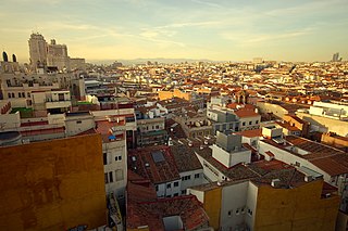
Universidad is an administrative neighborhood of Madrid, part the Centro District. The areas of Malasaña and Conde Duque are located in the neighborhood.

San Blas-Canillejas is a district to the east of Madrid's city centre. The population of the district is estimated in 149,909.

Port Kenyon is an unincorporated community in Humboldt County, California. It is located 1.5 miles (2.4 km) northwest of Ferndale, at an elevation of 13 feet.

Goya is an administrative neighborhood (barrio) of Madrid belonging to the district of Salamanca. It has an area of 0.771228 km2 (0.297773 sq mi). As of 1 March 2020, it has a population of 30,010. The WiZink Center is located in the neighborhood.

Lista is an administrative neighborhood (barrio) of Madrid belonging to the district of Salamanca. It has an area of 0.520399 km2 (0.200927 sq mi). As of 1 March 2020, it has a population of 21,362. The Hospital Universitario de la Princesa is located in the neighborhood.

Ciudad Jardín is a neighborhood (barrio) of the Chamartín district, situated in the northeast part of the city of Madrid and adjacent to the Salamanca district. It is located between Calle Príncipe de Vergara, Avenida Ramón y Cajal and Calle López de Hoyos, the latter being one of the longest streets in the city and well known for its great commercial activity.
Vallehermoso is an administrative neighborhood (barrio) of Madrid belonging to the district of Chamberí. It has an area of 1.068709 km2 (0.412631 sq mi). As of 1 February 2020, it has a population of 20,480. The Vallehermoso Stadium, the traditional venue in the city for athletics competitions, is located in the neighborhood. The stadium re-opened in 2019.

Valverde is an administrative neighborhood (barrio) of Madrid belonging to the district of Fuencarral-El Pardo. It has an area of 8.977802 km2 (3.466349 sq mi). As of 1 March 2020, it has a population of 65,022. The historic centre of Fuencarral, belongs to the Valverde neighborhood. The Hospital Universitario Ramón y Cajal is also located in the neighborhood.

Vista Alegre is an administrative neighborhood (barrio) of Madrid belonging to the district of Carabanchel. It has an area of 1.589877 km2 (0.613855 sq mi). As of 1 February 2020, it as a population of 47,757. The Palacio Vistalegre, a multipurpose arena, is located in the neighborhood.

Abrantes is an administrative neighborhood (barrio) of Madrid belonging to the district of Carabanchel. It has an area of 1.564207 km2 (0.603944 sq mi). As of 1 February 2020, it as a population of 32,145. The Emperatriz María de Austria Park, 0.597458 km2 (0.230680 sq mi) in size, spreads across a large part of the neighborhood.
Orcasur is an administrative neighborhood (barrio) of Madrid belonging to the district of Usera. It has an area of 1.384234 km2 (0.534456 sq mi). As of 1 March 2020, it has a population of 14,264. The Hospital Universitario 12 de Octubre is located in the neighborhood.

Palomeras Bajas is an administrative neighborhood (barrio) of Madrid belonging to the district of Puente de Vallecas. It has an area of 1.724430 km2 (0.665806 sq mi). As of 1 February 2020, it has a population of 41,034. The seat of the Assembly of Madrid, the regional legislature of the Community of Madrid, is located in the neighborhood.

Numancia is an administrative neighborhood (barrio) of Madrid belonging to the district of Puente de Vallecas.

Pavones is an administrative neighborhood (barrio) of Madrid belonging to the district of Moratalaz. It has an area of 1.016979 km2 (0.392658 sq mi). As of 1 February 2020, it has a population of 9197. The Madrid Spain Temple of the Church of Jesus Christ of Latter-day Saints is located here; it is the church's most iconic building in Spain.

Marroquina is an administrative neighborhood (barrio) of Madrid belonging to the district of Moratalaz. It is 1.789256 km2 in size and has a 6,746 m perimeter.

Vinateros is an administrative neighborhood (barrio) of Madrid belonging to the district of Moratalaz. It has an area of 0.593979 km2 (0.229337 sq mi). As of 1 March 2020, it has a population of 17,225.

Ventas is an administrative neighborhood (barrio) of Madrid belonging to the district of Ciudad Lineal.

Santa Eugenia is an administrative neighborhood (barrio) of Madrid belonging to the district of Villa de Vallecas. It has an area of 2.070637 km2 (0.799477 sq mi). As of 1 March 2020, it has a population of 24,782. The Hospital Universitario Infanta Leonor is located in the neighborhood.

Arcos is an administrative neighborhood (barrio) of Madrid belonging to the district of San Blas-Canillejas.

Salvador is an administrative neighborhood (barrio) of Madrid belonging to the district of San Blas-Canillejas. It has an area of 1.881765 km2 (0.726554 sq mi). As of 1 February 2020, it has a population of 11,516.

