Numancia (Madrid)

Last updated
Numancia
(Numancia) Puente de Vallecas - Aerial photograph (color, contrast, tone) (cropped).jpg
Numancia. 136. Barrios de Madrid.svg
Country Spain
Region Community of Madrid
Municipality Madrid
District Ciudad Lineal
Area
  Total1.849172 km2 (0.713969 sq mi)
Population
 (2020)
  Total48,815
  Density26,000/km2 (68,000/sq mi)
Numancia (Madrid)

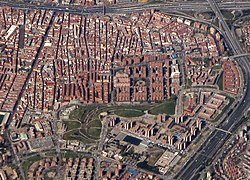
Numancia is an administrative neighborhood (barrio) of Madrid belonging to the district of Puente de Vallecas.

It has an area of 1.849172 km2 (0.713969 sq mi). [1] As of 1 March 2020, it has a population of 48,815. [2]

Related Research Articles

<span class="mw-page-title-main">Goya (Madrid)</span> City neighborhood in Madrid, Community of Madrid, Spain

Goya is an administrative neighborhood (barrio) of Madrid belonging to the district of Salamanca. It has an area of 0.771228 km2 (0.297773 sq mi). As of 1 March 2020, it has a population of 30,010. The WiZink Center is located in the neighborhood.

<span class="mw-page-title-main">Lista (Madrid)</span> City neighborhood in Madrid, Community of Madrid, Spain

Lista is an administrative neighborhood (barrio) of Madrid belonging to the district of Salamanca. It has an area of 0.520399 km2 (0.200927 sq mi). As of 1 March 2020, it has a population of 21,362. The Hospital Universitario de la Princesa is located in the neighborhood.

<span class="mw-page-title-main">Vallehermoso (Madrid)</span> City neighborhood in Madrid, Community of Madrid, Spain

Vallehermoso is an administrative neighborhood (barrio) of Madrid belonging to the district of Chamberí. It has an area of 1.068709 km2 (0.412631 sq mi). As of 1 February 2020, it has a population of 20,480. The Vallehermoso Stadium, the traditional venue in the city for athletics competitions, is located in the neighborhood. The stadium re-opened in 2019.

<span class="mw-page-title-main">Valverde (Madrid)</span> City neighborhood in Madrid, Spain

Valverde is an administrative neighborhood (barrio) of Madrid belonging to the district of Fuencarral-El Pardo. It has an area of 8.977802 km2 (3.466349 sq mi). As of 1 March 2020, it has a population of 65,022. The historic centre of Fuencarral, belongs to the Valverde neighborhood. The Hospital Universitario Ramón y Cajal is also located in the neighborhood.

<span class="mw-page-title-main">Vista Alegre (Madrid)</span> City neighborhood in Madrid, Community of Madrid, Spain

Vista Alegre is an administrative neighborhood (barrio) of Madrid belonging to the district of Carabanchel. It has an area of 1.589877 km2 (0.613855 sq mi). As of 1 February 2020, it as a population of 47,757. The Palacio Vistalegre, a multipurpose arena, is located in the neighborhood.

<span class="mw-page-title-main">Puerta Bonita (Madrid)</span> City neighborhood in Madrid, Community of Madrid, Spain

Puerta Bonita is an administrative neighborhood (barrio) of Madrid belonging to the district of Carabanchel. It has an area of 1.607994 km2 (0.620850 sq mi). With an area of 0.45 km2 (0.17 sq mi), the Quinta of Vistalegre, which is chiefly owned by the regional administration, spreads over much of the neighborhood. The name of the neighborhood comes from a former iron gate of the quinta, which was accidentally destroyed in 1982. As of 1 February 2020, it has a population of 36,157.

<span class="mw-page-title-main">Abrantes (Madrid)</span> City neighborhood in Madrid, Community of Madrid, Spain

Abrantes is an administrative neighborhood (barrio) of Madrid belonging to the district of Carabanchel. It has an area of 1.564207 km2 (0.603944 sq mi). As of 1 February 2020, it as a population of 32,145. The Emperatriz María de Austria Park, 0.597458 km2 (0.230680 sq mi) in size, spreads across a large part of the neighborhood.

<span class="mw-page-title-main">Orcasur</span> City neighborhood in Madrid, Community of Madrid, Spain

Orcasur is an administrative neighborhood (barrio) of Madrid belonging to the district of Usera. It has an area of 1.384234 km2 (0.534456 sq mi). As of 1 March 2020, it has a population of 14,264. The Hospital Universitario 12 de Octubre is located in the neighborhood.

<span class="mw-page-title-main">Palomeras Bajas</span> City neighborhood in Madrid, Community of Madrid, Spain

Palomeras Bajas is an administrative neighborhood (barrio) of Madrid belonging to the district of Puente de Vallecas. It has an area of 1.724430 km2 (0.665806 sq mi). As of 1 February 2020, it has a population of 41,034. The seat of the Assembly of Madrid, the regional legislature of the Community of Madrid, is located in the neighborhood.

<span class="mw-page-title-main">Portazgo (Madrid)</span> City neighborhood in Madrid, Community of Madrid, Spain

Portazgo is an administrative neighborhood (barrio) of Madrid belonging to the district of Puente de Vallecas. It has an area of 1.245274 km2 (0.480803 sq mi). As of 1 February 2020, it has a population of 29,094.

<span class="mw-page-title-main">Pavones</span> City neighborhood in Madrid, Community of Madrid, Spain

Pavones is an administrative neighborhood (barrio) of Madrid belonging to the district of Moratalaz. It has an area of 1.016979 km2 (0.392658 sq mi). As of 1 February 2020, it has a population of 9197. The Madrid Spain Temple of the Church of Jesus Christ of Latter-day Saints is located here; it is the church's most iconic building in Spain.

<span class="mw-page-title-main">Media Legua</span> City neighborhood in Madrid, Community of Madrid, Spain

Media Legua is an administrative neighborhood (barrio) of Madrid belonging to the district of Moratalaz.

<span class="mw-page-title-main">Vinateros</span> City neighborhood in Madrid, Community of Madrid, Spain

Vinateros is an administrative neighborhood (barrio) of Madrid belonging to the district of Moratalaz. It has an area of 0.593979 km2 (0.229337 sq mi). As of 1 March 2020, it has a population of 17,225.

<span class="mw-page-title-main">Ventas (Madrid)</span> City neighborhood in Madrid, Community of Madrid, Spain

Ventas is an administrative neighborhood (barrio) of Madrid belonging to the district of Ciudad Lineal.

<span class="mw-page-title-main">Pueblo Nuevo (Madrid)</span> City neighborhood in Madrid, Community of Madrid, Spain

Pueblo Nuevo is an administrative neighborhood (barrio) of Madrid belonging to the district of Ciudad Lineal.

<span class="mw-page-title-main">Santa Eugenia (Madrid)</span> City neighborhood in Madrid, Community of Madrid, Spain

Santa Eugenia is an administrative neighborhood (barrio) of Madrid belonging to the district of Villa de Vallecas. It has an area of 2.070637 km2 (0.799477 sq mi). As of 1 March 2020, it has a population of 24,782. The Hospital Universitario Infanta Leonor is located in the neighborhood.

<span class="mw-page-title-main">Hellín (Madrid)</span> City neighborhood in Madrid, Community of Madrid, Spain

Hellín is an administrative neighborhood (barrio) of Madrid belonging to the district of San Blas-Canillejas.

<span class="mw-page-title-main">Arcos (Madrid)</span> City neighborhood in Madrid, Community of Madrid, Spain

Arcos is an administrative neighborhood (barrio) of Madrid belonging to the district of San Blas-Canillejas.

<span class="mw-page-title-main">Salvador (Madrid)</span> City neighborhood in Madrid, Community of Madrid, Spain

Salvador is an administrative neighborhood (barrio) of Madrid belonging to the district of San Blas-Canillejas. It has an area of 1.881765 km2 (0.726554 sq mi). As of 1 February 2020, it has a population of 11,516.

<span class="mw-page-title-main">Corralejos</span> City neighborhood in Madrid, Community of Madrid, Spain

Corralejos is a neighborhood (barrio) of Madrid belonging to the district of Barajas.

References

  1. "Callejero vigente. Barrios". Ayuntamiento de Madrid.
  2. "Población por distrito y barrio". Ayuntamiento de Madrid . Retrieved 20 March 2020.

Coordinates: 40°24′3″N3°39′47″W / 40.40083°N 3.66306°W / 40.40083; -3.66306