
Caroline County is a United States county located on the eastern part of the Commonwealth of Virginia. The northern boundary of the county borders on the Rappahannock River, notably at the historic town of Port Royal. The Caroline county seat is Bowling Green.

Arnold is a suburb of Annapolis and a census-designated place (CDP) in Anne Arundel County, Maryland, United States. The population was 23,106 at the 2010 census. Neighborhoods straddle College Parkway and Maryland Route 2. Arnold is located on the scenic Broadneck peninsula. The ZIP code is 21012.

Hanover is a town in Plymouth County, Massachusetts, United States. The population was 13,879 at the 2010 census.
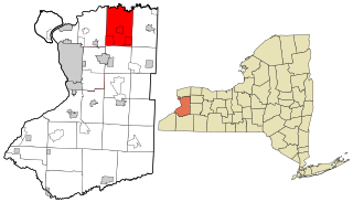
Clarence is a town located in the northeastern part of Erie County, New York, United States, northeast of Buffalo. The population was 30,673 according to the 2010 census. This represents an increase of 17.42% from the 2000 census figure. The Clarence census-designated place occupies the southeast part of the town and roughly corresponds to a postal district with ZIP code 14031 and 14221 in the western side which it shares with nearby Williamsville. The town is named in honor of Prince William, Duke of Clarence and St Andrews (1765–1837), the third son of King George III and later king himself, as William IV.

The Baltimore–Washington metropolitan area is a combined statistical area consisting of the overlapping labor market region of the cities of Washington, D.C. and Baltimore, Maryland. The region includes Central Maryland, Northern Virginia, three counties in the Eastern Panhandle of West Virginia, and one county in South Central Pennsylvania. It is the most educated, highest-income, and fourth largest combined statistical area in the United States.

Arnold is a market town, unparished area and suburb of the city of Nottingham, in the ceremonial county of Nottinghamshire in the East Midlands of England. It is situated to the north-east of Nottingham's city boundary. Arnold's town centre is the largest in the borough of Gedling and the most important in the northeastern part of the Greater Nottingham conurbation. Since 1968 Arnold has had a market, and the town used to have numerous factories associated with the hosiery industry. Nottinghamshire Police have been headquartered in Arnold since 1979. At the time of the 2011 census, Arnold had a population of 37,768.

State Route 123 is a primary state highway in the U.S. state of Virginia. The state highway runs 29.27 miles (47.11 km) from U.S. Route 1 in Woodbridge north to the Chain Bridge across the Potomac River into Washington from Arlington. It goes by three local names. From its southern terminus to the Occoquan River Bridge, it is known as Gordon Boulevard. From the Occoquan River Bridge to the city of Fairfax it is known as Ox Road. From Fairfax to its intersection with I-495 in Tysons Corner it is known as Chain Bridge Road. East of Tysons, it is known as Dolley Madison Boulevard. SR 123 is a partial circumferential highway in Northern Virginia that connects Woodbridge in eastern Prince William County with the independent city of Fairfax and the Fairfax County communities of Vienna, Tysons Corner, and McLean, the last being the home of the National Counterterrorism Center and the Central Intelligence Agency. The state highway also connects all of the major highways that radiate from Washington, including Interstate 95, I-66, US 29, US 50, SR 267, and the George Washington Memorial Parkway. Furthermore, SR 123 crosses another pair of circumferential highways, I-495 and the Fairfax County Parkway, and SR 7, a major northwest–southeast highway through Northern Virginia. The state highway is a part of the National Highway System for its entire length.

Loudonville is a hamlet in the town of Colonie, in Albany County, New York, United States. Loudonville was a census-designated place in the 1970, 1980, and 1990 US Census, but ceased to be in the 2000 Census, but became a CDP again in 2020.

State Route 3 is a primary state highway in the U.S. state of Virginia that extends from the town of Culpeper south and eastwardly to Gloucester in Virginia's Middle Peninsula region. For many years, a portion was named "Historyland Highway".
Bells Corners is a suburban community in College Ward in the city of Ottawa, Ontario, Canada. It is located in the former city of Nepean within Ottawa's western Greenbelt. As of the Canada 2016 Census, the community had a population of 9,272.

Owens is a small unincorporated crossroads community at the intersection of Dahlgren Road, Windsor Drive, and Owens Drive in King George County, Virginia, United States. State Routes 206 and 218 meet at this intersection, with 206 going east towards U.S. Route 301 and Dahlgren, 218 going south towards US 301 and Colonial Beach and 206 and 218 joined together going west towards Arnolds Corner and Fredericksburg. The eastern part of the community is within the Dahlgren census-designated place.

Prince County is located in western Prince Edward Island, Canada. The county's defining geographic feature is Malpeque Bay, a sub-basin of the Gulf of St. Lawrence, which creates the narrowest portion of Prince Edward Island's landmass, an isthmus upon which the city of Summerside is located.

State Route 205 is a primary state highway in the U.S. state of Virginia. The state highway runs 18.47 miles (29.72 km) from SR 3 at Purkins Corner east to SR 3 at Oak Grove. SR 205 connects several small communities in eastern King George County and northwestern Westmoreland County. The state highway also passes through the Potomac River resort of Colonial Beach, where the highway has a spur, State Route 205Y.

State Route 206 is a primary state highway in the U.S. state of Virginia. Known as Dahlgren Road, the state highway runs 11.04 miles (17.77 km) from SR 3 at Arnolds Corner east to SR 604 at the entrance to the Naval Surface Warfare Center Dahlgren Division in Dahlgren in eastern King George County.

State Route 218 is a primary state highway in the U.S. state of Virginia. The state highway runs 30.00 miles (48.28 km) from U.S. Route 1 and US 17 Business in Falmouth east to SR 205 in Tetotum. SR 218 connects suburban communities in Stafford County east of Fredericksburg with rural areas in northern and eastern King George County.
Carlton Corner is an unincorporated community in King and Queen County, Virginia, United States. It is a very rural area centered on the intersection of Mt. Zion Road and State Route 617.

Blackwells Corner is an unincorporated community in the Antelope Valley of Kern County, California. It is located 50 miles (80 km) west-northwest of Bakersfield, at an elevation of 650 feet. Blackwells Corner is at the intersection of California State Route 46 and California State Route 33, and was the last place James Dean was seen alive prior to his death in a car wreck.

Kaiser is a ghost town in Price County, Wisconsin, United States. Kaiser was located in the town of Lake along the current route of the Tuscobia State Trail, 5 miles (8.0 km) west-southwest of Park Falls. The town was marked on USGS maps as late as 1941.

Natural Bridge Station is an unincorporated community in Rockbridge County, Virginia, United States, named for both its proximity to Natural Bridge and formerly having a train depot along the Norfolk & Western rail line. Formerly known as Greenlee, and prior to that, Sherwood, it was the home of former Washington State Senator and United States Ambassador to Peru, Miles Poindexter. Natural Bridge Station is located along the James River and Virginia State Route 130, 3.2 miles (5.1 km) west of Glasgow. Natural Bridge Station is made up mostly of the southeastern corner of Rockbridge County encompassing all of the community of Arnolds Valley. Natural Bridge Station has a post office with ZIP code 24579. The current population is 1,622.

Coxs Corner, also known as Cox's Corner or Wrightsville, is an unincorporated community located within Upper Freehold Township, in Monmouth County, New Jersey, United States. Named for congressman and brigadier general James Cox (1753–1810), who had lived here at the family home of "Box Grove", it is at the juncture of County Route 524 and County Route 43. The Upper Freehold Historic Farmland Byway passes through the area.


