
Spotsylvania County is a county in the U.S. state of Virginia. As of the 2019 estimate, the population was 136,215. Spotsylvania is a part of Northern Virginia and the Baltimore–Washington metropolitan area. Its county seat is Spotsylvania Courthouse.

Richmond County is a county located on the Northern Neck in the U.S. state of Virginia. As of the 2010 census, the population was 9,254. Its county seat is Warsaw. The rural county should not be confused with the large city and state capital Richmond, Virginia. It was formed in 1692 when the first Rappahannock County was divided to form Richmond County and Essex County.

Fairfax County, officially the County of Fairfax, is located in the Commonwealth of Virginia in the United States. Part of Northern Virginia, Fairfax County borders both the City of Alexandria and Arlington County and forms part of the suburban ring of Washington, D.C. The county is thus predominantly suburban in character, with some urban and rural pockets.

Seven Corners is a commercial center and census-designated place (CDP) in Fairfax County, Virginia, United States. The population was 9,255 at the 2010 census. Seven Corners has a "Falls Church" mailing address but is not within Falls Church's city limits. The area got its name from the intersection of State Route 7, U.S. Route 50, State Route 613, State Route 338 and Wilson Boulevard. The junction of these four roads once created seven corners.

Tysons, also known as Tysons Corner, is a census-designated place (CDP) and unincorporated community in Fairfax County, Virginia, United States. Located in Northern Virginia between the community of McLean and the town of Vienna along the Capital Beltway (I-495), it lies within the Washington Metropolitan Area. Tysons is home to two super-regional shopping malls—Tysons Corner Center and Tysons Galleria—and the corporate headquarters of numerous companies such as Intelsat, DXC Technology, Gannett, Hilton Worldwide, Freddie Mac, Capital One, and Booz Allen Hamilton. Tysons is Fairfax County's central business district and a regional commercial center. It has been characterized as a quintessential example of an edge city. The population was 19,627 as of the 2010 census.

The Baltimore–Washington metropolitan area is a combined statistical area consisting of the overlapping labor market region of the cities of Washington, D.C. and Baltimore, Maryland. The region includes Central Maryland, Northern Virginia, three counties in the Eastern Panhandle of West Virginia, and one county in South Central Pennsylvania. It is the most educated, highest-income, and fourth largest combined statistical area in the United States.

The George Washington Birthplace National Monument is a national monument in Westmoreland County, Virginia, United States. This site was developed in the mid-17th century as a colonial tobacco plantation by Englishman John Washington. A member of the assembly, he was a great-grandfather of George Washington, general and the first United States president. George Washington was born in this house on February 22, 1732. He lived here until age three, returning later to live here as a teenager.
Tri-state area is an informal term in the eastern contiguous United States for any of several regions associated with a particular town or metropolis that, with adjacent suburbs, lies across three states. Some of these involve a state boundary tripoint. Other tri-state areas have a more diffuse population that shares a connected economy and geography—especially with respect to geology, botany, or climate. The term "tri-state area" is often present in films, radio and television commercials.

Gilberts Corner is an unincorporated area at the intersection of U.S. Route 50 and U.S. Route 15 in Loudoun County, Virginia, located east of the historic village of Aldie.
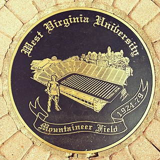
Mountaineer Field, known as the "Jewel of the Mountains", was a football stadium located in downtown Morgantown, West Virginia. It was the home of the West Virginia Mountaineers football team.

State Route 205 is a primary state highway in the U.S. state of Virginia. The state highway runs 18.47 miles (29.72 km) from SR 3 at Purkins Corner east to SR 3 at Oak Grove. SR 205 connects several small communities in eastern King George County and northwestern Westmoreland County. The state highway also passes through the Potomac River resort of Colonial Beach, where the highway has a spur, State Route 205Y.

Odricks Corner is an unincorporated community in Fairfax County, Virginia, United States. Odricks Corner lies north of the Dulles Toll Road at the intersection of Spring Hill and Lewinsville Roads.
Butts Corner is an unincorporated community of southern Fairfax County, Virginia, United States located at the intersection of Ox, Chapel, and Wolf Run Shoals Roads off the Fairfax County Parkway. The locale is officially inside the limits of Fairfax Station, Virginia.

The Corner is a seven-block collection of bars, restaurants, bookstores, and night spots on University Avenue in Charlottesville, Virginia, extending from 121⁄2 Street Southwest to Chancellor Street. located across the street from the University of Virginia. It is bounded by Graduate Charlottesville on the east and Bank of America on the west.
Comptons Corner is an unincorporated community in Fairfax County, Virginia, United States. Comptons Corner is located between Centreville and Yorkshire on State Route 28. The actual "corner" is created by the intersection of Sully and Compton Roads. According to the Geographic Names Information System, the community has also been known as Johnsons Corner in its past.

Lankford Corner is an unincorporated community in Lancaster and Northumberland Counties in the U. S. state of Virginia.

Chimney Corner is an unincorporated community in Fayette County, West Virginia, United States. Chimney Corner is located at the junction of U.S. Route 60 and West Virginia Route 16 3.5 miles (5.6 km) southeast of Gauley Bridge.
Farrs Corner is an unincorporated community in Fairfax County, in the U.S. state of Virginia.
Nancy Wrights Corner is an unincorporated community in Caroline County, in the U.S. state of Virginia. It is located along US 1 and VSR 605, west of Woodford. The community was one of the sites of the Battle of North Anna.


