
Santa Ana is a city and the county seat of Orange County, California. Located in the Greater Los Angeles region of Southern California, the city's population was 310,227 at the 2020 Census, making Santa Ana the 13th-most populous city in California and the 4th densest large city in the United States. Santa Ana is a major regional economic and cultural hub for the Orange Coast.

Sebastopol is a city in Sonoma County, in California with a recorded population of 7,379, per the 2010 U.S. Census.
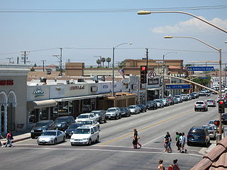
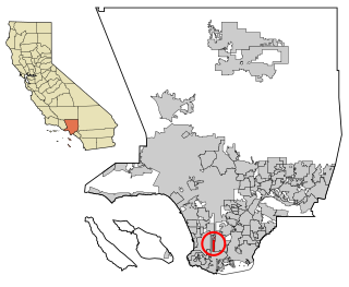
Artesia is a city in southeast Los Angeles County, California. Artesia was incorporated on May 29, 1959, and is one of Los Angeles County's Gateway Cities. The city has a 2010 census population of 16,522. Artesia is surrounded on the west, south, and east sides by Cerritos, with Norwalk to the north. Artesia is the home of the East West Ice Palace, an ice rink which is co-owned by Michelle Kwan. It was also the childhood home of former First Lady Pat Nixon, who lived there from 1914 to 1931, though the property on which she grew up is now part of neighboring Cerritos.

Ladera Heights is a community and unincorporated area in Los Angeles County, California. The population was 6,634 at the 2020 census. Culver City lies to its west, the Baldwin Hills neighborhood to its north, the View Park-Windsor Hills community to its east, the Westchester neighborhood to its south and southwest and the city of Inglewood to its southeast. With an average household income of $132,824, Ladera Heights ranks third amongst the ten wealthiest Black communities in the United States.

View Park−Windsor Hills is an unincorporated community in Los Angeles County, California.
West Carson is an unincorporated community in Los Angeles County, California. The population was 21,699 at the 2010 census, up from 21,138 at the 2000 census. For statistical purposes, the United States Census Bureau has defined West Carson as a census-designated place (CDP).

Santa Venetia is a census-designated place (CDP) in Marin County, California, United States. Santa Venetia is located 1.5 miles (2.4 km) north of downtown San Rafael, at an elevation of 56 feet. The population was 4,289 at the 2020 census.

Buena Park is a city in northwestern Orange County, about 12 miles (20 km) northwest of downtown Santa Ana, the county seat. As of Census 2010 its population was 80,530. It is the location of several tourist attractions, including Knott's Berry Farm. It is located about 24 miles southeast of Downtown Los Angeles and is within the Los Angeles metropolitan area.
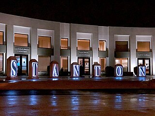
Stanton is a city in northern Orange County, California, part of the Los Angeles metropolitan area. The population was 37,962 at the 2020 United States Census. The city was incorporated in 1956 and operates under the council–manager form of government, providing a full range of municipal services. Stanton is bounded by Cypress on the west, Anaheim on the north, and east, and Garden Grove on the east and south.

Tustin is a city located in Orange County, California, in the Los Angeles metropolitan area. In 2020, Tustin had a population of 80,276. The city is located next to the county seat, Santa Ana, and does not include the unincorporated community of North Tustin.

Santa Ynez is a census-designated place (CDP) in the Santa Ynez Valley of Santa Barbara County, California.

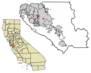
Stanford is a census-designated place (CDP) in the northwest corner of Santa Clara County, California, United States and is the home of Stanford University. The population was 21,150 at the 2020 census.

Riverbank is a city in Stanislaus County, California, United States. The population was 22,678 at the 2010 census, up from 15,826 at the 2000 census. Incorporated on August 23, 1922, Riverbank's official slogan is "City of Action." It is part of the Modesto Metropolitan Statistical Area.
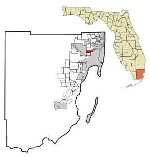
Gladeview is a census-designated place (CDP) in Miami-Dade County, Florida, United States. The population was 11,535 at the 2010 census.

East Dundee is a village in Kane County with a small section in Cook County. The population was 3,152 at the 2020 census.
Burbank is a census-designated place in Santa Clara County, California. Part of the neighborhood has been annexed to San Jose, while the rest consists of unincorporated areas of Santa Clara County. The population was 4,926 at the 2010 census. The area was named for horticulturist Luther Burbank.

Santa Teresa is a census-designated place (CDP) in Dona Ana County, New Mexico, United States. It is home to the Santa Teresa Port of Entry and is part of the Las Cruces Metropolitan Statistical Area, although geographically it is considerably closer to El Paso, Texas than to Las Cruces. While the United States Census Bureau has defined Santa Teresa as a CDP, the census definition of the area may not precisely correspond to local understanding of the area with the same name. The population was 4,258 at the 2010 census.

Okanogan is a city in Okanogan County, Washington, United States. The population was 2,552 at the 2010 census, within the Greater Omak Area. It is the seat of Okanogan County.

Hillandale is an unincorporated area and census-designated place located in Montgomery and Prince George's counties, Maryland, United States. As of the 2020 census, it had a population of 5,774. Hillandale is contained between the Prince George's / Montgomery County line to the east, the Anacostia River to the west, McCeney Avenue to the north, and D.C.'s Capital Beltway to the south. It borders the communities of Adelphi, Avenel, White Oak and Beltsville.
Carver City-Lincoln Gardens is a neighborhood within the city limits of Tampa, Florida. As of the 2010 census the neighborhood had a population of 2,204. The ZIP Codes serving the neighborhood are 33607 and 33609.

