Santa Ana Freeway

Last updated

I-5 (CA).svg

US 101 (1961 cutout).svg

Santa Ana Freeway

Santa Ana Freeway
Santa Ana Freeway highlighted in red
Route information
Maintained by Caltrans
Component
highways
I-5 (1961).svg I-5 from Irvine to Boyle Heights, Los Angeles [1]
US 101 (1961 cutout).svg US 101 from Boyle Heights to Downtown Los Angeles
Major junctions
South endI-5 (1961).svgI-405 (1961).svg I-5  / I-405 (El Toro Y) in Irvine
Major intersectionsCalifornia 133.svg SR 133 in Irvine
Toll plate California.svg
California 261.svg
SR 261 Toll in Irvine
California 55.svg SR 55 in Tustin
California 22.svgCalifornia 57.svg SR 22  / SR 57 (Orange Crush) in Orange
California 91.svg SR 91 in Buena Park
I-605 (1961).svg I-605 in Downey
I-710 (1961).svg I-710 in Vernon
I-5 (1961).svgI-10 (1961).svgUS 101 (1961 cutout).svgCalifornia 60.svg I-5  / I-10  / US 101 (East LA Int.) / SR 60 in Boyle Heights [1]
North endUS 101 (1961 cutout).svgCalifornia 110.svg US 101  / SR 110 (4 Level Int.) in Downtown Los Angeles
Location
Country United States
State California
Counties Orange, Los Angeles
Highway system
Southern California freeways

The Santa Ana Freeway is one of the principal freeways in Southern California, connecting Los Angeles and its southeastern suburbs including the freeway's namesake, the city of Santa Ana. The freeway begins at its junction with the San Diego Freeway (Interstate 405, I-405), called the El Toro Y, in Irvine, signed as I-5. From there, it generally goes southeast to northwest to the East Los Angeles Interchange, where it takes the designation of U.S. Route 101 (US 101). It then proceeds 2.95 miles (4.75 km) northwest to the Four Level Interchange (also known as the Bill Keene Memorial Interchange) in downtown Los Angeles. Formerly, the entirety of the route was marked as US 101 until the 1964 highway renumbering, which truncated US 101 to the East Los Angeles Interchange and designated the rest of the freeway as I-5.

Contents

North of the East Los Angeles Interchange complex, I-5 follows the Golden State Freeway. South of the El Toro Y, I-5 takes on the San Diego Freeway name from I-405.

An abundance of landmarks, most importantly Disneyland and Angel Stadium of Anaheim, along the Orange County portion of its route combines with a severe bottleneck beginning at the Los Angeles County line (shrinking from 10 to 6 lanes) to make it one of the most congested freeways in Southern California. The infamously busy intersection of the Santa Ana, Garden Grove, and Orange freeways in southwestern Orange is nicknamed the Orange Crush.

The freeway is officially defined as Routes 101 and 5 from Route 110 (Four Level Interchange) to Route 405. [2]

History

The Santa Ana Freeway is often congested, especially where it meets Interstate 605 (the San Gabriel River Freeway) in southeastern Los Angeles County. Santaanafreeway.jpg
The Santa Ana Freeway is often congested, especially where it meets Interstate 605 (the San Gabriel River Freeway) in southeastern Los Angeles County.

The Santa Ana Freeway is a bypass of the original state highway from Los Angeles to Santa Ana, which passed through Whittier and mostly became SR 72 in the 1964 renumbering. Southeast of Santa Ana, this earlier highway, added to the state highway system in 1910 as Route 2, generally followed the present freeway from Tustin past East Irvine to El Toro. [3] This route was marked as part of US 101 in 1928. [4]

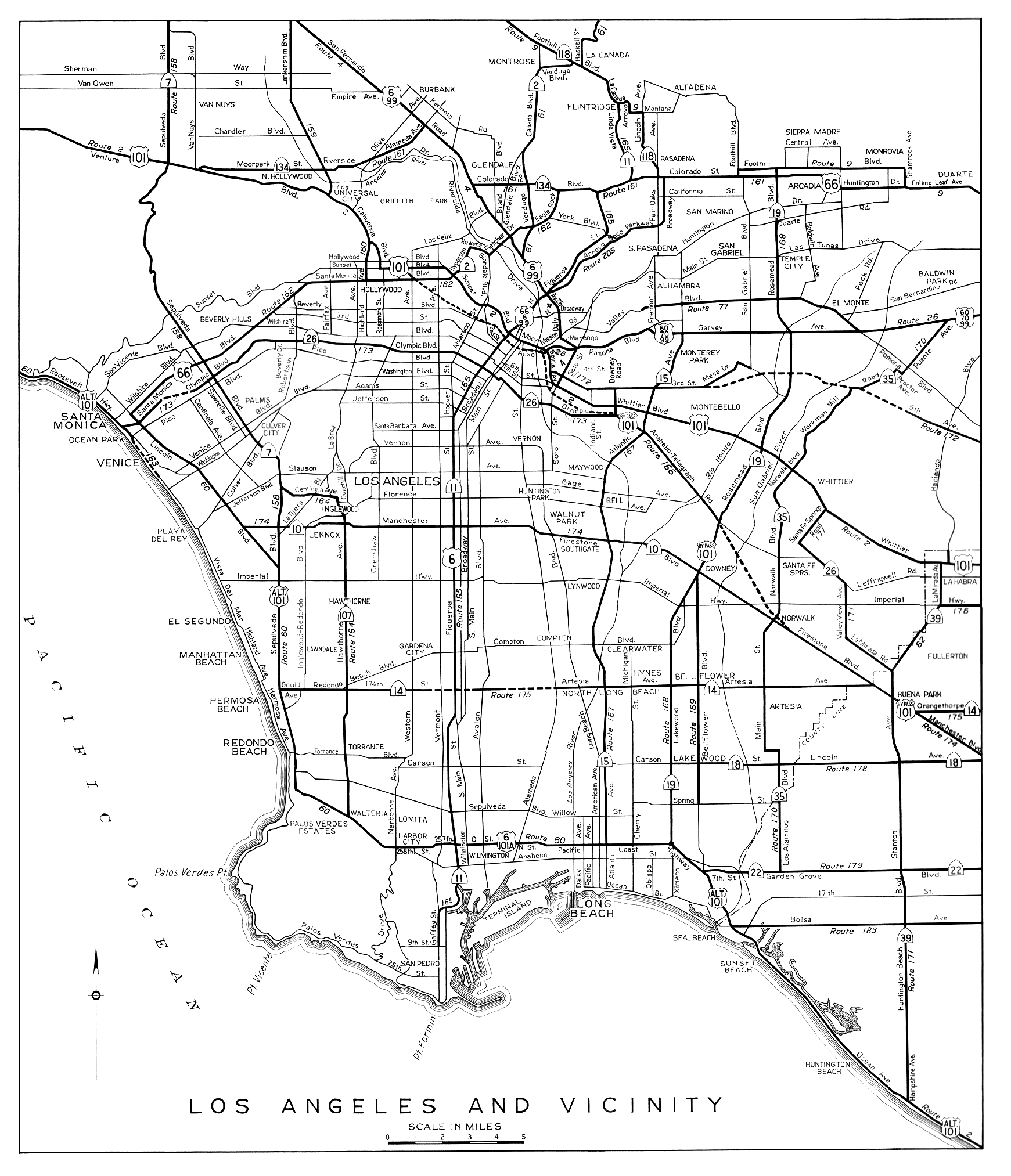
In 1933, the state legislature added a number of routes to the state highway system, including two that later formed parts of the Santa Ana Freeway. Route 166 began at the new Route 172 (now SR 60), at the corner of Indiana and Third Streets, and headed south on Indiana Street and east and southeast on Mines Avenue (Olympic Boulevard) and Anaheim-Telegraph Road (now Telegraph Road) to Route 171 (now SR 39) at the intersection with Los Nietos Road near Santa Fe Springs. Route 174 began at Route 60 (then signed Alternate U. S. 101 now SR 1) in what now is known as Westchester and followed Manchester Avenue and Firestone Boulevard (then under construction alongside the Southern Pacific Railroad's Santa Ana Branch) to Route 2 (then Los Angeles Street, now Anaheim Boulevard) in southern Anaheim. A second piece began further southeast on Route 2, where it turned east on Chapman Avenue, and followed the shorter Santa Ana Boulevard diagonally to Route 2 (Main Street) in northern Santa Ana. [5] [6] In 1934, Route 166, except on Indiana Street, was marked as part of Sign Route 6 (which continued along Route 171 to Buena Park), and the entire length of Route 174 became Sign Route 10. [7] [8] (SR 6 was renumbered to SR 26 in 1937, when US 6 entered California; [9] SR 10 was soon truncated to Anaheim Boulevard, as US 101 had moved from Route 2 to the shorter Route 174 in Santa Ana. [10] )

A U.S. Route 101 Bypass was created by 1941, beginning at the intersection of Routes 166 (Indiana Street, soon moved to Downey Road[ citation needed ]) and 2 (US 101 along Whittier Boulevard), and following Routes 166 and 174 to Route 2 (US 101) in Anaheim. The connection between Routes 166 and 174 was made via Route 168 (Rosemead Boulevard, then and now SR 19). This resulted in SR 10 being truncated further, to the intersection of Firestone and Rosemead Boulevards, though SR 26 continued to extend east on Routes 166 and 171 to Buena Park. [11] [12] [13]

A freeway connecting downtown Los Angeles with Orange County was planned by 1939, [14] and was included in A Transit Program for the Los Angeles Metropolitan Area, published that year by the Metropolitan Transportation Engineering Board. [15] To allow for its construction by the state, the definition of Route 166 was modified in 1941, changing the southeast end to Route 174 near Norwalk; at the same time, the northernmost piece was changed from Indiana Street to Downey Road. [16]

The entire Santa Ana Freeway began construction in 1947 and completed in 1956. Originally it was signed as US 101 before the segment of 101 between the East Los Angeles Interchange and the United States–Mexico border in San Ysidro, California was decommissioned in favor of Interstate 5. It was approved as a chargeable interstate in 1961. The Santa Ana Freeway and also portions of San Diego Freeway (before the freeway was built) south of El Toro Y went up changing the U.S. 101 signs to Interstate 5 in 1964, including full length of Golden State Freeway which was originally signed as US 99.

Former Interstate 105

From 1964 to 1968, the I-105 designation was used on a stretch of road linking I-5/I-10, US 101, and SR 10 (former I-110) north of downtown Los Angeles, now known as the East Los Angeles Interchange. In 1968, this I-105 was decommissioned, and that portion of the Santa Ana Freeway was folded into US 101. [17]

Exit list

Except where prefixed with a letter, postmiles were measured on the road as it was in 1964, based on the alignment that existed at the time, and do not necessarily reflect current mileage. R reflects a realignment in the route since then, M indicates a second realignment, L refers to an overlap due to a correction or change, and T indicates postmiles classified as temporary (for a full list of prefixes, see California postmile § Official postmile definitions ). [18] Segments that remain unconstructed or have been relinquished to local control may be omitted. The numbers reset at county lines; the start and end postmiles in each county are given in the county column.

CountyLocationPostmile
[18] [19] [20]
Exit [21] [22] DestinationsNotes
Orange Irvine 21.30South plate blue 1961.svg
I-5 (1961).svg
I-5 south (San Diego Freeway) San Diego
Continuation beyond I-405
94ANorth plate blue 1961.svg
I-405 (1961).svg
To plate California.svg
South plate California.svg
California 133.svg
I-405 north (San Diego Freeway north) to SR 133 south Long Beach
Northbound exit and southbound entrance; south end of Santa Ana Freeway; south end of I-5 overlap
See I-5 Exits 94A–134
Los Angeles Los Angeles 16.88
S0.00 [lower-alpha 1]
North plate blue 1961.svg
I-5 (1961).svg
I-10 (1961).svg I-5 north (Golden State Freeway) / I-10  Sacramento, San Bernardino, Santa Monica
North end of I-5 overlap; south end of US 101 overlap; no access from I-5 north to US 101 north, and vice versa
See US 101 Exits 1–3
Los Angeles Los Angeles 1.57 [lower-alpha 1] 3 [lower-alpha 2] California 110.svgTo plate blue 1961.svg
South plate blue 1961.svg
I-110 (1961).svg
SR 110 to I-110 south (Harbor Freeway) / Grand Avenue Pasadena, San Pedro
North end of Santa Ana Freeway; north end of US 101 overlap
North plate 1961.svg
US 101 (1961 cutout).svg
US 101 north (Hollywood Freeway) Ventura
Continuation beyond SR 110
1.000 mi = 1.609 km; 1.000 km = 0.621 mi
  1. 1 2 Indicates that the postmile represents the distance along US 101 rather than I-5.
  2. Exit numbers follow US 101 rather than I-5.

See also

Related Research Articles

<span class="mw-page-title-main">California State Route 1</span> State highway in California, United States

State Route 1 (SR 1) is a major north–south state highway that runs along most of the Pacific coastline of the U.S. state of California. At 656 miles (1,056 km), it is the longest state route in California, and the second-longest in the US after Montana Highway 200. SR 1 has several portions designated as either Pacific Coast Highway (PCH), Cabrillo Highway, Shoreline Highway, or Coast Highway. Its southern terminus is at Interstate 5 (I-5) near Dana Point in Orange County and its northern terminus is at U.S. Route 101 (US 101) near Leggett in Mendocino County. SR 1 also at times runs concurrently with US 101, most notably through a 54-mile (87 km) stretch in Ventura and Santa Barbara counties, and across the Golden Gate Bridge.

<span class="mw-page-title-main">California State Route 91</span> Highway in California

State Route 91 (SR 91) is a major east–west state highway in the U.S. state of California that serves several regions of the Greater Los Angeles urban area. A freeway throughout its entire length, it officially runs from Vermont Avenue in Gardena, just west of the junction with the Harbor Freeway, east to Riverside at the junction with the Pomona and Moreno Valley freeways.

<span class="mw-page-title-main">California State Route 22</span> Highway in Los Angeles and Orange counties in California, United States

State Route 22 is an east–west state highway in the U.S. state of California that serves southern Los Angeles County and northern Orange County. It runs between Pacific Coast Highway in Long Beach and the Costa Mesa Freeway in Orange by way of Garden Grove. The westernmost part of SR 22 runs along Long Beach's 7th Street. From West Garden Grove to its eastern terminus in Orange, it is known as the Garden Grove Freeway. It is one of the two principal east–west routes in Orange County.

<span class="mw-page-title-main">California State Route 57</span> Highway in California

State Route 57 (SR 57), also known as the Orange Freeway for most of its length, is a north–south state highway in the Greater Los Angeles Area of the U.S. state of California. It connects the interchange of Interstate 5 (I-5) and SR 22 near downtown Orange, locally known as the Orange Crush, to the Glendora Curve interchange with I-210 and SR 210 in Glendora. The highway provides a route across several spurs of the Peninsular Ranges, linking the Los Angeles Basin with the Pomona Valley and San Gabriel Valley.

<span class="mw-page-title-main">Hollywood Freeway</span> Freeway in California

The Hollywood Freeway is one of the principal freeways of Los Angeles, California and one of the busiest in the United States. It is the principal route through the Cahuenga Pass, the primary shortcut between the Los Angeles Basin and the San Fernando Valley. It is considered one of the most important freeways in the history of Los Angeles and instrumental in the development of the San Fernando Valley. It is the second oldest freeway in Los Angeles. From its southern end at the Four Level Interchange to its intersection with the Ventura Freeway in the southeastern San Fernando Valley, it is signed as part of U.S. Route 101. It is then signed as State Route 170 north to its terminus at the Golden State Freeway.

<span class="mw-page-title-main">Ventura Freeway</span> Freeway in Southern California

The Ventura Freeway is a freeway in southern California, United States, running from the Santa Barbara/Ventura county line to Pasadena in Los Angeles County. It is the principal east-west route through Ventura County and in the southern San Fernando Valley in Los Angeles County. From the Santa Barbara County line to its intersection with the Hollywood Freeway in the southeastern San Fernando Valley in Los Angeles, it is signed as U.S. Route 101 (US 101), which was built in the late 1950s and opened on April 5, 1960. East of the Hollywood Freeway intersection, it is signed as State Route 134 (SR 134) which was built by 1971.

<span class="mw-page-title-main">California State Route 58</span> Major state highway in California

State Route 58 is a major east-west state highway in the U.S. state of California that runs across the Coast Ranges, the southern San Joaquin Valley, the Tehachapi Mountains, which border the southern Sierra Nevada, and the Mojave Desert. It runs between U.S. Route 101 near Santa Margarita and Interstate 15 in Barstow. It has junctions with Interstate 5 near Buttonwillow, State Route 99 in Bakersfield, State Route 202 in Tehachapi, State Route 14 near Mojave, and U.S. Route 395 at Kramer Junction. SR 58 also provides access to Edwards Air Force Base. At various points it is known as the Calf Canyon Highway, Carrisa Highway, Bakersfield-McKittrick Highway, Rosa Parks Highway, Rosedale Highway, Barstow-Bakersfield Highway, Bakersfield Tehachapi Highway, Kern County Korean War Veterans Memorial Highway, and Mojave-Barstow Highway.

<span class="mw-page-title-main">California State Route 60</span> State highway in California

State Route 60 (SR 60) is an east–west state highway in the U.S. state of California. It serves the cities and communities on the eastern side of the Los Angeles metropolitan area and runs along the south side of the San Gabriel Valley. It functions as a bypass route of Interstate 10 (I-10) through the area between the East Los Angeles Interchange in Los Angeles and Beaumont. SR 60 provides a route across several spurs of the Peninsular Ranges, linking the Los Angeles Basin with the Pomona Valley and San Gabriel Valley. The highway also runs concurrently with SR 57 and I-215. Portions of SR 60 are designated as either the Pomona Freeway or the Moreno Valley Freeway.

<span class="mw-page-title-main">California State Route 2</span> State highway in California, United States

State Route 2 (SR 2) is a state highway in the U.S. state of California. It connects the Los Angeles Basin with the San Gabriel Mountains and the Victor Valley in the Mojave Desert. The highway's southwestern end is at the intersection of Centinela Avenue at the Santa Monica-Los Angeles border and its northeastern end is at SR 138 east of Wrightwood. The SR 2 is divided into four segments, and it briefly runs concurrently with U.S. Route 101 (US 101) and Interstate 210 (I-210). The southwestern section of SR 2 runs along a segment of the east–west Santa Monica Boulevard, an old routing of US 66, to US 101 in East Hollywood; the second section runs along segments of both the north–south Alvarado Street and Glendale Boulevard in Echo Park; the third section to I-210 in Glendale is known as the north–south Glendale Freeway; and the northeastern portion from I-210 in La Cañada Flintridge to SR 138 is designated as the Angeles Crest Highway.

<span class="mw-page-title-main">California State Route 72</span> Highway in California

State Route 72 is a state highway in the U.S. state of California. The route runs along Whittier Boulevard in the Los Angeles area from SR 39 in La Habra to Interstate 605 in Whittier. SR 72 forms part of El Camino Real.

<span class="mw-page-title-main">California State Route 118</span> Highway in California

State Route 118 is a state highway in the U.S. state of California that runs west to east through Ventura and Los Angeles counties. It travels from State Route 126 at the eastern edge of Ventura immediately northwest of Saticoy, then through Saticoy, in Ventura County east to Interstate 210 near Lake View Terrace in Los Angeles. SR 118 crosses the Santa Susana Pass and the northern rim of the San Fernando Valley along its route.

<span class="mw-page-title-main">California State Route 126</span> Highway in California

State Route 126 is a state highway in the U.S. state of California that serves Ventura and Los Angeles counties. The route runs from U.S. Route 101 in Ventura to Interstate 5 in Santa Clarita through the Santa Clara River Valley. The highway is an important connector highway in Ventura County, and serves as an alternate route into the Santa Clarita Valley, and the San Fernando Valley area of Los Angeles and the High Desert of Antelope Valley.

<span class="mw-page-title-main">California State Route 23</span> Highway in California

State Route 23 is a state highway in the U.S. state of California that connects the Pacific coast and the Santa Monica Mountains to the Conejo and Santa Clara River valleys. It runs from Pacific Coast Highway in Malibu in Los Angeles County to Ventura Street in Fillmore in Ventura County.

<span class="mw-page-title-main">Southern California freeways</span> Freeway system

The Southern California freeways are a vast network of interconnected freeways in the megaregion of Southern California, serving a population of 23 million people. The Master Plan of Metropolitan Los Angeles Freeways was adopted by the Regional Planning Commission in 1947 and construction began in the early 1950s. The plan hit opposition and funding limitations in the 1970s, and by 2004, only some 61% of the original planned network had been completed.

<span class="mw-page-title-main">California State Route 90</span> Highway in California

State Route 90 is a state highway in the U.S. state of California that consists of two unconnected pieces in Greater Los Angeles.

<span class="mw-page-title-main">U.S. Route 101 in California</span> U.S. Highway in California

U.S. Route 101 (US 101) is a major north–south United States Numbered Highway, stretching from Los Angeles, California, to Tumwater, Washington. The California portion of US 101 is one of the last remaining and longest U.S. Routes still active in the state, and the longest highway of any kind in California. US 101 was also one of the original national routes established in 1926. Significant portions of US 101 between the Los Angeles area and the San Francisco Bay Area follow El Camino Real, the commemorative route connecting the former Alta California's 21 missions.

<span class="mw-page-title-main">California State Route 42</span> Former highway in California

State Route 42 (SR 42) is a decommissioned state highway in the southern region part of the U.S. state of California, running along Manchester Avenue, Manchester Boulevard and Firestone Boulevard in Los Angeles and the cities south of it. In its final official routing that lasted from 1968 to 2000, SR 42 ran from State Route 1 west of Inglewood east to what was then a direct interchange with Interstate 5 in Norwalk. Though signed as SR 42, it was officially Route 105 until it was replaced by the parallel Interstate 105 on October 14, 1993. The entire route was deleted from the California Freeway and Expressway System in 2000, with the remaining portion of SR 42 being relinquished to local jurisdictions in that year. The direct interchange with I-5 was later demolished in 2013 in favor widening that portion of the Interstate. However, some SR 42 signs may still remain along the route.

<span class="mw-page-title-main">Interstate 10 in California</span> Interstate Highway in California

Interstate 10 (I-10) is a transcontinental Interstate Highway in the United States, stretching from Santa Monica, California to Jacksonville, Florida. The segment of I-10 in California runs east from Santa Monica through Los Angeles, San Bernardino, and Palm Springs before crossing into the state of Arizona. In the Greater Los Angeles area, it is known as the Santa Monica Freeway and the San Bernardino Freeway, linked by a short concurrency on I-5 at the East Los Angeles Interchange. I-10 also has parts designated as the Rosa Parks Freeway and the Sonny Bono Memorial Freeway. Some parts were also formerly designated as the Christopher Columbus Transcontinental Highway. However, the California State Legislature removed this designation following the passage of a bill on August 31, 2022. I-10 is also known colloquially as "the 10" to Southern California residents (See also California English § Freeways).

<span class="mw-page-title-main">California State Route 26 (1937–1964)</span> Former state highway in Los Angeles

State Route 26 (SR 26) was a state highway in Los Angeles and Orange counties in the U.S. state of California, from 1937 to 1964. It traveled from U.S. Route 101 Alternate in Santa Monica to SR 39 in Buena Park.

References

  1. 1 2 "Mapping L.A.: Boyle Heights". Los Angeles Times. Retrieved 2013-08-05.
  2. 2013 Named Freeways, Highways, Structures and Other Appurtenances in California (PDF). Caltrans. p. 63. Retrieved 2014-06-13.
  3. Ben Blow, California Highways: A Descriptive Record of Road Development by the State and by Such Counties as Have Paved Highways, 1920 (Archive.org or Internet Archive), pp. 165, 194-195
  4. California Highways and Public Works, United States Numbered Highways, January 1928
  5. California State Assembly. "An act to amend sections 2, 3 and 5 and to add two sections to be numbered 6 and 7 to an act entitled 'An act to provide for the acquisition of rights of way for and the construction, maintenance..." Fiftieth Session of the Legislature. Statutes of California. State of California. Ch. 767 p. 2040.: "Los Angeles, Indiana and 3rd Streets, to the Huntington Beach-Whittier Road near Santa Fe Springs." "State Highway Route 60 via Manchester Avenue to State Highway Route 2 near Miraflores." "State Highway Route 2 near Orange County Hospital to Main Street, Santa Ana, via Santa Ana Boulevard."
  6. California State Assembly. "An act to establish a Streets and Highways Code, thereby consolidating and revising the law relating to public ways and all appurtenances thereto, and to repeal certain acts and parts of acts specified herein". Fifty-first Session of the Legislature. Statutes of California. State of California. Ch. 29 p. 286.: "Route 166 is from Route 172, at the intersection of Indiana and Third Streets, in Los Angeles, to Route 171 near Santa Fe Springs." "Route 174 is from: (a) Route 60 via Manchester Avenue to Route 2 near Miraflores. (b) Route 2 near Orange County Hospital to Main Street, Santa Ana, via Santa Ana Boulevard."
  7. Dennis, T.H. (August 1934). "State Routes Will Be Numbered and Marked with Distinctive Bear Signs". California Highways and Public Works . 11 (8): 20–21, 32. ISSN   0008-1159 via Archive.org.
  8. H.M. Gousha Company, Los Angeles and Vicinity, 1935
  9. Richard F. Weingroff, U.S. 6: The Grand Army of the Republic Highway
  10. H.M. Gousha Company, Los Angeles and Vicinity, 1939
  11. H.M. Gousha Company, Los Angeles and Vicinity Archived 2011-06-29 at the Wayback Machine , 1941: SR 10 overlaps US 101 Bypass to Anaheim
  12. H.M. Gousha Company, Los Angeles and Vicinity Archived 2006-04-24 at the Wayback Machine , 1942: SR 10 has been truncated
  13. Division of Highways, Los Angeles and Vicinity, 1944
  14. Los Angeles Times, Super-Road Hearing Set, September 8, 1939, p. 20
  15. Ann Forsyth, Reforming Suburbia: The Planned Communities of Irvine, Columbia, and The Woodlands, University of California Press, 2005, ISBN   0-520-24166-5, p. 61
  16. California State Assembly. "An act to amend Sections 345, 466 and 612 of the Streets and Highways Code, relating to descriptions of certain State highways". Fifty-fourth Session of the Legislature. Statutes of California. State of California. Ch. 142 p. 1185.: "Route 166 is from Route 172, at the intersection of Downey Road to Route 174, near Norwalk."
  17. "105 California". Interstate Guide. Retrieved 4 October 2014.
  18. 1 2 California Department of Transportation. "State Truck Route List". Sacramento: California Department of Transportation. Archived from the original (XLS file) on June 30, 2015. Retrieved June 30, 2015.
  19. California Department of Transportation (July 2007). "Log of Bridges on State Highways". Sacramento: California Department of Transportation.
  20. Staff (2005–2006). "All Traffic Volumes on CSHS". California Department of Transportation.
  21. "Interstate 5" (PDF). California Numbered Exit Uniform System . California Department of Transportation. August 17, 2015. Retrieved June 20, 2016.
  22. "US 101" (PDF). California Numbered Exit Uniform System . California Department of Transportation. May 21, 2012. Retrieved June 20, 2016.
Template:Attached KML/Santa Ana Freeway
KML is from Wikidata