California State Route 55

Last updated • 5 min readFrom Wikipedia, The Free Encyclopedia

California 55.svg
State Route 55
California State Route 55
SR 55 highlighted in red
Route information
Maintained by Caltrans
Length17.807 mi [1]  (28.658 km)
Existed1964–present
Major junctions
South endVia Lido in Newport Beach
Major intersections
North endCalifornia 91.svg SR 91 in Anaheim
Location
Country United States
State California
Counties Orange
Highway system
California 54.svg SR 54 California 56.svg SR 56

State Route 55 (SR 55) is an 18-mile (30-km) long northsouth state highway that passes through suburban Orange County in the U.S. state of California. The portion of the route built to freeway standards is known as the Costa Mesa Freeway (formerly the Newport Freeway). SR 55 runs between Via Lido [2] south of Pacific Coast Highway (SR 1) in Newport Beach and the Riverside Freeway (SR 91) in Anaheim to the north, intersecting other major Orange County freeways such as SR 22, SR 73, and Interstate 405 (I-405).

Contents

SR 55 was first added to the state highway system in 1931, known as part of Legislative Route 43, and was routed on surface streets. It was renumbered SR 55 in 1959, and the construction of the freeway portion began in the 1960s and continued until 1992. Due to congestion, several alternatives are being discussed to expand the freeway portion past its current end in Newport Beach. SR 55 received the first carpool lane in Orange County in 1985, and the first direct carpool ramp in 1995.

Route description

Route 55 interchange with 17th Street in Santa Ana CA55 at 17th Street in Santa Ana.jpg
Route 55 interchange with 17th Street in Santa Ana
Interchange with Dyer Road CA55 at Dyer Road Aerial.jpg
Interchange with Dyer Road

Starting at Via Lido on Newport Boulevard in Newport Beach, 0.3 miles (0.48 km) south of SR 1, SR 55 (Newport Boulevard) is a four-lane expressway for approximately 0.75 miles (1.21 km) to its intersection with 17th Street in Costa Mesa. It then follows a traditional street routing through a retail and commercial section of Costa Mesa until its intersection with 19th Street. The segment on Newport Boulevard includes a limited-access interchange at SR 1. Following the 19th Street intersection, SR 55 becomes an eight-lane below-grade freeway that bisects the northbound and southbound lanes of Newport Boulevard until the Mesa Drive undercrossing. [3]

North of Fair Drive, SR 55 is an at-grade or above-grade freeway, with the exception of a 1 mile (1.6 km) stretch between the 1st Street/4th Street exit and the 17th Street exit in Santa Ana, which is below-grade. SR 55 intersects SR 73 and I-405 next to John Wayne Airport. The freeway continues north into Santa Ana and Tustin, where there is an interchange with I-5. Southbound SR 55 does not have a direct link to northbound I-5. [3]

SR 55 continues north into Orange, where it meets the eastern terminus of SR 22. Following this, the freeway continues almost due north until reaching its northern terminus at SR 91 near the Santa Ana River. After the last exit, Lincoln Avenue and Nohl Ranch Road, there is an entrance to the 91 Express Lanes from the HOV lane. [3]

Today, SR 55 is a heavily travelled corridor linking southern Orange County with SR 91, the main corridor between the Inland Empire and the Los Angeles Metropolitan Area, as well as I-5, the main northsouth corridor for California. A HOV lane has been built along the entire freeway portion from I-405 to SR 91, with some direct access ramps, including one for I-5. However, congestion is still very prevalent throughout the day, as is the norm with many Orange County freeways; Route 55 experiences a peak daily traffic volume of 262,000 vehicles and 17,292 trucks. [4] [5]

SR 55 is part of the California Freeway and Expressway System, [6] and is part of the National Highway System, [7] a network of highways that are considered essential to the country's economy, defense, and mobility by the Federal Highway Administration. [8] SR 55 from SR 91 to Costa Mesa is known as the Costa Mesa Freeway, as named by Assembly Concurrent Resolution 177, Chapter 86 in 1976. [9]

History

SR 55 southbound at I-405 interchange in Costa Mesa CA 55.JPG
SR 55 southbound at I-405 interchange in Costa Mesa

SR 55 was built in 1931 and originally numbered Route 43. It was built from the southern terminus of SR 1 (the Pacific Coast Highway, or "PCH") and continued northbound on roughly the same route it follows today, [10] following Newport Road (today Newport Boulevard) northeast to Tustin, and then Tustin Avenue north to near its current terminus at SR 91. [11] From here, Route 43 continued east on what is now SR 91 towards Riverside. In 1959, the highway was renumbered as Route 55, and its route was shortened from Route 1 to the also-renumbered Route 91. [10] The freeway portion from Chapman Avenue to SR 91 opened on January 18, 1962, at a cost of $4.6 million (equivalent to $35.5 million in 2023 [12] ). [13] The segment between SR 73 and Chapman Avenue opened in 1966. [5]

SR 55 was the first freeway in Orange County to receive carpool lanes, opened in October 1985 between I-405 and SR 91. The stretch of SR 55 between Mesa Drive and 19th Street in Costa Mesa was opened in 1992; [5] plans to extend SR 55 freeway south from 19th Street to State Route 1 were never realized [14] due to community opposition, fueling an amendment to the city charter to prevent this extension. [15]

In 1995, the direct carpool lane ramps between I-5 and SR 55 were completed; these were the first in Orange County. [5] The year also saw further widening of SR 55 between SR 22 and McFadden Avenue. Between 1996 and 2002, the fifth lane in both directions was constructed between I-5 and SR 91, funded with a sales tax of half a cent approved by Measure M. [16] In April 2007, the Orange County Transportation Authority approved funds to study the feasibility of extending the Costa Mesa Freeway south to 17th Street via tunnels or flyover ramps. [14] The segment of SR 55 from Finley Street to the Newport Channel bridge was legally authorized to be turned over to the city of Newport Beach in 2009. [17]

In the mid 2000s, Caltrans began adding the city of Anaheim as a control city on State Route 55 North. Signs that mention State Route 55 North would have the newer reflective posting pasted over the button sign or would be replaced with a new one that says "Anaheim/Riverside" to reflect this change.

SR 55 was formerly called the Newport Freeway. [18] In 2010, the stretch between Chapman and Katella Avenues in the City of Orange was renamed the Paul Johnson Freeway for longtime local radio and television traffic reporter Paul Johnson, who died the same year. [19]

On May 21, 2021, a road rage incident occurred in which the perpetrator fatally shot 6-year-old Aiden Leos, a passenger in his mother's car as it was traveling on the 55 Freeway. [20] On June 6, Marcus Anthony Eriz and Wynne Lee were arrested in connection with the death. Both suspects pleaded not guilty in court on June 18. [21]

Exit list

The entire route is in Orange County.

Locationmi [22] kmExit [22] DestinationsNotes
Newport Beach Newport Boulevard southContinuation beyond Finley Avenue
0.000.00 [a] Finley AvenueOriginal southern terminus of SR 55 [a]
0.100.16 [a] Via LidoSouth end of state maintenance [a]
0.270.431California 1.svg SR 1 (Pacific Coast Highway) Laguna Beach, Huntington Beach, Long Beach
Costa Mesa 1.873.012Newport Boulevard north, Harbor Boulevard South end of freeway; northbound exit and southbound entrance
2.774.463Victoria Street, 22nd Street
4.026.474Del Mar Avenue, Fair Drive
4.747.635ASouth plate California.svg
California 73.svg
SR 73 south (Corona del Mar Freeway) San Diego via toll road
SR 73 north exits 17A-B
5BNorth plate California.svg
California 73.svg
To plate blue 1961.svg
North plate blue 1961.svg
I-405 (1961).svg
SR 73 north (Corona del Mar Freeway) to I-405 north (San Diego Freeway) Long Beach
Northbound exit and southbound entrance; SR 73 south exit 17A
5CBaker StreetSigned as exit 5B southbound
5.999.646ANorth plate blue 1961.svg
I-405 (1961).svg
I-405 north (San Diego Freeway) Long Beach
Southbound exit and northbound entrance; northbound access is via exit 5B; I-405 south exit 9A
6BSouth plate blue 1961.svg
I-405 (1961).svg
Airport Sign.svg I-405 south (San Diego Freeway) San Diego, John Wayne Airport
Signed as exit 6 northbound; I-405 north exit 9A
South plate blue 1961.svg
I-405 (1961).svg
I-405 south
HOV access only; southbound exit and northbound entrance
North plate blue 1961.svg
I-405 (1961).svg
I-405 north
HOV access only; southbound exit and northbound entrance
IrvineSanta Ana line6.9911.257MacArthur Boulevard, Main Street
Santa Ana 7.8512.638Dyer RoadSigned as exits 8A (east) and 8B (west) southbound
Santa AnaTustin line9.4415.199Edinger Avenue
9.9616.0310AMcFadden AvenueSigned as exit 10 southbound
Tustin North plate blue 1961.svg
I-5 (1961).svg
I-5 north Santa Ana
HOV access only; northbound exit and southbound entrance
10BNorth plate blue 1961.svg
I-5 (1961).svg
I-5 north (Santa Ana Freeway) Santa Ana
Northbound exit and southbound entrance; southbound access is via exit 11B; I-5 south exit 103
10.9817.6711ASouth plate blue 1961.svg
I-5 (1961).svg
I-5 south (Santa Ana Freeway) San Diego
I-5 north exits 103A-B
Santa AnaTustin line11BTo plate blue 1961.svg
North plate blue 1961.svg
I-5 (1961).svg
4th Street to I-5 north / Irvine Boulevard
“To I-5” is not signed northbound
11.7918.971217th StreetSigned as exits 12A (east) and 12B (west) southbound
Orange 12.9720.8713West plate California.svg
California 22.svg
SR 22 west (Garden Grove Freeway) Long Beach
SR 22 east exits 17B-C
13.7022.0514Chapman Avenue (CR S25 east)Signed as exits 14A (east) and 14B (west) northbound
15.2424.5315Katella Avenue (CR S18 south) – Villa Park
16.9827.3317Lincoln Avenue, Nohl Ranch Road
Anaheim 17.8328.6918AWest plate California.svg
California 91.svg
SR 91 west (Riverside Freeway) Los Angeles
Northern terminus of SR 55; SR 91 exit 34
East plate California.svg
Express plate.svg
California 91.svg
91 Express Lanes east
18BEast plate California.svg
California 91.svg
SR 91 east (Riverside Freeway) Anaheim, Riverside
1.000 mi = 1.609 km; 1.000 km = 0.621 mi
  1. 1 2 3 4 Miles and exit numbers are measured from SR 55's original southern end at Finley Avenue, before the segment between Finley Avenue and Via Lido was deleted and relinquished to local control in 2014.

See also

Related Research Articles

<span class="mw-page-title-main">Orange County Transportation Authority</span> Transportation planning commission for Orange County, California

The Orange County Transportation Authority (OCTA) is the transportation planning commission for Orange County, California, in the Los Angeles metropolitan area. OCTA is responsible for funding and implementing transit and capital projects for the transportation system in the county, including freeway expansions, express lane management, bus and rail transit operation, and commuter rail funding and oversight.

<span class="mw-page-title-main">Interstate 605</span> Interstate Highway in California

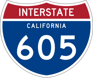
Interstate 605 is a 27-mile-long (43 km) major north–south auxiliary Interstate Highway in the Greater Los Angeles urban area of Southern California. It runs from I-405 and State Route 22 (SR 22) in Seal Beach in Orange County to I-210 just south of the Irwindale–Duarte border in Los Angeles County. The San Gabriel River Freeway closely parallels the San Gabriel River for most of its alignment, hence its name, which is one of the few Southern California freeways not named after a city along its route.

<span class="mw-page-title-main">California State Route 91</span> Highway in California

State Route 91 (SR 91) is a major east–west state highway in the U.S. state of California that serves several regions of the Greater Los Angeles urban area. A freeway throughout its entire length, it officially runs from Vermont Avenue in Gardena, just west of the junction with the Harbor Freeway, east to Riverside at the junction with the Pomona and Moreno Valley freeways.

<span class="mw-page-title-main">California State Route 22</span> Highway in Los Angeles and Orange counties in California, United States

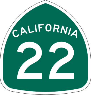
State Route 22 is an east–west state highway in the U.S. state of California that connects Long Beach with northern Orange County. It runs between Pacific Coast Highway in Long Beach and the Costa Mesa Freeway in Orange by way of Garden Grove. The westernmost part of SR 22 runs along Long Beach's 7th Street. From West Garden Grove to its eastern terminus in Orange, it is known as the Garden Grove Freeway. It is one of the two principal east–west routes in Orange County.

<span class="mw-page-title-main">California State Route 57</span> Highway in California

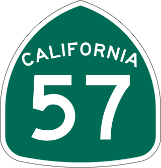
State Route 57 (SR 57), also known as the Orange Freeway for most of its length, is a north–south state highway in the Greater Los Angeles Area of the U.S. state of California. It connects the interchange of Interstate 5 (I-5) and SR 22 near downtown Orange, locally known as the Orange Crush, to the Glendora Curve interchange with I-210 and SR 210 in Glendora. The highway provides a route across several spurs of the Peninsular Ranges, linking the Los Angeles Basin with the Pomona Valley and San Gabriel Valley.

<span class="mw-page-title-main">Santa Ana Freeway</span> Highway in California

The Santa Ana Freeway is one of the principal freeways in Southern California, connecting Los Angeles and its southeastern suburbs including the freeway's namesake, the city of Santa Ana. The freeway begins at its junction with the San Diego Freeway, called the El Toro Y, in Irvine, signed as I-5. From there, it generally goes southeast to northwest to the East Los Angeles Interchange, where it takes the designation of U.S. Route 101 (US 101). It then proceeds 2.95 miles (4.75 km) northwest to the Four Level Interchange in downtown Los Angeles. Formerly, the entirety of the route was marked as US 101 until the 1964 highway renumbering, which truncated US 101 to the East Los Angeles Interchange and designated the rest of the freeway as I-5.

<span class="mw-page-title-main">Interstate 405 (California)</span> Interstate Highway in California

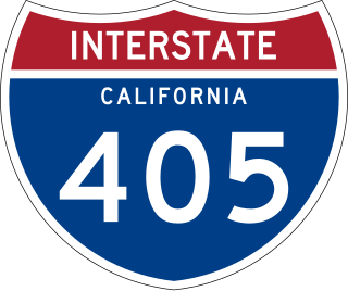
Interstate 405 is a major north–south auxiliary Interstate Highway in Southern California. The entire route is known as the northern segment of the San Diego Freeway. I-405 is a bypass auxiliary route of I-5, running along the southern and western parts of the Greater Los Angeles urban area from Irvine in the south to Sylmar in the north.

<span class="mw-page-title-main">Interstate 215 (California)</span> Interstate highway in California

Interstate 215 (I-215) is a 54.5-mile-long (87.7 km) north–south auxiliary Interstate Highway in the Inland Empire region of Southern California. It has portions designated as the Barstow, Escondido, and Armed Forces Freeways. I-215 is a bypass auxiliary route of I-15, running from Murrieta to northern San Bernardino. While I-215 connects the city centers of both Riverside and San Bernardino, its parent I-15 runs to the west through Corona and Ontario.

<span class="mw-page-title-main">California State Route 85</span> Highway in California

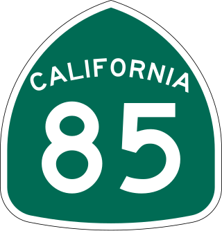
State Route 85 is a state highway which connects the cities of southern San Jose and Mountain View in the U.S. State of California. The highway intersects with major highways such as I-280, SR 17, and SR 87. The route serves as a bypass of U.S. Route 101 in the Santa Clara Valley area, running through the foothill cities of Los Gatos, Saratoga, Cupertino, roughly paralleling the Santa Cruz Mountains up to its interchange with I-280.

<span class="mw-page-title-main">California State Route 60</span> State highway in California

State Route 60 (SR 60) is an east–west state highway in the U.S. state of California. It serves the cities and communities on the eastern side of the Los Angeles metropolitan area and runs along the south side of the San Gabriel Valley. It functions as a bypass route of Interstate 10 (I-10) through the area between the East Los Angeles Interchange in Los Angeles and Beaumont. SR 60 provides a route across several spurs of the Peninsular Ranges, linking the Los Angeles Basin with the Pomona Valley and San Gabriel Valley. The highway also runs concurrently with SR 57 and I-215. Portions of SR 60 are designated as either the Pomona Freeway or the Moreno Valley Freeway.

<span class="mw-page-title-main">California State Route 87</span> Highway in San Jose, California

State Route 87, known as the Guadalupe Freeway or referred to by the locals as Highway 87, is a north–south state highway in San Jose, California, United States. Before being upgraded to a freeway, it was Guadalupe Parkway.

<span class="mw-page-title-main">California State Route 237</span> Highway in California

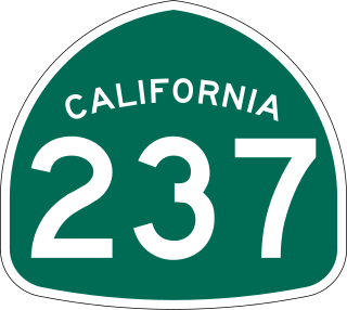
State Route 237 is a state highway in the U.S. state of California that runs from El Camino Real in Mountain View to Interstate 680 in Milpitas. Known as the Southbay Freeway for most of its length, SR 237 runs south of the San Francisco Bay, connecting the East Bay to the Peninsula.

<span class="mw-page-title-main">Southern California freeways</span> Freeway system

A vast network of interconnected freeways in the megaregion of Southern California serves a population of over 23 million people. The Master Plan of Metropolitan Los Angeles Freeways was adopted by the Regional Planning Commission in 1947 and construction began in the early 1950s. The plan hit opposition and funding limitations in the 1970s, and by 2004, only some 61% of the original planned network had been completed.

<span class="mw-page-title-main">California State Route 39</span> Highway in California

State Route 39 is a state highway in the U.S. state of California that travels through Orange and Los Angeles counties. Its southern terminus is at Pacific Coast Highway, in Huntington Beach. SR 39's northern terminus is at Islip Saddle on Angeles Crest Highway in the Angeles National Forest, but its northernmost 4.5-mile (7.2 km) segment has been closed to public highway traffic since 1978 due to a massive mud and rockslide.

<span class="mw-page-title-main">California State Route 73</span> Highway and toll road in Orange County, California

State Route 73 (SR 73) is an approximately 17.76-mile (28.58 km) state highway in Orange County, California. The southernmost 12 miles (19.31 km) of the highway is a toll road operated by the San Joaquin Hills Transportation Corridor Agency named the San Joaquin Hills Transportation Corridor, which opened in November 1996. The northernmost 5.76 miles (9.27 km) of the highway, which opened in 1978, is part of the Corona del Mar Freeway. SR 73's southern terminus is at Interstate 5 (I-5) near the San Juan Capistrano–Mission Viejo–Laguna Niguel tripoint. Its northern terminus is at Interstate 405 (I-405) in Costa Mesa. The highway's alignment through the San Joaquin Hills follows an approximately parallel path between the Pacific Coast Highway and I-405. Currently, there are no HOV lanes for the three-mile freeway segment, but the medians have been designed with sufficient clearance for their construction should the need arise in the future.

<span class="mw-page-title-main">California State Route 107</span> Highway in California

State Route 107 is a state highway in the U.S. state of California that forms part of Hawthorne Boulevard in the Los Angeles Area from State Route 1 in Torrance north to Redondo Beach Boulevard at the Redondo Beach–Lawndale border.

<span class="mw-page-title-main">California State Route 71</span> Highway in California

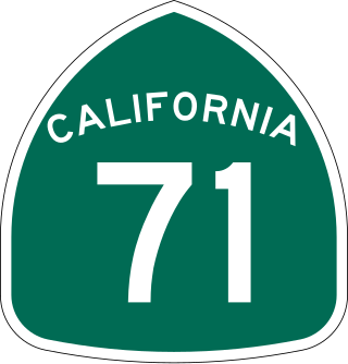
State Route 71 (SR 71) is a 15-mile (24 km) state highway in the U.S. state of California. Serving Riverside, San Bernardino, and Los Angeles counties, it runs from SR 91 in Corona to the Kellogg Interchange with I-10 and SR 57 on the border of Pomona and San Dimas. The segment from SR 91 to SR 83 in Chino Hills is called the Corona Freeway, formerly the Corona Expressway and before then the Temescal Freeway. SR 71 is designated as the Chino Valley Freeway between SR 83 and the Kellogg Interchange.

<span class="mw-page-title-main">California State Route 47</span> Highway in California

State Route 47 is a state highway in the U.S. state of California, connecting Terminal Island to the mainland in the Los Angeles area. From its south end at I-110 in San Pedro, it heads east across the Vincent Thomas Bridge to the island and the end of state maintenance. The state highway begins again at the junction with I-710 on Terminal Island, crossing the Schuyler Heim Bridge north to the mainland and the second terminus, where SR 103 begins. Signage continues along a locally maintained route, mainly Alameda Street, to the Gardena Freeway in Compton, and an unconstructed alignment follows the same corridor to the Santa Monica Freeway (I-10) near downtown Los Angeles.

<span class="mw-page-title-main">Interstate 5 in California</span> Interstate Highway in California

Interstate 5 (I-5) is a major north–south route of the Interstate Highway System in the United States, running largely parallel to the Pacific Coast between the Mexican border and the Canadian border. The segment of I-5 in California runs across the length of the state from the Mexican border at the San Ysidro Port of Entry in the San Ysidro neighborhood of San Diego to the Oregon state line south of the Medford-Ashland metropolitan area. It is the longest interstate in California at 796.77 miles (1,282.28 km), and accounts for more than half of I-5's total length of 1,381.29 miles (2,222.97 km). It is also the second longest stretch of Interstate Highway with a single designation within a single state after I-10 in Texas.

<span class="mw-page-title-main">Jamboree Road</span> Arterial road in Orange County, California

Jamboree Road is a 15.8-mile (25.4 km) long major arterial road through Orange County, California, running through the cities of Newport Beach, Irvine, Tustin, and Orange.

References

  1. California Department of Transportation. "State Truck Route List". Sacramento: California Department of Transportation. Archived from the original (XLS file) on September 5, 2015. Retrieved June 30, 2015.
  2. "California Highways (www.cahighways.org): Routes 49 through 56". Cahighways.org. Retrieved June 29, 2018.l
  3. 1 2 3 "SR 55" (Map). Google Maps . Retrieved February 10, 2008.
  4. Staff. 2005 Average Annual Daily Truck Traffic on the California highway system (PDF). California Department of Transportation. p. 94. Retrieved July 24, 2012.
  5. 1 2 3 4 Staff. "Route Concept Report: State Route 55" (PDF). California Department of Transportation. Retrieved July 4, 2012.
  6. "Article 2 of Chapter 2 of Division 1". California Streets and Highways Code. Sacramento: California Office of Legislative Counsel. Retrieved February 6, 2019.
  7. Federal Highway Administration (March 25, 2015). National Highway System: Los Angeles, CA (PDF) (Map). Scale not given. Washington, DC: Federal Highway Administration. Retrieved October 14, 2017.
  8. Natzke, Stefan; Neathery, Mike & Adderly, Kevin (June 20, 2012). "What is the National Highway System?". National Highway System. Washington, DC: Federal Highway Administration. Retrieved July 1, 2012.
  9. California Department of Transportation; California State Transportation Agency (January 2021). 2020 Named Freeways, Highways, Structures and Other Appurtenances in California (PDF). Sacramento: California Department of Transportation. p. 41. Archived from the original (PDF) on October 10, 2022.
  10. 1 2 Staff. "SR-55 Background and History". California Department of Transportation . Retrieved July 5, 2012.
  11. Road Map of California (Map). California Division of Highways. 1936.
  12. Johnston, Louis; Williamson, Samuel H. (2023). "What Was the U.S. GDP Then?". MeasuringWorth . Retrieved November 30, 2023. United States Gross Domestic Product deflator figures follow the MeasuringWorth series.
  13. "New Freeway Section Will Open Today". Los Angeles Times. January 18, 1962. p. D15.
  14. 1 2 "OC Set To Study New End to 55 Freeway" (PDF). Los Angeles Times . p. 2. Archived from the original (PDF) on July 20, 2011. Retrieved April 22, 2007.
  15. Rogers, Bob (September 23, 2011). "Mayor Howard Rogers and the Freeway Fight". Newport Beach Independent. Newport Beach, California. Retrieved July 5, 2012.[ permanent dead link ]
  16. OCTA Completed Freeway Projects
  17. Staff. "Bill Text: CA Assembly Bill 344 - 2009-2010 Session". LegiScan. Retrieved July 5, 2012.
  18. California (Map). Shell Oil Company. 1965.
  19. Gauthier, Andrew (February 23, 2011). "Longtime KNBC Traffic Reporter Paul Johnson Gets His Own Freeway - TVSpy". Mediabistro.com. Archived from the original on May 14, 2012. Retrieved July 7, 2012.
  20. Amy Powell (May 23, 2021). "Family of boy killed on Orange County freeway grateful for outpouring of community support". ABC news. Retrieved June 3, 2021.
  21. Nathaniel Percy (June 11, 2021). "Aiden Leos to be memorialized with plaque at OC Zoo". Orange County Register.
  22. 1 2 Warring, KS (April 18, 2008). "Route 55 Freeway Interchanges" (PDF). California Numbered Exit Uniform System . California Department of Transportation . Retrieved May 16, 2015.
Template:Attached KML/California State Route 55
KML is from Wikidata