
Jacareí is a city in the state of São Paulo, Brazil. The population is 235,416 in an area of 464.27 km2. The city is known as "Capital of Beer" by the daily output of its factories, considered the biggest in Latin America. The economic activity is mainly based on industrial production. The industries produce mainly paper, chemicals, glass, wire, and rubber.

Município da Estância Turística de Bananal is a city in the state of São Paulo in Brazil. It is part of the Metropolitan Region of Vale do Paraíba e Litoral Norte. The population is 10,993 in an area of 616.43 km2 (238.00 sq mi).
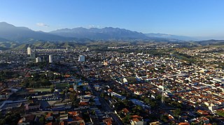
Cruzeiro is a municipality in the state of São Paulo in Brazil. It is located about 220 km (137 mi) from the state capital. It is part of the Metropolitan Region of Vale do Paraíba e Litoral Norte. The population is 82,571 in an area of 305,70 km2. People of things who come from or inhabit in Cruzeiro are called "cruzeirense".

Areias is a municipality in the state of São Paulo in Brazil. It is part of the Metropolitan Region of Vale do Paraíba e Litoral Norte. The population is 3,896 in an area of 305.23 km². The elevation is 509 m.

Guarulhos is a Brazilian municipality. It is the second most populous city in the Brazilian state of São Paulo, the 13th most populous city in Brazil, and is also the most populous city in the country that is not a state capital. In the last few years it has outgrown Campinas. It is part of the Metropolitan Region of São Paulo. Its population is 1,291,784 with an area of 318.68 km2.

Igaratá is a municipality in the state of São Paulo in Brazil. It is part of the Metropolitan Region of Vale do Paraíba e Litoral Norte. The population is 9,583 in an area of 292.95 km². The elevation is 745 m. This place name comes from the Tupi language.

Jambeiro is a municipality in the state of São Paulo in Brazil. It is part of the Metropolitan Region of Vale do Paraíba e Litoral Norte. The population is 6,717 in an area of 184.41 km2. The elevation is 695 m.
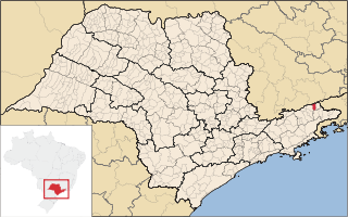
Lavrinhas is a municipality in the state of São Paulo in Brazil. It is formed by the seat and district of Pinheiros. The municipality is crossed by many rivers, creeks and so on; the main ones are: Jacu River, Braço River and Paraíba do Sul River, this one presenting rapids. It is a historical town, where many events of the 1932 Revolution took place in and which attracts, to this day, many tourists, who’re taken by guides to the trenches, vestiges of the conflict. As for its economy, most of it is based on agriculture, cattle raising and tourism.
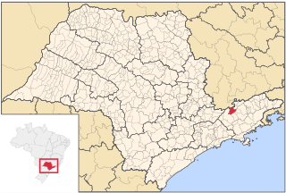
Monteiro Lobato is a municipality in the state of São Paulo in Brazil. It is part of the Metropolitan Region of Vale do Paraíba e Litoral Norte. The population is 4,696 in an area of 332.74 km2 (128.47 sq mi).

Natividade da Serra is a municipality in the state of São Paulo in Brazil. It is part of the Metropolitan Region of Vale do Paraíba e Litoral Norte. The population is 6,642 in an area of 833.37 km². The elevation is 720 m. The southern part is heavily forested and mountainous and there are few roads and tracks into the mountain. The hills and some mountains with farmlands dominate the rest of the municipality.
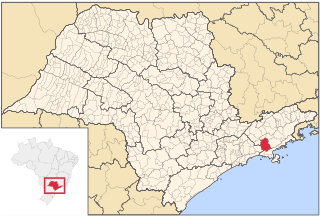
Paraibuna is a municipality (município) in the state of São Paulo in Brazil. It is part of the Metropolitan Region of Vale do Paraíba e Litoral Norte. The population is 18,263 in an area of 809.58 km². The elevation is 635 m. The SP-99 highway passes through the town.
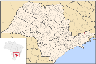
Piquete is a municipality in the state of São Paulo in Brazil. It is part of the Metropolitan Region of Vale do Paraíba e Litoral Norte. The population is 13,575 in an area of 176.00 km². The elevation is 645 m.

Queluz is a municipality in the state of São Paulo in Brazil. It is part of the Metropolitan Region of Vale do Paraíba e Litoral Norte.
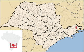
Silveiras is a municipality in São Paulo State, Brazil. It is part of the Metropolitan Region of Vale do Paraíba e Litoral Norte. The population is 6,339 in an area of 414.78 km². The elevation is 615 m.

Santa Branca is a municipality in the state of São Paulo in Brazil. It is part of the Metropolitan Region of Vale do Paraíba e Litoral Norte. The population is 14,857 in an area of 272.24 km2. The elevation is 648 m. The Rodovia Governador Carvalho Pinto (SP-070) passes north of Santa Branca.

Redenção da Serra is a municipality (município) in the eastern part of the state of São Paulo in Brazil. It is part of the Metropolitan Region of Vale do Paraíba e Litoral Norte. The population is 3,839 in an area of 309.44 km2. The elevation is 730 m.

São José do Barreiro is a municipality in the eastern part of the state of São Paulo, Brazil. The population is 4,144 in an area of 570.69 km².
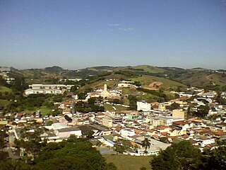
Santa Isabel is a municipality in the state of São Paulo in Brazil. It is part of the Metropolitan Region of São Paulo. The population is 57,966 in an area of 363.33 km². The elevation is 655 m. It is located 60 miles east of the downtown of the city of São Paulo.
The Jaguari River is a river of São Paulo state in southeastern Brazil. It is a tributary of the Paraíba do Sul.
The Mananciais do Rio Paraíba do Sul Environmental Protection Area is an environmental protection area in the state of São Paulo, Brazil.


