Related Research Articles

A gyroscope is a device used for measuring or maintaining orientation and angular velocity. It is a spinning wheel or disc in which the axis of rotation is free to assume any orientation by itself. When rotating, the orientation of this axis is unaffected by tilting or rotation of the mounting, according to the conservation of angular momentum.

Flight instruments are the instruments in the cockpit of an aircraft that provide the pilot with data about the flight situation of that aircraft, such as altitude, airspeed, vertical speed, heading and much more other crucial information in flight. They improve safety by allowing the pilot to fly the aircraft in level flight, and make turns, without a reference outside the aircraft such as the horizon. Visual flight rules (VFR) require an airspeed indicator, an altimeter, and a compass or other suitable magnetic direction indicator. Instrument flight rules (IFR) additionally require a gyroscopic pitch-bank, direction and rate of turn indicator, plus a slip-skid indicator, adjustable altimeter, and a clock. Flight into instrument meteorological conditions (IMC) require radio navigation instruments for precise takeoffs and landings.

In navigation, dead reckoning is the process of calculating the current position of a moving object by using a previously determined position, or fix, and incorporating estimates of speed, heading, and elapsed time. The corresponding term in biology, to describe the processes by which animals update their estimates of position or heading, is path integration.

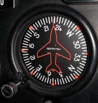
The heading indicator (HI), also known as a directional gyro (DG) or direction indicator (DI), is a flight instrument used in an aircraft to inform the pilot of the aircraft's heading.

The attitude indicator (AI), formerly known as the gyro horizon or artificial horizon, is a flight instrument that informs the pilot of the aircraft orientation relative to Earth's horizon, and gives an immediate indication of the smallest orientation change. The miniature aircraft and horizon bar mimic the relationship of the aircraft relative to the actual horizon. It is a primary instrument for flight in instrument meteorological conditions.
The basic principles of air navigation are identical to general navigation, which includes the process of planning, recording, and controlling the movement of a craft from one place to another.
A guidance system is a virtual or physical device, or a group of devices implementing a controlling the movement of a ship, aircraft, missile, rocket, satellite, or any other moving object. Guidance is the process of calculating the changes in position, velocity, altitude, and/or rotation rates of a moving object required to follow a certain trajectory and/or altitude profile based on information about the object's state of motion.

An autopilot is a system used to control the path of an aircraft, marine craft or spacecraft without requiring constant manual control by a human operator. Autopilots do not replace human operators. Instead, the autopilot assists the operator's control of the vehicle, allowing the operator to focus on broader aspects of operations.

In aviation, an electronic flight instrument system (EFIS) is a flight instrument display system in an aircraft cockpit that displays flight data electronically rather than electromechanically. An EFIS normally consists of a primary flight display (PFD), multi-function display (MFD), and an engine indicating and crew alerting system (EICAS) display. Early EFIS models used cathode ray tube (CRT) displays, but liquid crystal displays (LCD) are now more common. The complex electromechanical attitude director indicator (ADI) and horizontal situation indicator (HSI) were the first candidates for replacement by EFIS. Now, however, few flight deck instruments cannot be replaced by an electronic display.

The Garmin G1000 is an electronic flight instrument system (EFIS) typically composed of two display units, one serving as a primary flight display, and one as a multi-function display. Manufactured by Garmin Aviation, it serves as a replacement for most conventional flight instruments and avionics. Introduced in June 2004, the system has since become one of the most popular integrated glass cockpit solutions for general aviation and business aircraft.

An air data computer (ADC) or central air data computer (CADC) computes altitude, vertical speed, air speed, and Mach number from pressure and temperature inputs. It is an essential avionics component found in modern aircraft. This computer, rather than individual instruments, can determine the calibrated airspeed, Mach number, altitude, and altitude trend data from an aircraft's pitot-static system. In some very high-speed aircraft such as the Space Shuttle, equivalent airspeed is calculated instead of calibrated airspeed.

An inertial reference unit (IRU) is a type of inertial sensor which uses gyroscopes (electromechanical, ring laser gyro or MEMS) and accelerometers (electromechanical or MEMS) to determine a moving aircraft’s or spacecraft’s change in rotational attitude (angular orientation relative to some reference frame) and translational position (typically latitude, longitude and altitude) over a period of time. In other words, an IRU allows a device, whether airborne or submarine, to travel from one point to another without reference to external information.
The Delco Carousel — proper name Carousel IV — was an inertial navigation system (INS) for aircraft developed by Delco Electronics. Before the advent of sophisticated flight management systems, Carousel IV allowed pilots to automate navigation of an aircraft along a series of waypoints that they entered via a control console in the cockpit.

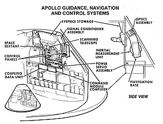
Guidance, navigation and control is a branch of engineering dealing with the design of systems to control the movement of vehicles, especially, automobiles, ships, aircraft, and spacecraft. In many cases these functions can be performed by trained humans. However, because of the speed of, for example, a rocket's dynamics, human reaction time is too slow to control this movement. Therefore, systems—now almost exclusively digital electronic—are used for such control. Even in cases where humans can perform these functions, it is often the case that GNC systems provide benefits such as alleviating operator work load, smoothing turbulence, fuel savings, etc. In addition, sophisticated applications of GNC enable automatic or remote control.

An inertial navigation system is a navigation device that uses motion sensors (accelerometers), rotation sensors (gyroscopes) and a computer to continuously calculate by dead reckoning the position, the orientation, and the velocity of a moving object without the need for external references. Often the inertial sensors are supplemented by a barometric altimeter and sometimes by magnetic sensors (magnetometers) and/or speed measuring devices. INSs are used on mobile robots and on vehicles such as ships, aircraft, submarines, guided missiles, and spacecraft. Older INS systems generally used an inertial platform as their mounting point to the vehicle and the terms are sometimes considered synonymous.

The LN-3 inertial navigation system is an inertial navigation system (INS) that was developed in the 1960s by Litton Industries. It equipped the Lockheed F-104 Starfighter versions used as strike aircraft in European forces. An inertial navigation system is a system which continually determines the position of a vehicle from measurements made entirely within the vehicle using sensitive instruments. These instruments are accelerometers which detect and measure vehicle accelerations, and gyroscopes which act to hold the accelerometers in proper orientation.
Spacecraft attitude control is the process of controlling the orientation of a spacecraft with respect to an inertial frame of reference or another entity such as the celestial sphere, certain fields, and nearby objects, etc.

An inertial measurement unit (IMU) is an electronic device that measures and reports a body's specific force, angular rate, and sometimes the orientation of the body, using a combination of accelerometers, gyroscopes, and sometimes magnetometers. When the magnetometer is included, IMUs are referred to as IMMUs.

Pressure reference system (PRS) is an enhancement of the inertial reference system and attitude and heading reference system designed to provide position angles measurements which are stable in time and do not suffer from long term drift caused by the sensor imperfections. The measurement system uses behavior of the International Standard Atmosphere where atmospheric pressure descends with increasing altitude and two pairs of measurement units. Each pair measures pressure at two different positions that are mechanically connected with known distance between units, e.g. the units are mounted at the tips of the wing. In horizontal flight, there is no pressure difference measured by the measurement system which means the position angle is zero. In case the airplane banks (to turn), the tips of the wings mutually change their positions, one is going up and the second one is going down, and the pressure sensors in every unit measure different values which are translated into a position angle.

The Hemispherical Resonator Gyroscope (HRG), also called wine-glass gyroscope or mushroom gyro, is a compact, low-noise, high-performance angular rate or rotation sensor. An HRG is made using a thin solid-state hemispherical shell, anchored by a thick stem. This shell is driven to a flexural resonance by electrostatic forces generated by electrodes which are deposited directly onto separate fused-quartz structures that surround the shell. The gyroscopic effect is obtained from the inertial property of the flexural standing waves. Although the HRG is a mechanical system, it has no moving parts, and can be very compact.
References
- ↑ "MARG sensors + Bluetooth". 3 February 2011.
- ↑ Whitfield, Bethany (16 September 2016). "How It Works: Attitude and Heading Reference System - FLYING Magazine". FLYING Magazine. Retrieved 15 August 2023.
- ↑ "AHRS Attitude Heading Reference System". Xsens 3D motion tracking. Retrieved 2019-01-22.
- ↑ AHRS – OpenPilot Project Archived August 12, 2011, at the Wayback Machine