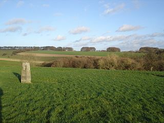
Winkelbury Hill is a 62.95 hectare biological Site of Special Scientific Interest in Wiltshire, notified in 1971.

Upton Cow Down is a 16.4 hectare biological Site of Special Scientific Interest in Wiltshire. The down is an area of chalk grassland on the western edge of Salisbury Plain. It lies one mile south of the town of Westbury, above the village of Upton Scudamore.

Cull-Peppers Dish is a 0.9-hectare (2.2-acre) geological Site of Special Scientific Interest in Dorset, notified in 1989.

Pincombe Down is a 23.8 hectare biological Site of Special Scientific Interest in Wiltshire, notified in 1971.

Rotherley Downs is a 120.05 hectare biological Site of Special Scientific Interest in Wiltshire, England, notified in 1989.

Roundway Down and Covert is an 86 hectare biological Site of Special Scientific Interest near Devizes in Wiltshire, England. It was notified in 1971.
Abbotsbury Blind Lane is a 0.4 hectares geological Site of Special Scientific Interest in Dorset, notified in 1986; this area is slightly smaller than when it was first notified in 1977. It is also a Geological Conservation Review (GCR) site.

Batcombe Down is an 18.6 hectare biological Site of Special Scientific Interest in Dorset, England: notified in 1952.
Bryanston SSSI is a 0.3 hectare biological Site of Special Scientific Interest in Dorset, England notified in 1977.
Conegar Road Cutting is a 0.15 hectare geological Site of Special Scientific Interest in Dorset, notified in 1996.

Brenscombe Heath is a 34.7 hectare biological Site of Special Scientific Interest in Dorset, notified in 1985.
Blashenwell Farm Pit is an 11.4 hectare geological Site of Special Scientific Interest in Dorset, notified in 1954.
Crookhill Brick Pit is a 4.77 hectare biological and geological Site of Special Scientific Interest in Dorset, notified in 2003.
Corton Cutting is a 0.24 hectare geological Site of Special Scientific Interest in Dorset, England, notified in 1997.
Goathill Quarry is a 0.3 hectare geological Site of Special Scientific Interest near Goathill in Dorset, England, notified in 1977.
Holnest SSSI, Dorset is a 54.83 hectare biological Site of Special Scientific Interest in Dorset, notified in 2004.
Worgret Heath SSSI, Dorset is an 8.4 hectare biological Site of Special Scientific Interest in Dorset, notified in 1987.
Bere Stream is an 11.2 hectare biological Site of Special Scientific Interest in Dorset, notified in 1977.

Black Hill Down is a 71.84 hectare biological Site of Special Scientific Interest in Dorset, notified in 1989.
Black Hill Heath is a 69.67 hectare biological Site of Special Scientific Interest in Dorset, notified in 1989.
This page is based on this
Wikipedia article Text is available under the
CC BY-SA 4.0 license; additional terms may apply.
Images, videos and audio are available under their respective licenses.


