The south-east coast drainage division is the very long, narrow area of southern Australia between the Great Dividing Range and the Coral and Tasman seas, and the Bass Strait. It includes the small part of south-eastern South Australia which lies to the east of the Murray-Darling Basin, and all of coastal Victoria and coastal New South Wales. While the southern, eastern, and western boundaries are clearly defined by geography, the northern boundary is arbitrarily defined as the New South Wales - Queensland border. [1] The distinguishing feature of the drainage basin is the Great Dividing Range and the associated Australian Alps.
Australia, officially the Commonwealth of Australia, is a sovereign country comprising the mainland of the Australian continent, the island of Tasmania, and numerous smaller islands. It is the largest country in Oceania and the world's sixth-largest country by total area. The neighbouring countries are Papua New Guinea, Indonesia, and East Timor to the north; the Solomon Islands and Vanuatu to the north-east; and New Zealand to the south-east. The population of 25 million is highly urbanised and heavily concentrated on the eastern seaboard. Australia's capital is Canberra, and its largest city is Sydney. The country's other major metropolitan areas are Melbourne, Brisbane, Perth, and Adelaide.
The Great Dividing Range, or the Eastern Highlands, is Australia's most substantial mountain range and the third longest land-based range in the world. It stretches more than 3,500 kilometres (2,175 mi) from Dauan Island off the northeastern tip of Queensland, running the entire length of the eastern coastline through New South Wales, then into Victoria and turning west, before finally fading into the central plain at the Grampians in western Victoria. The width of the range varies from about 160 km (100 mi) to over 300 km (190 mi). The Greater Blue Mountains Area, Gondwana Rainforests, and Wet Tropics of Queensland World Heritage Areas are located in the range.
The Coral Sea is a marginal sea of the South Pacific off the northeast coast of Australia, and classified as an interim Australian bioregion. The Coral Sea extends 2,000 kilometres (1,200 mi) down the Australian northeast coast.
Major rivers of the division, from north to south, then east to west include the Clarence, Macleay, Hunter, Hawkesbury-Nepean, Shoalhaven, Clyde, Snowy, La Trobe, Hopkins, and Glenelg rivers. [1]
The Clarence River, a mature wave dominated, barrier estuary, is situated in the Northern Rivers district of New South Wales, Australia.
Macleay River, an open and trained mature wave dominated, barrier estuary, is located in the Northern Tablelands and Mid North Coast districts of New South Wales, Australia.
The Hunter River is a major river in New South Wales, Australia. The Hunter River rises in the Liverpool Range and flows generally south and then east, reaching the Tasman Sea at Newcastle, the second largest city in New South Wales and a major harbour port. Its lower reaches form an open and trained mature wave dominated barrier estuary.
For administrative purposes, within the drainage division, the basins are generally classified into the following catchments, from north to south, then east to west:
A drainage basin is any area of land where precipitation collects and drains off into a common outlet, such as into a river, bay, or other body of water. The drainage basin includes all the surface water from rain runoff, snowmelt, and nearby streams that run downslope towards the shared outlet, as well as the groundwater underneath the earth's surface. Drainage basins connect into other drainage basins at lower elevations in a hierarchical pattern, with smaller sub-drainage basins, which in turn drain into another common outlet.
Northern Rivers is the most north-easterly region of the Australian state of New South Wales, located between 590 kilometres (370 mi) and 820 kilometres (510 mi) north of the state capital, Sydney, and encompasses the catchments and fertile valleys of the Clarence, Richmond and Tweed rivers. It extends from Tweed Heads in the north to the southern extent of the Clarence river catchment which lies between Grafton and Coffs Harbour, and includes the main towns of Tweed Heads, Byron Bay, Ballina, Kyogle, Lismore, Casino and Grafton. At its most northern point, the region is 102 kilometres (63 mi) south south–east of the Queensland capital, Brisbane.
The Sydney Basin is an interim Australian bioregion and is both a structural entity and a depositional area, now preserved on the east coast of New South Wales, Australia and with some of its eastern side now subsided beneath the Tasman Sea. The basin is named for the city of Sydney, on which it is centred.
Port Phillip , is a port in southern Victoria, Australia. It is nearly surrounded by the city of Melbourne and its suburbs. Geographically, the port covers 1,930 square kilometres and the shore stretches roughly 264 km (164 mi). Although it is extremely shallow for its size, most of the port is navigable. The deepest portion is only 24 metres (79 ft), and half the region is shallower than 8 m (26 ft). The volume of the water in the port is around 25 cubic kilometres (6.0 cu mi).
This page discusses the rivers and hydrography of the state of New South Wales, Australia.
The Liverpool Range is a mountain range and a lava-field province in New South Wales, Australia.
Western Australia is divided into regions according to a number of systems.
The Avon River is a perennial river of the West Gippsland catchment, located in the West Gippsland region, of the Australian state of Victoria. The Avon, forms an important part of the Latrobe sub-catchment, draining the south eastern slopes of the Great Dividing Range, to form the Gippsland Lakes.
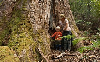
East Gippsland is the eastern region of Gippsland, Victoria, Australia covering 31,740 square kilometres (14%) of Victoria. It has a population of 80,114.
Stream capture, river capture, river piracy or stream piracy is a geomorphological phenomenon occurring when a stream or river drainage system or watershed is diverted from its own bed, and flows instead down the bed of a neighbouring stream. This can happen for several reasons, including:
The geology of Australia includes virtually all known rock types and from all geological time periods spanning over 3.8 billion years of the Earth's history. Australia is a continent situated on the Indo-Australian Plate.
The Glenelg River, a perennial river of the Glenelg Hopkins catchment, is located in the Australian states of Victoria and South Australia.
The north-east coast drainage division or north-east coast basin is the area of Queensland between the Great Dividing Range and the Pacific Ocean. It lies between Torres Strait and an arbitrary line drawn along the Queensland - New South Wales border. In the north it meets the Gulf of Carpentaria basin to its west while further south lies the Lake Eyre Basin and the Murray-Darling Basin. In the south the Australian south-east coast drainage division continues to the east of the Great Divide.
In the state of New South Wales, Australia, there are many areas which are commonly known by regional names. Regions are areas that share similar characteristics. These characteristics may be natural such as the Murray River, the coastline, or the Snowy Mountains. Alternatively, the characteristics may be cultural, such as a viticulture land use. New South Wales is divided by numerous regional boundaries, based on different characteristics. In many cases boundaries defined by different agencies are coterminous.
A continental divide is a drainage divide on a continent such that the drainage basin on one side of the divide feeds into one ocean or sea, and the basin on the other side either feeds into a different ocean or sea, or else is endorheic, not connected to the open sea. Every continent on earth except Antarctica which has no free-flowing water has at least one continental drainage divide; islands, even small ones like Killiniq Island on the Labrador Sea in Canada, may also host part of a continental divide or have their own island-spanning divide.
The Wannon River, a perennial river of the Glenelg Hopkins catchment, is located in the Western District of Victoria, Australia.
Victoria is the southernmost mainland state of Australia. With an area of 227,594 km², it is Australia's sixth largest state or territory. The State is comparable in size to the US state of Utah or the island of Great Britain. It is bound to the northwest by South Australia, directly north by New South Wales, and also shares a maritime border with Tasmania to the south, across the Bass Strait. Most of Victoria's northern border lies along the Murray River. The eastern half of the state is dominated by the Great Dividing Range and the surrounding uplands, which also to a lesser extent extend far into the west of the state and ease off after The Grampians. By comparison the north and northwest of the state is extremely flat with little prominence. Approximately three quarters of Victoria's population lives on and around the coast of the Port Phillip and Western Port bays, chiefly in Melbourne, in Victoria's South Central region.
The regions of Victoria vary according to the different ways that the Australian state of Victoria is divided into distinct geographic regions. The most commonly-used regions are those created by the state government for the purposes of economic development.
The geography of Queensland in the north-east of Australia, is varied. It includes tropical islands, sandy beaches, flat river plains that flood after monsoon rains, tracts of rough, elevated terrain, dry deserts, rich agricultural belts and densely populated urban areas.
In South Australia, one of the states of Australia, there are many areas which are commonly known by regional names. Regions are areas that share similar characteristics. These characteristics may be natural such as the Murray River, the coastline, desert or mountains. Alternatively, the characteristics may be cultural, such as common land use. South Australia is divided by numerous sets of regional boundaries, based on different characteristics. In many cases boundaries defined by different agencies are coterminous.
This article about a location in Victoria, Australia is a stub. You can help Wikipedia by expanding it. |
This New South Wales geography article is a stub. You can help Wikipedia by expanding it. |
This South Australia geography article is a stub. You can help Wikipedia by expanding it. |