Avielochan

Last updated

Avielochan
Avinlochan, Avielochan, Strathspey.jpg
Badenoch and Strathspey UK location map.svg
Red pog.svg
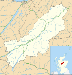
Avielochan
Location within the Badenoch and Strathspey area
OS grid reference NH905165
Council area
Country Scotland
Sovereign state United Kingdom
Police Scotland
Fire Scottish
Ambulance Scottish
UK Parliament
Scottish Parliament
List of places
UK
Scotland
57°13′41″N3°49′04″W / 57.2280°N 3.8177°W / 57.2280; -3.8177 Coordinates: 57°13′41″N3°49′04″W / 57.2280°N 3.8177°W / 57.2280; -3.8177

Avielochan (Scottish Gaelic : Aghaidh an Lochain) is a hamlet in the historical county of Inverness-shire, within the Highland council area of Scotland. It is located north of Aviemore, on the A9 road. The area is noted for its prehistoric cairn.

Contents

Geography and wildlife

Near the cairn Avielochan Chambered Cairn - geograph.org.uk - 897417.jpg
Near the cairn

Avielochan is located in Strathspey [1] in central, northern Scotland, within the Cairngorms National Park. The village is located south of Kinveachy and north of Granish. [2] The settlement takes its name from the body of water Avie Lochan [3] (meaning "the small lake of Avie) archaically named Loch-na- mhoon, measuring about 90 yards long, and 50 across. [4] Prior to the great floods in 1829, there was a floating island on the loch measuring about 30 yards across. [4] It attracts ospreys during the spring and summer months and goldeneye, coot and Slavonian grebe, amongst others. [5] Red squirrel, red deer, roe deer, black grouse and capercaillie inhabit the area. [5]

Buildings

Avelochan Farm lets out self-catering cottages during the warmer months of the year to tourists. [5] The farm itself covers an area of 270 hectares, with arable fields, rough grazing and woodland. [6] At certain times in the year it has around 80 cattle and some 60 Cheviot ewes which are crossed with a Suffolk tup before they are sold in early autumn. [6] One building of note is Clach Mhor (meaning 'big stone' in Gaelic) which is located on the edge of the village. [7]

Chamber tomb

Remains of a chambered cairn by Avielochan Chamber at Avielochan.jpg
Remains of a chambered cairn by Avielochan

The area is noted for its prehistoric chamber tomb stones which are said to be particularly old by some sources, although they have not been dated reliably. [8] [9] The site contains a cairn which is very circular in shape except for a slight flattening at the entrance, where part of a lignite amulet has been unearthed. [9] [10] The tumulus is about 40 feet in diameter. [1]

The cairn is said to be "aligned" with Glen Einich, and has views of the Cairngorm Mountains. [11]

Related Research Articles

Chambered cairn Burial monument (Usually Neolithic)

A chambered cairn is a burial monument, usually constructed during the Neolithic, consisting of a sizeable chamber around and over which a cairn of stones was constructed. Some chambered cairns are also passage-graves. They are found throughout Britain and Ireland, with the largest number in Scotland.

<span class="mw-page-title-main">Cairn</span> Man-made pile of stones or burial monument

A cairn is a man-made pile of stones raised for a purpose, usually as a marker or as a burial mound. The word cairn comes from the Scottish Gaelic: càrn[ˈkʰaːrˠn̪ˠ].

Scalpay is an inhabited island in the Inner Hebrides of Scotland which has a population of 4.

<span class="mw-page-title-main">Cairngorms</span> Mountain range in the eastern Highlands of Scotland

The Cairngorms are a mountain range in the eastern Highlands of Scotland closely associated with the mountain Cairn Gorm. The Cairngorms became part of Scotland's second national park on 1 September 2003. Although the Cairngorms give their name to, and are at the heart of, the Cairngorms National Park, they only form one part of the national park, alongside other hill ranges such as the Angus Glens and the Monadhliath, and lower areas like Strathspey.

<span class="mw-page-title-main">Cairngorms National Park</span> National park in Scotland

Cairngorms National Park is a national park in northeast Scotland, established in 2003. It was the second of two national parks established by the Scottish Parliament, after Loch Lomond and The Trossachs National Park, which was set up in 2002. The park covers the Cairngorms range of mountains, and surrounding hills. Already the largest national park in the United Kingdom, in 2010 it was expanded into Perth and Kinross.

<span class="mw-page-title-main">Court cairn</span> Type of chamber tomb found in northwestern and northern Ireland, and southwest Scotland

The court cairn or court tomb is a megalithic type of chambered cairn or gallery grave. During the period, 3900–3500 BCE, more than 390 court cairns were built in Ireland and over 100 in southwest Scotland. The Neolithic monuments are identified by an uncovered courtyard connected to one or more roofed and partitioned burial chambers. Many monuments were built in multiple phases in both Ireland and Scotland and later re-used in the Early Bronze Age.

Prehistoric Scotland

Archaeology and geology continue to reveal the secrets of prehistoric Scotland, uncovering a complex past before the Romans brought Scotland into the scope of recorded history. Successive human cultures tended to be spread across Europe or further afield, but focusing on this particular geographical area sheds light on the origin of the widespread remains and monuments in Scotland, and on the background to the history of Scotland.

Cairn Gorm Mountain in the Cairngorms range in the Scottish Highlands

Cairn Gorm is a mountain and listed Munro in the Scottish Highlands. It is part of the Cairngorms range and wider Grampian Mountains. With a summit elevation of 4,084 ft (1,245 m) AMSL, Cairn Gorm is the seventh-highest mountain in the British Isles. The high, broad domed summit overlooking Strathspey is one of the most readily identifiable mountains from the nearby town and regional centre of Aviemore.

Kilmartin Glen British Neolithic monument site

Kilmartin Glen is an area in Argyll north of Knapdale. It has the most important concentration of Neolithic and Bronze Age remains in mainland Scotland. The glen is located between Oban and Lochgilphead, surrounding the village of Kilmartin. In the village, Kilmartin Museum explains the stories of this ancient landscape and the people who dwelt there. There are more than 800 ancient monuments within a six-mile (ten-kilometre) radius of the village, with 150 monuments being prehistoric. Monuments include standing stones, a henge monument, numerous cists, and a "linear cemetery" comprising five burial cairns. Several of these, as well as many natural rocks, are decorated with cup and ring marks.

Breasclete Village in the Outer Hebrides, Scotland

Breasclete is a village and community on the west side of the Isle of Lewis, in the Outer Hebrides, Scotland. Breasclete is within the parish of Uig, and is situated adjacent to the A858.

Corrour Bothy

Corrour Bothy is a simple stone building on Mar Lodge Estate, Aberdeenshire, Scotland.

<span class="mw-page-title-main">Carlin stone</span> Name of many stones in Scotland

Carlin Stone or Carline Stane is the name given to a number of prehistoric standing stones and natural stone or landscape features in Scotland. The significance of the name is unclear, other than its association with old hags, witches, and the legends of the Cailleach.

<span class="mw-page-title-main">A' Mharconaich</span>

A' Mharconaich is a mountain near Dalwhinnie in the Scottish Highlands. It is a Munro with a height of 975 metres (3,199 ft). It is in a group of mountains east of Loch Ericht and west of the A9 road and Pass of Drumochter, and are known accordingly as the Drumochter Hills. A' Mharconaich is just within the Cairngorms National Park although it is not part of the Cairngorms mountains.

Achentoul Human settlement in Scotland

Achentoul is a hamlet in the Kinbrace area of Sutherland, in the Scottish council area of Highland. Consisting of a few farmhouses and barns, Achentoul lies around 1.5 miles (2.4 km) north of Kinbrace along the A897 road and south of Loch An Ruathair. Although the Achentoul Forest is located in this area, the landscape is said to be dominated by moist Atlantic heather moor.

Parc Cwm long cairn Burial chamber in Wales

Parc Cwm long cairn, also known as Parc le Breos burial chamber, is a partly restored Neolithic chambered tomb, identified in 1937 as a Severn-Cotswold type of chambered long barrow. The cromlech, a megalithic burial chamber, was built around 5850 years before present (BP), during the early Neolithic. It is about seven 12 miles (12 km) west south–west of Swansea, Wales, in what is now known as Coed y Parc Cwm at Parc le Breos, on the Gower Peninsula.

<span class="mw-page-title-main">Unstan Chambered Cairn</span> Neolithic chambered cairn

Unstan is a Neolithic chambered cairn located about 2 mi (3 km) north-east of Stromness on Mainland, Orkney, Scotland. The tomb was built on a promontory that extends into the Loch of Stenness near the settlement of Howe. Unstan is notable as an atypical hybrid of the two main types of chambered cairn found in Orkney, and as the location of the first discovery of a type of pottery that now bears the name of the tomb. The site is in the care of Historic Environment Scotland as a scheduled monument.

Rubha an Dùnain Peninsula in Scotland

Rubha an Dùnain or Rubh' an Dùnain is an uninhabited peninsula to the south of the Cuillin hills on the Isle of Skye in Scotland. It contains unique archaeological sites which in 2017 were designated as a Historic Monument of national importance by Historic Environment Scotland.

The Pettigarths Field Cairns is a Neolithic site in the parish of Nesting, northeastern Whalsay, in the Shetland islands of Scotland. It is located approximately 140 metres (460 ft) to the northwest of Benie Hoose. The site contains upright stones as well as masonry. The south cairn is roughly 6 metres (20 ft) square, with an eastern entrance passage and circular chamber about 2 metres across. 4 metres (13 ft) to the north is a round cairn, 4.5 metres (15 ft) in diameter, with a rectangular cist. The two cairns are located on a rise, about 140 metres (460 ft) northwest of Benie Hoose.

Grey Cairns of Camster Chambered cairns in Scotland

The Grey Cairns of Camster are two large Neolithic chambered cairns located about 8+12 miles south of Watten and 5 miles (8 km) north of Lybster in Caithness, in the Highland region of Scotland. They are among the oldest structures in Scotland, dating to about 5,000 years ago. The cairns demonstrate the complexity of Neolithic architecture, with central burial chambers accessed through narrow passages from the outside. They were excavated and restored by Historic Environment Scotland in the late 20th century and are open to the public.

Hoy and West Mainland National Scenic Area

Hoy and West Mainland is a national scenic area (NSA) covering parts of the islands of Hoy and Mainland in the Orkney Islands of Scotland, as well as parts of the surrounding sea. It is one of 40 such areas in Scotland, which are defined so as to identify areas of exceptional scenery and to ensure its protection by restricting certain forms of development. The Hoy and West Mainland NSA covers 24,407 ha in total, consisting of 16,479 ha of land with a further 7928 ha being marine.

References

  1. 1 2 Thompson, Francis (1979). Portrait of the Spey. Hale. p. 93. ISBN   978-0-7091-7468-4 . Retrieved 20 February 2011.
  2. Google Maps (Map). Google. Retrieved 20 February 2011.
  3. "Get -a-Map". Ordnance Survey. Retrieved 21 Feb 2011.
  4. 1 2 The Topographical, Statistical, and Historical Gazetteer of Scotland: A-H. A. Fullarton. 1842. p. 82. Retrieved 20 February 2011.
  5. 1 2 3 "Welcome". Avielochan Cottages. Retrieved 20 February 2011.
  6. 1 2 "The Farm". Avielochan Cottages. Archived from the original on 16 February 2011. Retrieved 20 February 2011.
  7. Royal Institute of British Architects (1 January 1994). RIBA journal. RIBA Journals. p. 46. Retrieved 20 February 2011.
  8. Prehistoric Society (London; England); University of Cambridge. University Museum of Archaeology and Ethnology (1948). Proceedings of the Prehistoric Society for ... University Museum of Archaeology and Ethnology. p. 176. Retrieved 20 February 2011.
  9. 1 2 The Prehistory of Scotland. Taylor & Francis. p. 52. Retrieved 20 February 2011.
  10. Henshall, Audrey S.; Ritchie, James Neil Graham (2001). The chambered cairns of the central Highlands: an inventory of the structures and their contents. Edinburgh University Press. p. 84. ISBN   978-0-7486-0643-6 . Retrieved 20 February 2011.
  11. Bradley, Richard; Batey, Colleen E. (1 July 2000). The good stones: a new investigation of the Clava Cairns. Society Antiquaries Scotland. p. 182. ISBN   978-0-903903-17-2 . Retrieved 20 February 2011.