
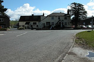
Much Marcle is a village and civil parish in Herefordshire, England, located 7 miles (11 km) north-east of Ross-on-Wye. The 2011 Census recorded the parish's population as 660. The name Marcle comes from the Anglo-Saxon word for a boundary field, mearc-leah. Much, in this case, means large or great, from the Middle English usage of the word.

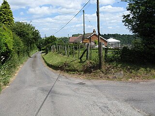
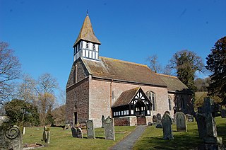
Aston Ingham is a village in south-eastern Herefordshire, England, near Newent and about 7 miles (11 km) east of Ross-on-Wye. The population of the village at the 2011 census was 398. There is a church, dedicated to St John the Baptist, which has been a Grade II* listed building since 17 March 1987.

Blanche Parry of Newcourt in the parish of Bacton, Herefordshire, in the Welsh Marches, was a personal attendant of Queen Elizabeth I, who held the offices of Chief Gentlewoman of the Queen's Most Honourable Privy Chamber and Keeper of Her Majesty's Jewels.
Wormelow Tump is a village in Herefordshire, England, 6 miles (10 km) south of Hereford and 6+1⁄2 mi (10 km) north-west of Ross-on-Wye. Most of the village lies in the parish of Much Birch, but it extends west across the parish boundary – which here follows the A466 – into Much Dewchurch parish.

Coddington is a hamlet and civil parish in eastern Herefordshire, England, about 3 miles (4.8 km) north of Ledbury. The west side of the parish covers part of the Malvern Hills, an official Area of Outstanding Natural Beauty. Coddington shares a parish council with neighbouring village of Bosbury.

Brampton Abbotts is a village and civil parish in Herefordshire, England. It is located 2 km north of Ross-on-Wye and 16 km south east of Hereford. The village lies near the western terminus of M50 motorway.
Tretire with Michaelchurch is a civil parish in Herefordshire, England. It is approximately 9 miles (14 km) south from the city and county town of Hereford and 5 miles (8 km) west from the market town of Ross-on-Wye. The parish, entirely rural, incorporates the hamlet settlements of Tretire and Michaelchurch.

Grendon Bishop is a civil parish in the county of Herefordshire, England.

The Bacton Altar Cloth is a 16th-century garment that is considered the sole surviving dress of Queen Elizabeth I. The cloth, embroidered in an elaborate floral design and made of cloth of silver, is an important relic of Tudor fashion and luxury trade, containing dyes from as far away as India and Mexico. It was rediscovered in 2015 at St Faith's Church in Bacton, Herefordshire, where it had been used as an altar cloth for centuries. After several years of conservation and restoration, the garment was exhibited to the public in 2019 and 2020 along with the Rainbow Portrait, in which the queen is depicted wearing a highly similar dress.
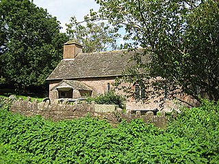
Little Birch is a hamlet and civil parish in Herefordshire, England. It is approximately 5 miles (8 km) south from the city and county town of Hereford and 7 miles (11 km) north-west from the market town of Ross-on-Wye. The parish is significant for its Grade II* listed church, and Athelstan Wood, formerly anciently managed but now largely coniferised.

Humber is a hamlet and civil parish in the county of Herefordshire, England, and is 10 miles (16 km) north from the city and county town of Hereford. The closest large town is Leominster 3 miles (5 km) to the north-west.
Ford and Stoke Prior is a civil parish in the county of Herefordshire, England, and is 10 miles (16 km) north from the city and county town of Hereford. The closest large town is the market town of Leominster, adjacent at the north-west. The parish includes the hamlet of Ford, the village of Stoke Prior, and the medieval parish churches of St Luke and St John of Jerusalem. At the west of the parish is the site of a Romano-British settlement.
Newton is a linear settlement hamlet and civil parish in the county of Herefordshire, England, and is 10 miles (16 km) north from the city and county town of Hereford. The closest large town is the market town of Leominster, 3 miles (5 km) to the north. A Cadbury's confectionery factory is within the parish.

Eye, Moreton and Ashton is a civil parish in the county of Herefordshire, England. The parish is 15 miles (24 km) north from the city and county town of Hereford. The closest large town is the market town of Leominster, 3 miles (5 km) to the south. Within the parish is the National Trust property of Berrington Hall.

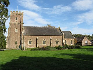
King's Pyon is a village and civil parish in the county of Herefordshire, England, and is approximately 8 miles (13 km) north-west from the city and county town of Hereford. The closest large town is the market town of Leominster, 6 miles (10 km) to the north-west. The parish includes the Grade I listed church of St Mary the Virgin.
Castle Frome is a village and civil parish in the county of Herefordshire, England, and is 10 miles (16 km) north-east from the city and county town of Hereford. The closest large town is the market town of Bromyard, 5 miles (8 km) to the north. The Norman font in Castle Frome church is "one of the outstanding works of the Herefordshire school".

Little Cowarne is a village and civil parish in the county of Herefordshire, England, and is 9 miles (14 km) north-east from the city and county town of Hereford. The closest town is the market town of Bromyard, 4 miles (6 km) to the north-east.
Docklow and Hampton Wafer, is a civil parish in the county of Herefordshire, England, and is 11 miles (18 km) north from the city and county town of Hereford. The closest large town is Leominster 4 miles (6 km) to the west. The parish contains the remains of Uphampton Camp, a probable Iron Age hillfort, and the Church of St Bartholomew, in part dating to the 12th and 13th century.

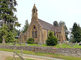
Hatfield and Newhampton is a civil parish in the county of Herefordshire, England, and is 11 miles (18 km) north from the city and county town of Hereford. The closest large town is Leominster 4 miles (6 km) to the west. The parish includes the small village of Hatfield, the former extra-parochial liberty of New Hampton, the site of former abbey lands of Fencote, the preserved Fencote railway station, and the Grade II* listed 11th-century Church of St Leonard.
Kington Rural is a civil parish in west Herefordshire, England, and is approximately 17 miles (30 km) north-west from the city and county town of Hereford. The parish borders Wales at the west, and contains the hamlets and small settlements of Upper Hergest, Lower Hergest, Chickward, Bredward, and Kingswood at the south, and Bradnor Green and Rushok at the north. The nearest town is the market town of Kington which, with its parish, is to a large extent enclosed by Kington Rural. Significant landmarks of the parish are the Castle Twts motte and bailey earthwork, Hergest Court 15th-century manor house, and Hergest Ridge on the England–Wales border.


