
Manila Bay is a natural harbor that serves the Port of Manila, in the Philippines. Strategically located around the capital city of the Philippines, Manila Bay facilitated commerce and trade between the Philippines and its neighboring countries, becoming the gateway for socio-economic development even prior to Spanish occupation. With an area of 1,994 km2 (769.9 sq mi), and a coastline of 190 km (118.1 mi), Manila Bay is situated in the western part of Luzon and is bounded by Cavite and Metro Manila on the east, Bulacan and Pampanga on the north, and Bataan on the west and northwest. Manila Bay drains approximately 17,000 km2 (6,563.7 sq mi) of watershed area, with the Pampanga River contributing about 49% of the freshwater influx. With an average depth of 17 m (55.8 ft), it is estimated to have a total volume of 28.9 billion cubic meters. Entrance to the bay is 19 km (11.8 mi) wide and expands to a width of 48 km (29.8 mi). However, width of the bay varies from 22 km (13.7 mi) at its mouth and expanding to 60 km (37.3 mi) at its widest point.
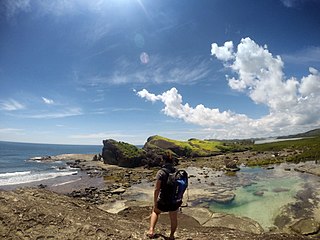
Biri, officially the Municipality of Biri, is a 5th class municipality in the province of Northern Samar, Philippines. According to the 2020 census, it has a population of 11,274 people.

Apo Reef is a coral reef system in the Philippines situated in the western waters of Occidental Mindoro province in the Mindoro Strait. Encompassing 34 square kilometres (13 sq mi), it is considered the world's second-largest contiguous coral reef system, and is the largest in the country. The reef and its surrounding waters are protected areas administered as the Apo Reef Natural Park (ARNP). It is one of the best known and most popular diving regions in the country, and is in the tentative list for UNESCO World Heritage Sites.

The Coral Triangle (CT) is a roughly triangular area in the tropical waters around the Philippines, Indonesia, Malaysia, Papua New Guinea, the Solomon Islands and Timor-Leste. This area contains at least 500 species of reef-building corals in each ecoregion. The Coral Triangle is located between the Pacific and Indian oceans and encompasses portions of two biogeographic regions: the Indonesian-Philippines Region, and the Far Southwestern Pacific Region. As one of eight major coral reef zones in the world, the Coral Triangle is recognized as a global centre of marine biodiversity and a global priority for conservation. Its biological resources make it a global hotspot of marine biodiversity. Known as the "Amazon of the seas" (by analogy to the Amazon rainforest in South America), it covers 5.7 million square kilometres (2,200,000 sq mi) of ocean waters. It contains more than 76% of the world's shallow-water reef-building coral species, 37% of its reef fish species, 50% of its razor clam species, six out of seven of the world's sea turtle species, and the world's largest mangrove forest. In 2014, the Asian Development Bank (ADB) reported that the gross domestic product of the marine ecosystem in the Coral Triangle is roughly $1.2 trillion per year and provides food to over 120 million people. According to the Coral Triangle Knowledge Network, the region annually brings in about $3 billion in foreign exchange income from fisheries exports, and another $3 billion from coastal tourism revenues.
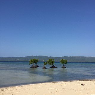
Global mangrove distributions have fluctuated throughout human and geological history. The area covered by mangroves is influenced by a complex interaction between land position, rainfall hydrology, sea level, sedimentation, subsidence, storms and pest-predator relationships). In the last 50 years, human activities have strongly affected mangrove distributions, resulting in declines or expansions of worldwide mangrove area. Mangroves provide several important ‘free services’ including coastal stabilization, juvenile fish habitats, and the filtration of sediment and nutrients). Mangrove loss has important implications for coastal ecological systems and human communities dependent on healthy mangrove ecosystems. This article presents an overview of global mangrove forest biome trends in mangrove ecoregions distribution, as well as the cause of such changes.
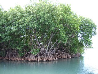
Mangrove ecosystems represent natural capital capable of producing a wide range of goods and services for coastal environments and communities and society as a whole. Some of these outputs, such as timber, are freely exchanged in formal markets. Value is determined in these markets through exchange and quantified in terms of price. Mangroves are important for aquatic life and home for many species of fish.

Marine habitats are habitats that support marine life. Marine life depends in some way on the saltwater that is in the sea. A habitat is an ecological or environmental area inhabited by one or more living species. The marine environment supports many kinds of these habitats. Marine habitats can be divided into coastal and open ocean habitats. Coastal habitats are found in the area that extends from as far as the tide comes in on the shoreline out to the edge of the continental shelf. Most marine life is found in coastal habitats, even though the shelf area occupies only seven percent of the total ocean area. Open ocean habitats are found in the deep ocean beyond the edge of the continental shelf.
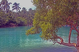
Bongsanglay Natural Park is a protected area of mangrove forests and swamps on Ticao Island in the Bicol Region of the Philippines. It is located in the municipality of Batuan in the island province of Masbate covering an area of 244.72 hectares. The protected area was established on 29 December 1981 when the area "from Panciscan Point in Bitos Bay up to Bano Sanlay" in Batuan was declared a Mangrove Swamp Forest Reserve under Proclamation No. 2152 signed by President Ferdinand Marcos. In 2000, when President Joseph Estrada signed Proclamation No. 319, Bongsanglay was reclassified as a natural park pursuant to the National Integrated Protected Areas System (NIPAS) Act.

Pujada Bay, sometimes called Pujaga Bay, is a bay on the Pacific coast of the southern Philippine island of Mindanao. It is an arm of the Philippine Sea in Davao Oriental province formed by the Guanguan Peninsula which separates it from the Mayo Bay on the east and the Pujada Peninsula which separates it from the Davao Gulf on the west. Pujada Bay borders Mati, the province's capital and largest city, with its port and city proper situated at its head. It is entered between Lamigan Point on the east and Tumago Point on the west, with the Pujada Island dividing its entrance into two channels. There are three other islands on the bay, namely Uanivan, Oak and Ivy islands.
Murcielagos Island locally known as Pulo Baliudyong is a small low-lying island in the Sulu Sea off the coast of Zamboanga del Norte in the southern Philippine island of Mindanao. It measures over 500 metres (1,600 ft) across at its widest point and is situated on an oval reef about 1.6 kilometres (0.99 mi) in length. situated in 4.8 kilometres (3.0 mi) north of Quipit Point on the west side of Patauag Bay in the Zamboanga municipality of Labason. It is known for its white coral-sand beaches and rich marine resources. To its west lies an islet called Bayangan Island. The two islands are collectively known as Murcielagos Islands and are administratively part of the Labason poblacion of Antonino.

Selinog, historically known as Silino and also named Silinog, is an island barangay in Dapitan, Zamboanga del Norte, Philippines. It is coterminous with Silino Island and is located 12.9 kilometres (8.0 mi) off Tagolo Point, the northern entrance point to Dapitan Bay, and some 15 kilometres (9.3 mi) east of the island of Aliguay in the Bohol Sea. The island is a flat coralline island with a land area of 78 hectares. It is surrounded by 70 hectares of coral reefs and sandy areas. According to the 2010 census, the island community has a population of 712 inhabitants.

Malampaya Sound is a protected inlet of the South China Sea on the northwestern coast of Palawan Island in western Philippines. It is a geographic sound consisting of a complex of sheltered bays, coves, estuaries and islands separated from the sea to the west by the Copoas Peninsula. The sound is within the municipality of Taytay and is an important feature for the ecology and economy of the province of Palawan. It is considered one of the finest natural harbors in the Philippines and one of Palawan's richest fishing grounds.
Alibijaban is a small island located off the southeastern coast of Bondoc Peninsula in the Philippines. It belongs administratively to the municipality of San Andres, Quezon province, and is coterminous with the barangay of the same name. With a population of 1,643 inhabitants in 2015, it is the smallest of seven barangays in San Andres.
Malabungot, alternatively spelled as Malabungut, and also known as Mahad, is an island in Binagasbasan Bay off the coast of Garchitorena in Camarines Sur, Philippines. It is separated from Caramoan Peninsula in the south by the Quinalasag Passage, also known as Sisiran Passage, which connects Lamit and Sisiran bays. The island forms the head of Binagasbasan Bay, bordered to the west by the Lamit Islands and to the east by Quinalasag Island, and which opens northward to the Philippine Sea. It is designated as a protected landscape and seascape on account of its biodiversity and ecological significance.
The Mabini Protected Landscape and Seascape, in Davao de Oro, Philippines, is a terrestrial and marine protected area established in 2000 to protect ecologically significant habitats in the Davao Gulf. The park extends along the coast of the municipality of Mabini from the mouth of the Pandasan River to the southern tip of Kopiat Island. It also includes Lunod Island, also known as Pandasan Island, which was earlier declared a wilderness area in 1981. It covers 6,106 hectares of extensive mangrove forests, white sand beaches and rich coral reef systems.
The Biri Larosa Protected Landscape and Seascape is a protected area located in Northern Samar, Philippines, about 40 kilometres (25 mi) west of Catarman. It protects the Balicuatro Islands, composed of the island municipality of Biri and associated smaller islands, off the northwestern coast of Samar in the San Bernardino Strait. It also includes the coastal areas of the adjacent municipalities from which it derives the second half of its name – a combination of the first two letters of Lavezares, Rosario and San Jose.
The Guiuan Protected Landscape and Seascape, also known as the Guiuan Marine Reserve, is a protected area associated with the Guiuan Island Group which is located off the coast of the municipality of Guiuan on the eastern side of Leyte Gulf in the Philippines. The protected area consists of the following islands from within the group: Calicoan, Manicani, Suluan, Tubabao, Victory, Homonhon and other smaller islands and their surrounding reefs. It also includes the coastal area of mainland Guiuan in Eastern Samar covering a total area of 60,448 hectares. The land which now comprises the conservation area was previously declared as a Marine Reserve and Tourist Zone and was placed under the administration and control of the Philippine Tourism Authority in 1978. It was re-proclaimed and re-classified as a protected landscape/seascape in 1994 under the National Integrated Protected Areas System Act of 1992.

Three Bays Protected Area, also known as Three Bays National Park, is a protected area in northeastern Haiti. It protects coral reefs, seagrass beds, mangrove forests, and dry forests.

Cabilao is a Philippine island in the Cebu Strait, part of Bohol Province. It is home to the only natural lake in the province: Cabilao Island Lake, also called Lake Danao or Lanao.
The East African coral coast is a marine ecoregion along the eastern coast of Africa. It extends along the coasts of Kenya, Tanzania, and northern Mozambique, from Lamu in Kenya to Angoche in Mozambique. It adjoins the Northern Monsoon Current Coast ecoregion to the north, and the Bight of Sofala/Swamp Coast ecoregion to the south.

