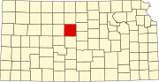
Russell County is a county in the U.S. state of Kansas. As of the 2020 census, the population was 6,691. The largest city and county seat is Russell. Russell, the county seat, was the home of former U.S. Senate Majority leader and 1996 GOP presidential nominee Bob Dole for many years. It was also the boyhood home of U.S. Senator Arlen Specter of Pennsylvania, who was born in Wichita.

Cheyenne County is the fourth-least densely populated of the 64 counties of the U.S. state of Colorado. The county population was 1,748 at 2020 census. The county seat is Cheyenne Wells.

Ellsworth is a city in and the county seat of Ellsworth County, Kansas, United States. As of the 2020 census, the population of the city was 3,066. Known as a cow town in the 1870s, when the Kansas Pacific Railroad operated a stockyard here for shipping cattle to eastern markets, in the 21st century, it serves as the trading center of the rural county.
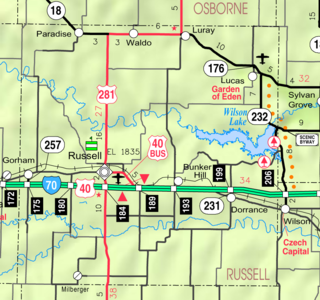
Bunker Hill is a city in Russell County, Kansas, United States. As of the 2020 census, the population of the city was 103.
Dorrance is a city in Russell County, Kansas, United States. As of the 2020 census, the population of the city was 146.
Gorham is a city in Russell County, Kansas, United States. As of the 2020 census, the population of the city was 376.

Russell is the most populous city in and the county seat of Russell County, Kansas, United States. As of the 2020 census, the population of the city was 4,401.

Walker is an unincorporated community in Herzog Township, Ellis County, Kansas, United States. It is located between Hays and Russell, along old Hwy 40 on the north side of I-70. Walker has a post office with ZIP code 67674.
Milberger is an unincorporated community in Lincoln Township, Russell County, Kansas, United States. It is located about 10.5 miles south of Russell and 3.5 miles west of U.S. Route 281 on Michaelis Rd.
Dubuque is an unincorporated community in Barton and Russell Counties in the U.S. state of Kansas. It is approximately 10 miles (18 km) south of Dorrance.

Winterset Township is a township in Russell County, Kansas, United States. As of the 2010 United States Census, it had a population of 67.

Big Creek Township is a township in Russell County, Kansas, United States. As of the 2010 United States Census, it had a population of 479.
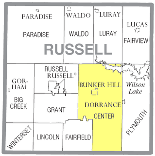
Center Township is a township in Russell County, Kansas, United States. As of the 2010 United States Census, it had a population of 221.

Russell Township is a township in Russell County, Kansas, United States. As of the 2010 United States Census, it had a population of 82.
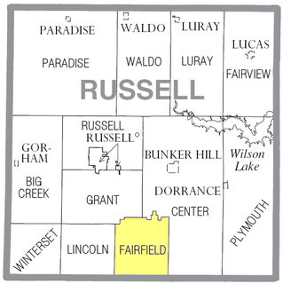
Fairfield Township is a township in Russell County, Kansas, United States. As of the 2010 United States Census, it had a population of 31.

Grant Township is a township in Russell County, Kansas, United States. As of the 2010 United States Census, it had a population of 186.

Lincoln Township is a township in Russell County, Kansas, United States. As of the 2010 United States Census, it had a population of 150.

Plymouth Township is a township in Russell County, Kansas, United States. As of the 2010 United States Census, it had a population of 280.
Homer is an unincorporated area in Russell County, Kansas, United States. It lies on the border between Grant and Russell Townships. There is no community or settlement at Homer.

Stickney is an unincorporated area in Wheatland Township, Barton County, Kansas, United States. It is the site of a grain elevator, but there is no community or settlement at Stickney.