Plymouth Township, Russell County, Kansas

Last updated

Plymouth Township
Map highlighting Plymouth Township, Russell County, Kansas.png
Location of Plymouth Township in Russell County
Coordinates: 38°49′38″N98°32′22″W / 38.82722°N 98.53944°W / 38.82722; -98.53944 Coordinates: 38°49′38″N98°32′22″W / 38.82722°N 98.53944°W / 38.82722; -98.53944
CountryUnited States
State Kansas
County Russell
Area
  Total107.44 sq mi (278.3 km2)
  Land98.30 sq mi (254.6 km2)
  Water9.14 sq mi (23.7 km2)  8.5%
Elevation
1,683 ft (513 m)
Population
 (2010) [1]
  Total280
  Density2.6/sq mi (1.0/km2)
Time zone UTC-6 (Central (CST))
  Summer (DST) UTC-5 (CDT)
ZIP code
67490, 67525, 67634, 67648
Area code 785
GNIS feature ID475235 [2]

Plymouth Township is a township in Russell County, Kansas, United States. As of the 2010 United States Census, it had a population of 280. [1]

Contents

Geography

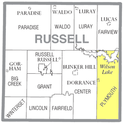
The center of Plymouth Township is located at 38°49′38″N98°32′22″W / 38.82722°N 98.53944°W / 38.82722; -98.53944 (39.8272331, −98.5395133) at an elevation of 1,683 feet (513 m). [2] The township lies in the Smoky Hills region of the Great Plains. [3] The eastern two-thirds of Wilson Lake lies in the northern part of the township. The Smoky Hill River flows windingly east through the township's center, fed by Coal Creek, one of its tributaries, which runs north-northeast through the southern half of the township. Another of the river's tributaries, Blood Creek, flows northeast through the extreme southeastern corner of the township. [4] [5]

According to the United States Census Bureau, Plymouth Township occupies an area of 107.44 square miles (278.3 km2) of which 98.30 square miles (254.6 km2) is land and 9.14 square miles (23.7 km2) is water. Comprising east-central and southeastern Russell County, it includes the city of Dorrance, which is located in the west-central part of the township, and it borders Fairview Township to the north, Lincoln County's Pleasant Township to the northeast, Lincoln County's Highland Township and Ellsworth County's Wilson and Noble Townships to the east, Barton County's Cleveland and Beaver Townships to the south, Center Township to the west, and Luray Township to the northwest. [6]

Demographics

Historical population
CensusPop.Note
1880 1,073
1890 1,0962.1%
1900 1,1343.5%
1910 1,116−1.6%
1920 1,1311.3%
1930 1,016−10.2%
1940 1,000−1.6%
1950 795−20.5%
1960 604−24.0%
1970 430−28.8%
1980 373−13.3%
1990 316−15.3%
2000 3190.9%
2010 280−12.2%
U.S. Decennial Census

As of the 2010 census, there were 280 people, 132 households, and 80 families residing in the township. The population density was 2.6 people per square mile (1.0 people/km2). There were 219 housing units at an average density of 2.2 per square mile (0.85/km2). The racial makeup of the township was 96.8% White, 2.9% American Indian, and 0.4% Asian. Hispanics or Latinos of any race were 0.4% of the population. [1]

There were 132 households, out of which 20.5% had children under the age of 18 living with them, 52.3% were married couples living together, 4.5% had a male householder with no wife present, 3.8% had a female householder with no husband present, and 39.4% were non-families. 36.4% of all households were made up of individuals, and 15.1% had someone living alone who was 65 years of age or older. The average household size was 2.12, and the average family size was 2.70. [1]

In the township, the population was spread out, with 16.8% under the age of 18, 5.4% from 18 to 24, 21.8% from 25 to 44, 32.4% from 45 to 64, and 23.6% who were 65 years of age or older. The median age was 49.5 years. For every 100 females, there were 112.1 males. For every 100 females age 18 and over, there were 109.9 males age 18 and over. [1]

Education

Plymouth Township lies within Unified School District (USD) 112, based in Lorraine, Kansas. [7] Local public school students attend school in nearby Wilson. [8]

Transportation

Interstate 70 and U.S. Route 40 run concurrently east–west through the central part of the township. The former alignment of U.S. 40, now a paved county road, runs southeast–northwest through the township south of I-70/U.S. 40. K-232, a north–south route, enters the northeastern part of the township from the north and runs south along the eastern shore of Wilson Lake before turning slightly southeast and exiting the county. A network of mostly unpaved county roads is laid out in a rough grid pattern across the township. Shoreline Road, a paved county road, runs roughly parallel to the southern shoreline of Wilson Lake, terminating at its junction with K-232. Another paved road, 200th Boulevard, enters the township from the west 3.5 miles south of Dorrance, turns north, and runs north through Dorrance before finally terminating at the southern shore of Wilson Lake. [4] [5]

The Kansas Pacific (KP) line of the Union Pacific Railroad runs southeast–northwest through the township, parallel to the old alignment of U.S. 40. [4] [9]

Related Research Articles

<span class="mw-page-title-main">Russell County, Kansas</span> County in Kansas, United States

Russell County is a county in the U.S. state of Kansas. As of the 2020 census, the population was 6,691. The largest city and county seat is Russell. Russell, the county seat, was the home of former U.S. Senate Majority leader and 1996 GOP presidential nominee Bob Dole for many years. It was also the boyhood home of U.S. Senator Arlen Specter of Pennsylvania, who was born in Wichita.

<span class="mw-page-title-main">Galatia, Kansas</span> City in Barton County, Kansas

Galatia is a city in Barton County, Kansas, United States. As of the 2020 census, the population of the city was 45.

<span class="mw-page-title-main">Wilson, Kansas</span> City in Ellsworth County, Kansas

Wilson is a city in Ellsworth County, Kansas, United States. The community promotes itself as the "Czech Capital of Kansas" due to the role of Czech immigrant settlers in its early history. As of the 2020 census, the population of the city was 859.

<span class="mw-page-title-main">Bunker Hill, Kansas</span> City in Russell County, Kansas

Bunker Hill is a city in Russell County, Kansas, United States. As of the 2020 census, the population of the city was 103.

<span class="mw-page-title-main">Dorrance, Kansas</span> City in Russell County, Kansas

Dorrance is a city in Russell County, Kansas, United States. As of the 2020 census, the population of the city was 146.

<span class="mw-page-title-main">Gorham, Kansas</span> City in Russell County, Kansas

Gorham is a city in Russell County, Kansas, United States. As of the 2020 census, the population of the city was 376.

<span class="mw-page-title-main">Luray, Kansas</span> City in Russell County, Kansas

Luray is a city in Russell County, Kansas, United States. As of the 2020 census, the population of the city was 166.

<span class="mw-page-title-main">Waldo, Kansas</span> City in Russell County, Kansas

Waldo is a city in Waldo Township, Russell County, Kansas, United States. As of the 2020 census, the population of the city was 30.

<span class="mw-page-title-main">East Norriton Township, Montgomery County, Pennsylvania</span> Township in Pennsylvania, United States

East Norriton Township is a township and a census-designated place in Montgomery County, Pennsylvania, United States. The population was 13,590 at the 2010 census. It is served by the Norristown Area School District.

<span class="mw-page-title-main">Winterset Township, Russell County, Kansas</span> Township in Kansas, United States

Winterset Township is a township in Russell County, Kansas, United States. As of the 2010 United States Census, it had a population of 67.

<span class="mw-page-title-main">Big Creek Township, Russell County, Kansas</span> Township in Kansas, United States

Big Creek Township is a township in Russell County, Kansas, United States. As of the 2010 United States Census, it had a population of 479.

<span class="mw-page-title-main">Center Township, Russell County, Kansas</span> Township in Kansas, United States

Center Township is a township in Russell County, Kansas, United States. As of the 2010 United States Census, it had a population of 221.

<span class="mw-page-title-main">Russell Township, Russell County, Kansas</span> Township in Kansas, United States

Russell Township is a township in Russell County, Kansas, United States. As of the 2010 United States Census, it had a population of 82.

<span class="mw-page-title-main">Fairfield Township, Russell County, Kansas</span> Township in Kansas, United States

Fairfield Township is a township in Russell County, Kansas, United States. As of the 2010 United States Census, it had a population of 31.

<span class="mw-page-title-main">Fairview Township, Russell County, Kansas</span> Township in Kansas, United States

Fairview Township is a township in Russell County, Kansas, United States. As of the 2010 United States Census, it had a population of 466.

<span class="mw-page-title-main">Grant Township, Russell County, Kansas</span> Township in Kansas, United States

Grant Township is a township in Russell County, Kansas, United States. As of the 2010 United States Census, it had a population of 186.

<span class="mw-page-title-main">Lincoln Township, Russell County, Kansas</span> Township in Kansas, United States

Lincoln Township is a township in Russell County, Kansas, United States. As of the 2010 United States Census, it had a population of 150.

<span class="mw-page-title-main">Luray Township, Russell County, Kansas</span> Township in Kansas, United States

Luray Township is a township in Russell County, Kansas, United States. As of the 2010 United States Census, it had a population of 258.

<span class="mw-page-title-main">Paradise Township, Russell County, Kansas</span> Township in Kansas, United States

Paradise Township is a township in Russell County, Kansas, United States. As of the 2010 United States Census, it had a population of 166.

<span class="mw-page-title-main">Waldo Township, Russell County, Kansas</span> Township in Kansas, United States

Waldo Township is a township in Russell County, Kansas, United States. As of the 2010 United States Census, it had a population of 78. It includes the town of Waldo.

References

  1. 1 2 3 4 5 "U.S. Census website". United States Census Bureau . Retrieved August 28, 2011.
  2. 1 2 "US Board on Geographic Names". United States Geological Survey. October 25, 2007. Retrieved January 31, 2008.
  3. "2003–2004 Official Transportation Map" (PDF). Kansas Department of Transportation. 2003. Retrieved August 28, 2011.
  4. 1 2 3 "General Highway Map – Russell County, Kansas (township map)" (PDF). Kansas Department of Transportation. 1975. Retrieved August 28, 2011.
  5. 1 2 "General Highway Map – Russell County, Kansas" (PDF). Kansas Department of Transportation. October 1, 2010. Retrieved August 28, 2011.
  6. "Kansas: 2000 – Population and Housing Counts" (PDF). United States Census Bureau. July 2003. Retrieved August 28, 2011.
  7. "Kansas Unified School Districts (map)" (PDF). Kansas State Department of Education. Archived from the original (PDF) on July 21, 2011. Retrieved August 28, 2011.
  8. "New District Map". USD 328. Retrieved August 28, 2011.
  9. "UPRR Common Line Names" (PDF). Union Pacific Railroad . Retrieved October 23, 2010.