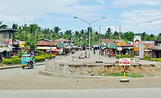
Banaybanay, Davao Oriental

Last updated
Banaybanay
Municipality of Banaybanay
Ph locator davao oriental banaybanay.png
Map of Davao Oriental with Banaybanay highlighted
Philippines location map (square).svg
Red pog.svg
Banaybanay
Location within the Philippines
Coordinates: 6°58′12″N126°00′45″E / 6.969936°N 126.012575°E / 6.969936; 126.012575 Coordinates: 6°58′12″N126°00′45″E / 6.969936°N 126.012575°E / 6.969936; 126.012575
Country Flag of the Philippines.svg  Philippines
Region Davao Region (Region XI)
Province Davao Oriental
District 2nd District
Barangays 14 (see Barangays)
Government
[1]
  Type Sangguniang Bayan
   Mayor Adalia L. Tambuang
   Vice Mayor Jose Amor C. Bagayas
  CongressmanJoel Mayo Z. Almario
  Electorate28,673 voters (2019)
Area
[2]
  Total408.52 km2 (157.73 sq mi)
Population
 (2015 census) [3]
  Total41,117
  Density100/km2 (260/sq mi)
Economy
   Income class 2nd municipal income class
   Poverty incidence 28.72% (2015) [4]
  Revenue (₱)140,630,536.63 (2016)
Time zone UTC+8 (PST)
ZIP code
8208
PSGC
IDD : area code +63(0)87
Climate type tropical rainforest climate
Native languagesDavawenyo
Surigaonon
Cebuano
Kalagan language
Kamayo
Tagalog
Website banaybanay.gov.ph

Banaybanay, officially the Municipality of Banaybanay, is a 2nd class municipality in the Province of Davao Oriental, Philippines. According to the 2015 census, it has a population of 41,117 people. [3]

Davao Oriental Province in Davao Region, Philippines

Davao Oriental is a province in the Philippines located in the Davao Region in Mindanao. Its capital is Mati, and it borders the province of Compostela Valley to the west, and Agusan del Sur and Surigao del Sur to the north. The province is the traditional homeland of the Mandaya and Kagan people.

Philippines Republic in Southeast Asia

The Philippines, officially the Republic of the Philippines, is an archipelagic country in Southeast Asia. Situated in the western Pacific Ocean, it consists of about 7,641 islands that are broadly categorized under three main geographical divisions from north to south: Luzon, Visayas and Mindanao. The capital city of the Philippines is Manila and the most populous city is Quezon City, both part of Metro Manila. Bounded by the South China Sea on the west, the Philippine Sea on the east and the Celebes Sea on the southwest, the Philippines shares maritime borders with Taiwan to the north, Japan to the northeast, Vietnam to the west, Palau to the east, and Malaysia and Indonesia to the south.

Contents

Barangays

Banaybanay is politically subdivided into 14 barangays.

Barangay equivalent of a village or neighborhood in the Philippines

A barangay or baranggay, sometimes referred to as barrio, is the smallest administrative division in the Philippines and is the native Filipino term for a village, district or ward. In metropolitan areas, the term often refers to an inner city neighbourhood, a suburb or a suburban neighborhood. The word barangay originated from balangay, a kind of boat used by a group of Austronesian peoples when they migrated to the Philippines.

Etymology

Banaybanay is derived from the two native word "Banay", (Kalagan word) means sprout due to its main livelihood in the area which is rice farming, and "Bânay" (Cebuano word) means clans due to the family clans that arrived in that area that came from Visayas Islands and Luzon and settled there along together with the Kalagans and Mandayan Natives.

History

Banaybanay was primarily inhabited by the Mandayas in the uplands of Causwagan, Panikian and Mahayag, and Kalagans in shorelines and the mouth rivers of Piso, Pongoton, Mogbongcogon and Maputi which they have a strong settlement and a Muslim governance on that area leads by a Datus or Imams.

Around the 1800s before Uyanguren arrived in the Davao, there was a strong community of the Kalagans (Kagan) in the Piso which was led by a chieftain named Datu Panayangan. Their dwelling was along the Piso River along with his people who lived there peacefully.

The story of the arriving of the Kallaw people from Samal Island is very well known especially among the Kalagans of Banaybanay. They arrived in the Piso to settled there along with their Kalagan Brothers on the permission of Datu Panayangan. The Kallaw chieftain named Datu Lamaran reconciled to Datu Panayangan to settle the swampy place of Piso which later was called Barrio Pongoton from the word pangotanan which means a place of abundance of fish and crabs to catch.

Until now, the grandsons or the clans of Datu Panayangan and Datu Lamaran are still living on the areas that divide into many families.

Second World War

On the time of Japanese occupation, Banaybanay (formerly known as Piso) gives an important location for the Japanese on the Second World War due to its strategic location in the Davao Gulf. The Japanese established a Camp called Piso Camp in Barangay Calubihan.

Demographics

Population census of Banaybanay
YearPop.±% p.a.
1970 14,866    
1975 19,894+6.02%
1980 24,644+4.37%
1990 29,606+1.85%
1995 33,082+2.10%
2000 33,714+0.41%
2007 35,693+0.79%
2010 39,121+3.39%
2015 41,117+0.95%
Source: Philippine Statistics Authority [3] [5] [6] [7]

Climate

Climate data for Banaybanay, Davao Oriental
MonthJanFebMarAprMayJunJulAugSepOctNovDecYear
Average high °C (°F)29
(84)
29
(84)
30
(86)
30
(86)
30
(86)
29
(84)
29
(84)
29
(84)
30
(86)
30
(86)
29
(84)
30
(86)
30
(85)
Average low °C (°F)22
(72)
22
(72)
22
(72)
23
(73)
24
(75)
24
(75)
24
(75)
24
(75)
24
(75)
24
(75)
24
(75)
23
(73)
23
(74)
Average precipitation mm (inches)168
(6.6)
141
(5.6)
143
(5.6)
141
(5.6)
216
(8.5)
235
(9.3)
183
(7.2)
169
(6.7)
143
(5.6)
176
(6.9)
226
(8.9)
168
(6.6)
2,109
(83.1)
Average rainy days22.118.521.722.527.828.127.426.624.726.326.524.9297.1
Source: Meteoblue [8]


Related Research Articles

San Isidro, Davao Oriental Municipality in Davao Region, Philippines

San Isidro, officially the Municipality of San Isidro, is a 4th class municipality in the province of Davao Oriental, Philippines. According to the 2015 census, it has a population of 36,032 people.

Caraga, Davao Oriental Municipality in Davao Region, Philippines

Caraga, officially the Municipality of Caraga, is a 1st class municipality in the province of Davao Oriental, Philippines. According to the 2015 census, it has a population of 40,379 people.

Talaingod, Davao del Norte Municipality in Davao Region, Philippines

Talaingod is a 2nd class municipality in the province of Davao del Norte, Philippines. According to the 2015 census, it has a population of 27,482 people.

San Isidro, Davao del Norte Municipality in Davao Region, Philippines

San Isidro, officially the Municipality of San Isidro, is a 5th class municipality in the province of Davao del Norte, Philippines. According to the 2015 census, it has a population of 26,651 people.

Matuguinao, Samar Municipality in Eastern Visayas, Philippines

Matuguinao, officially the Municipality of Matuguinao, is a 5th class municipality in the province of Samar, Philippines. According to the 2015 census, it has a population of 7,288 people.

New Bataan, Compostela Valley Municipality in Davao Region, Philippines

New Bataan, officially the Municipality of New Bataan, is a 1st class municipality in the province of Compostela Valley, Philippines. According to the 2015 census, it has a population of 47,726 people.

Magsaysay, Davao del Sur Municipality in Davao Region, Philippines

Magsaysay, officially the Municipality of Magsaysay, is a 3rd class municipality in the province of Davao del Sur, Philippines. According to the 2015 census, it has a population of 53,876 people.

Matanao, Davao del Sur Municipality in Davao Region, Philippines

Matanao, officially the Municipality of Matanao, is a 2nd class municipality in the province of Davao del Sur, Philippines. According to the 2015 census, it has a population of 56,755 people.

Santa Maria, Davao Occidental Municipality in Davao Region, Philippines

Santa Maria, officially the Municipality of Santa Maria, is a 2nd class municipality in the province of Davao Occidental, Philippines. According to the 2015 census, it has a population of 53,671 people.

Sarangani, Davao Occidental Municipality in Davao Region, Philippines

Sarangani, officially the Municipality of Sarangani, is a 4th class municipality in the province of Davao Occidental, Philippines. According to the 2015 census, it has a population of 24,039 people.

Sulop, Davao del Sur Municipality in Davao Region, Philippines

Sulop, officially the Municipality of Sulop, is a 3rd class municipality in the province of Davao del Sur, Philippines. According to the 2015 census, it has a population of 33,613 people.

Cateel, Davao Oriental Municipality in Davao Region, Philippines

Cateel, officially the Municipality of Cateel, is a 2nd class municipality in the province of Davao Oriental, Philippines. According to the 2015 census, it has a population of 40,704 people.

Governor Generoso, Davao Oriental Municipality in Davao Region, Philippines

Governor Generoso, officially the Municipality of Governor Generoso, is a 2nd class municipality in the province of Davao Oriental, Philippines. According to the 2015 census, it has a population of 55,109 people.

Lupon, Davao Oriental Municipality in Davao Region, Philippines

Lupon, officially the Municipality of Lupon, is a 1st class municipality in the province of Davao Oriental, Philippines. According to the 2015 census, it has a population of 65,785 people.

Manay, Davao Oriental Municipality in Davao Region, Philippines

Manay, officially the Municipality of Manay, is a 2nd class municipality in the province of Davao Oriental, Philippines. According to the 2015 census, it has a population of 42,690 people.

Maslog, Eastern Samar Municipality in Eastern Visayas, Philippines

Maslog, officially the Municipality of Maslog, is a 5th class municipality in the province of Eastern Samar, Philippines. According to the 2015 census, it has a population of 5,407 people.

Bansud, Oriental Mindoro Municipality of the Philippines in the province of Oriental Mindoro

Bansud, officially the Municipality of Bansud,, is a 2nd class municipality in the province of Oriental Mindoro, Philippines. According to the 2015 census, it has a population of 40,992 people.

Talayan Municipality in Bangsamoro Autonomous Region in Muslim Mindanao, Philippines

Talayan, officially the Municipality of Talayan, is a 4th class municipality in the province of Maguindanao, Philippines. According to the 2015 census, it has a population of 30,032 people.

Datu Saudi-Ampatuan, Maguindanao Municipality in Bangsamoro Autonomous Region in Muslim Mindanao, Philippines

Datu Saudi-Ampatuan is a 4th class municipality in the province of Maguindanao, Philippines. According to the 2015 census, it has a population of 26,427 people.

Datu Hoffer Ampatuan, Maguindanao Municipality in Bangsamoro Autonomous Region in Muslim Mindanao, Philippines

Datu Hoffer Ampatuan, officially the Municipality of Datu Hoffer Ampatuan, is a — municipality in the province of Maguindanao, Philippines. According to the 2015 census, it has a population of 25,012 people.

References

  1. "Municipality". Quezon City, Philippines: Department of the Interior and Local Government. Retrieved 31 May 2013.
  2. "Province: Davao Oriental". PSGC Interactive. Quezon City, Philippines: Philippine Statistics Authority . Retrieved 12 November 2016.
  3. 1 2 3 Census of Population (2015). "Region XI (Davao Region)". Total Population by Province, City, Municipality and Barangay. PSA . Retrieved 20 June 2016.
  4. "PSA releases the 2015 Municipal and City Level Poverty Estimates". Quezon City, Philippines. Retrieved 12 October 2019.
  5. Census of Population and Housing (2010). "Region XI (Davao Region)". Total Population by Province, City, Municipality and Barangay. NSO . Retrieved 29 June 2016.
  6. Censuses of Population (1903–2007). "Region XI (Davao Region)". Table 1. Population Enumerated in Various Censuses by Province/Highly Urbanized City: 1903 to 2007. NSO.
  7. "Province of Davao Oriental". Municipality Population Data. Local Water Utilities Administration Research Division. Retrieved 17 December 2016.
  8. "Banaybanay: Average Temperatures and Rainfall". Meteoblue. Retrieved 17 November 2019.