Cateel, Davao Oriental

Last updated
Cateel
Municipality of Cateel
Cateel Davao Oriental.png
Seal
Ph locator davao oriental cateel.png
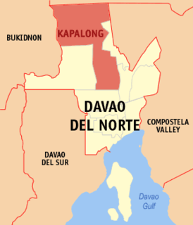
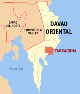
Map of Davao Oriental with Cateel highlighted
Philippines location map (square).svg
Red pog.svg
Cateel
Location within the Philippines
Coordinates: 7°47′N126°27′E / 7.78°N 126.45°E / 7.78; 126.45 Coordinates: 7°47′N126°27′E / 7.78°N 126.45°E / 7.78; 126.45
Country Flag of the Philippines.svg  Philippines
Region Davao Region (Region XI)
Province Davao Oriental
District 1st District
FoundedOctober 29, 1903
Barangays 16 (see Barangays)
Government
[1]
  Type Sangguniang Bayan
   Mayor Erlinda C. Nuñez
   Vice Mayor Camilo T. Nuñez
  CongressmanCorazon N. Malanyaon
  Electorate27,964 voters (2019)
Area
[2]
  Total545.56 km2 (210.64 sq mi)
Population
 (2015 census) [3]
  Total40,704
  Density75/km2 (190/sq mi)
Economy
   Income class 2nd municipal income class
   Poverty incidence 30.61% (2015) [4]
  Revenue (₱)137,649,998.41 (2016)
Time zone UTC+8 (PST)
ZIP code
8205
PSGC
IDD : area code +63(0)87
Climate type tropical rainforest climate
Native languagesDavawenyo
Surigaonon
Cebuano
Kalagan language
Kamayo
Mandaya
Website www.cateel.gov.ph

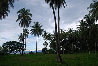
Cateel, officially the Municipality of Cateel, is a 2nd class municipality in the province of Davao Oriental, Philippines. According to the 2015 census, it has a population of 40,704 people. [3]

Davao Oriental Province in Davao Region, Philippines

Davao Oriental is a province in the Philippines located in the Davao Region in Mindanao. Its capital is Mati, and it borders the province of Compostela Valley to the west, and Agusan del Sur and Surigao del Sur to the north. The province is the traditional homeland of the Mandaya and Kagan people.

Philippines Republic in Southeast Asia

The Philippines, officially the Republic of the Philippines, is an archipelagic country in Southeast Asia. Situated in the western Pacific Ocean, it consists of about 7,641 islands that are broadly categorized under three main geographical divisions from north to south: Luzon, Visayas and Mindanao. The capital city of the Philippines is Manila and the most populous city is Quezon City, both part of Metro Manila. Bounded by the South China Sea on the west, the Philippine Sea on the east and the Celebes Sea on the southwest, the Philippines shares maritime borders with Taiwan to the north, Japan to the northeast, Vietnam to the west, Palau to the east, and Malaysia and Indonesia to the south.

Contents

Cateel is the home of the Aliwagwag Falls, located at barangay Aliwagwag within the Aliwagwag Protected Landscape. It is a towering waterfalls considered by hydraulic engineers as the highest in the country and regarded as one of the most beautiful falls in the Philippines. It is a series of 84 falls appearing like stairway to heaven with various heights among the steps ranging from 2 to 33.5 metres (7 to 110 ft). One step is measured 22 metres (72 ft) and another is 20 metres (66 ft). Overall Aliwagwag Falls has a height of 340 metres (1,120 ft) and a width of 20 metres (66 ft). All these in the midst of virgin forest, with a river at the foot of the falls. 13 rapids to cross.

Aliwagwag Protected Landscape Philippine protected area

The Aliwagwag Protected Landscape is a protected area that preserves a major drainage catchment in the southern Philippine island of Mindanao in the Davao Region. It contains the headwaters of the Cateel River in the southern Diuata Mountain Range which provides the water source and irrigation for surrounding rice fields and communities in Davao Oriental and Compostela Valley provinces. It was named after the remote rural village in the municipality of Cateel where Aliwagwag Falls, the country's highest waterfall, is located.

History

Aftermath of Typhoon Bopha in Cateel Aftermath of Typhoon Bopha in Cateel, Davao Oriental.jpg
Aftermath of Typhoon Bopha in Cateel

Cateel is the first municipality in Mindanao. It was the place where Spaniards first docked in Mindanao which reflects how majority of its primary inhabitants converted to Catholicism.

In 1959,the Mainit and Alegria were converted into barrios. [5]

The municipality was one of the hardest-hit towns of Typhoon Bopha when it hit the town on December 3, 2012. [6]

Typhoon Bopha Pacific typhoon in 2012

Typhoon Bopha, known in the Philippines as Typhoon Pablo, was the strongest tropical cyclone on record to ever affect the southern Filipino island of Mindanao, making landfall as a Category 5 super typhoon with winds of 175 mph (280 km/h). The twenty-fourth tropical storm, along with being the fourth and final super typhoon of the 2012 Pacific Typhoon season, Bopha originated unusually close to the equator, becoming the second-most southerly Category 5 super typhoon, reaching a minimum latitude of 7.4°N on December 3, 2012, as only Typhoon Louise-Marge of 1964 came closer to the equator at this strength, at 7.3°N. After first landfalling in Palau, where it destroyed houses, disrupted communications and caused power outages, flooding and uprooted trees, Bopha made landfall late on December 3 on Mindanao, an island that had been devastated by the much weaker Tropical Storm Washi in December 2011. The storm caused widespread destruction on Mindanao, leaving thousands of people homeless and killing 1901 people.

Barangays

Cateel is politically subdivided into 16 barangays.

Barangay equivalent of a village or neighborhood in the Philippines

A barangay or baranggay, sometimes referred to as barrio, is the smallest administrative division in the Philippines and is the native Filipino term for a village, district or ward. In metropolitan areas, the term often refers to an inner city neighbourhood, a suburb or a suburban neighborhood. The word barangay originated from balangay, a kind of boat used by a group of Austronesian peoples when they migrated to the Philippines.

Demographics

Population census of Cateel
YearPop.±% p.a.
1903 4,101    
1918 5,906+2.46%
1939 9,243+2.16%
1948 10,671+1.61%
1960 14,586+2.64%
1970 14,633+0.03%
1975 15,849+1.61%
YearPop.±% p.a.
1980 20,084+4.85%
1990 26,144+2.67%
1995 27,211+0.75%
2000 28,655+1.11%
2007 33,109+2.01%
2010 38,579+5.72%
2015 40,704+1.03%
Source: Philippine Statistics Authority [3] [7] [8] [9]

Climate

Climate data for Cateel, Davao Oriental
MonthJanFebMarAprMayJunJulAugSepOctNovDecYear
Average high °C (°F)27
(81)
27
(81)
28
(82)
30
(86)
30
(86)
30
(86)
30
(86)
30
(86)
30
(86)
30
(86)
29
(84)
28
(82)
29
(84)
Average low °C (°F)23
(73)
23
(73)
23
(73)
23
(73)
24
(75)
24
(75)
24
(75)
24
(75)
24
(75)
24
(75)
24
(75)
24
(75)
24
(74)
Average precipitation mm (inches)160
(6.3)
127
(5.0)
96
(3.8)
62
(2.4)
141
(5.6)
197
(7.8)
185
(7.3)
186
(7.3)
183
(7.2)
181
(7.1)
128
(5.0)
111
(4.4)
1,757
(69.2)
Average rainy days20.017.215.913.923.827.228.128.227.027.021.318.7268.3
Source: Meteoblue [10]

Related Research Articles

San Isidro, Davao Oriental Municipality in Davao Region, Philippines

San Isidro, officially the Municipality of San Isidro, is a 4th class municipality in the province of Davao Oriental, Philippines. According to the 2015 census, it has a population of 36,032 people.

Caraga, Davao Oriental Municipality in Davao Region, Philippines

Caraga, officially the Municipality of Caraga, is a 1st class municipality in the province of Davao Oriental, Philippines. According to the 2015 census, it has a population of 40,379 people.

Malungon, Sarangani Municipality in Soccsksargen, Philippines

Malungon, officially the Municipality of Malungon, is a 1st class municipality in the province of Sarangani, Philippines. According to the 2015 census, it has a population of 103,604 people.

Mainit, Surigao del Norte Municipality in Caraga, Philippines

Mainit, officially the Municipality of Mainit, is a 4th class municipality in the province of Surigao del Norte, Philippines. According to the 2015 census, it has a population of 26,741 people.

Alegria, Surigao del Norte Municipality in Caraga, Philippines

Alegria, officially the Municipality of Alegria, is a 5th class municipality in the province of Surigao del Norte, Philippines. According to the 2015 census, it has a population of 16,011 people.

Kapalong, Davao del Norte Municipality in Davao Region, Philippines

Kapalong, officially the Municipality of Kapalong, is a 1st class municipality in the province of Davao del Norte, Philippines. According to the 2015 census, it has a population of 76,334 people.

New Corella, Davao del Norte Municipality in Davao Region, Philippines

New Corella, officially the Municipality of New Corella, is a 2nd class municipality in the province of Davao del Norte, Philippines. According to the 2015 census, it has a population of 54,844 people.

San Isidro, Davao del Norte Municipality in Davao Region, Philippines

San Isidro, officially the Municipality of San Isidro, is a 5th class municipality in the province of Davao del Norte, Philippines. According to the 2015 census, it has a population of 26,651 people.

Mabini, Compostela Valley Municipality in Davao Region, Philippines

Mabini, officially the Municipality of Mabini, is a 2nd class municipality in the province of Compostela Valley, Philippines. According to the 2015 census, it has a population of 41,102 people.

Maco, Compostela Valley Municipality in Davao Region, Philippines

Maco, officially the Municipality of Maco, is a 1st class municipality in the province of Compostela Valley, Philippines. According to the 2015 census, it has a population of 81,277 people.

Kiblawan, Davao del Sur Municipality in Davao Region, Philippines

Kiblawan, officially the Municipality of Kiblawan, is a 2nd class municipality in the province of Davao del Sur, Philippines. According to the 2015 census, it has a population of 48,897 people.

Magsaysay, Davao del Sur Municipality in Davao Region, Philippines

Magsaysay, officially the Municipality of Magsaysay, is a 3rd class municipality in the province of Davao del Sur, Philippines. According to the 2015 census, it has a population of 53,876 people.

Matanao, Davao del Sur Municipality in Davao Region, Philippines

Matanao, officially the Municipality of Matanao, is a 2nd class municipality in the province of Davao del Sur, Philippines. According to the 2015 census, it has a population of 56,755 people.

Sarangani, Davao Occidental Municipality in Davao Region, Philippines

Sarangani, officially the Municipality of Sarangani, is a 4th class municipality in the province of Davao Occidental, Philippines. According to the 2015 census, it has a population of 24,039 people.

Banaybanay, Davao Oriental Municipality in Davao Region, Philippines

Banaybanay, officially the Municipality of Banaybanay, is a 2nd class municipality in the Province of Davao Oriental, Philippines. According to the 2015 census, it has a population of 41,117 people.

Boston, Davao Oriental Municipality in Davao Region, Philippines

Boston, officially the Municipality of Boston, is a 3rd class municipality in the province of Davao Oriental, Philippines. According to the 2015 census, it has a population of 13,535 people.

Governor Generoso, Davao Oriental Municipality in Davao Region, Philippines

Governor Generoso, officially the Municipality of Governor Generoso, is a 2nd class municipality in the province of Davao Oriental, Philippines. According to the 2015 census, it has a population of 55,109 people.

Manay, Davao Oriental Municipality in Davao Region, Philippines

Manay, officially the Municipality of Manay, is a 2nd class municipality in the province of Davao Oriental, Philippines. According to the 2015 census, it has a population of 42,690 people.

Tarragona, Davao Oriental Municipality in Davao Region, Philippines

Tarragona, officially the Municipality of Tarragona, is a 3rd class municipality in the province of Davao Oriental, Philippines. According to the 2015 census, it has a population of 26,225 people.

Medina, Misamis Oriental Municipality in Northern Mindanao, Philippines

Medina, officially the Municipality of Medina, is a 4th class municipality in the province of Misamis Oriental, Philippines. According to the 2015 census, it has a population of 32,907 people.

References

  1. "Municipality". Quezon City, Philippines: Department of the Interior and Local Government. Retrieved 31 May 2013.
  2. "Province: Davao Oriental". PSGC Interactive. Quezon City, Philippines: Philippine Statistics Authority . Retrieved 12 November 2016.
  3. 1 2 3 Census of Population (2015). "Region XI (Davao Region)". Total Population by Province, City, Municipality and Barangay. PSA . Retrieved 20 June 2016.
  4. "PSA releases the 2015 Municipal and City Level Poverty Estimates". Quezon City, Philippines. Retrieved 12 October 2019.
  5. "R.A. No. 2105, An Act Creating Certain Barrios in the Municipality of Cateel, Province of Davao". LawPH.com. Retrieved 2011-04-13.
  6. "Typhoon death toll climbs to over 200". Inquirer. Retrieved 5 December 2012.
  7. Census of Population and Housing (2010). "Region XI (Davao Region)". Total Population by Province, City, Municipality and Barangay. NSO . Retrieved 29 June 2016.
  8. Censuses of Population (1903–2007). "Region XI (Davao Region)". Table 1. Population Enumerated in Various Censuses by Province/Highly Urbanized City: 1903 to 2007. NSO.
  9. "Province of Davao Oriental". Municipality Population Data. Local Water Utilities Administration Research Division. Retrieved 17 December 2016.
  10. "Cateel: Average Temperatures and Rainfall". Meteoblue. Retrieved 17 November 2019.