Bangecuo

Last updated
Bangor Co
Bangecuo 2021-10-11 Sentinel-2 L2A Highlight Optimized Natural Color.jpg
Sentinel-2 image (2021)
China Tibet Autonomous Region rel location map.svg
Red pog.svg
Bangor Co
Location Xainza County, Nagqu, Tibet, China
Coordinates 31°44′16.5″N89°28′35.8″E / 31.737917°N 89.476611°E / 31.737917; 89.476611

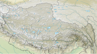
Bangecuo (also spelled as Bangor Co, Tibetan : བྲང་ཁོག་མཚོ, Wylie : brang khog mtsho, ZYPY : Drangkhok Tso; Chinese :班戈错; pinyin :Bāngēcuò) is a graben basin salt lake [1] [2] on the Tibetan Plateau in Xainza County within Nagqu in the Tibet Autonomous Region of China.

Contents

It was reported in 2003 that the water levels of Siling Lake and Bangecuo had increased by 19.34% since 1969. [3]

Siling Lake is another nearby salt lake located west of Bangecuo, [4] around four miles away.
See also

References

  1. Meng, Kai and Shi, Xuhua and Wang, Erchie (February 2011). "High-altitude salt lake elevation changes and glacial ablation in Central Tibet, 2000–2010". Chinese Science Bulletin . 57 (5): 525–534. doi: 10.1007/s11434-011-4849-5 . S2CID   53638685.{{cite journal}}: CS1 maint: multiple names: authors list (link)
  2. Wang, Can; Wang, Hailei; Song, Gao; Zheng, Mianping (February 2019). "Grain size of surface sediments in Selin Co (central Tibet) linked to water depth and offshore distance". Journal of Paleolimnology. 61(2):1-13. DOI:10.1007/s10933-018-0054-8
  3. Yong, Qu. Shelincuo and Bangecuo extensional lake basins in the northern pa rt of Tibet and present chasmic activities. Semantic Scholar. S2CID   131135903.
  4. Doin, Marie-Pierre; Twardzik, Cédric; Ducret, Gabriel; Lasserre, Cécile; Guillaso, Stéphane; Jianbao, Sun (2015). "InSAR measurement of the deformation around Siling Co Lake: Inferences on the lower crust viscosity in central Tibet". Journal of Geophysical Research: Solid Earth. 120 (7). American Geophysical Union (AGU): 5290–5310. Bibcode:2015JGRB..120.5290D. doi: 10.1002/2014jb011768 . ISSN   2169-9313. S2CID   128466292.

Further reading