Siling Lake

Last updated
Siling Lake / Selincuo
Siling Lake.jpg
Tibet loc rel map.svg
Red pog.svg
Siling Lake / Selincuo
Location Nagqu Prefecture, Tibet, China
Coordinates 31°50′N89°00′E / 31.833°N 89.000°E / 31.833; 89.000
Basin  countriesChina
Surface area1,865 km2 (720 sq mi)
Surface elevation4,530 metres (14,860 ft)
Official nameTibet Selincuo Wetlands
Designated8 January 2018
Reference no.2352 [1]
Siling Lake
Siling Lake

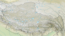
Siling Lake (Tibetan : སེར་གླིང་མཚོ, Wylie : ser gling mtsho, ZYPY : Sêling Co; Chinese :色林错; pinyin :Sèlín cuò), (also known as Qilin or Selincuo) is a salt lake in the Tibet Autonomous Region, China to the north of Xainza. Doijiang is located near the lake. Administratively it belongs to Xainza County and Baingoin County of the Nagqu.

Contents

Bangecuo is another nearby salt lake [2] located east of Siling Lake, [3] around four miles away.

Overview

The lake lies at an altitude of 4,530 metres (14,860 ft). It is a salt lake. It is fed by the rivers Za'gya Zangbo (or Tsagya Tsangpo) (扎加藏布) and the Boques Tsangpo (波曲藏布). With an area of 1,865 km2 (720 sq mi), Siling Co is the second largest saltwater lake in the northern Tibetan Plateau and forms part of the Siling Co National Nature Reserve (also Selincuo Reserve or Xainza Nature Reserve). The 400,000-hectare (990,000-acre) reserve was established in 1993 and contains significant populations of black-necked cranes and some 120 species of birds in total. [4] [5] The lake only has a single species of fish, Gymnocypris selincuoensis , exploited by fishermen[ citation needed ]. The prairie on the banks of the lake is traditionally used as grazing land for yaks and sheep.

The temperature at the lake is an annual average of −3 to −0.6 °C (26.6 to 30.9 °F), the maximum annual temperature 9.4 °C (48.9 °F). The average rainfall is 290 mm (11 in) per year, 90 percent of which falls in the months of June to September, often in the summer as hail.

Climate

Climate data for Siling Lake
MonthJanFebMarAprMayJunJulAugSepOctNovDecYear
Mean daily maximum °C (°F)−4.7
(23.5)
−2.7
(27.1)
1.2
(34.2)
5.7
(42.3)
10.1
(50.2)
14.8
(58.6)
15.7
(60.3)
14.5
(58.1)
12.4
(54.3)
6.2
(43.2)
0.0
(32.0)
−3.2
(26.2)
5.8
(42.5)
Daily mean °C (°F)−11.9
(10.6)
−9.8
(14.4)
−5.9
(21.4)
−1.3
(29.7)
3.1
(37.6)
7.9
(46.2)
9.6
(49.3)
8.7
(47.7)
6.3
(43.3)
−0.3
(31.5)
−7.0
(19.4)
−10.4
(13.3)
−0.9
(30.4)
Mean daily minimum °C (°F)−19.0
(−2.2)
−16.8
(1.8)
−12.9
(8.8)
−8.2
(17.2)
−3.8
(25.2)
1.1
(34.0)
3.5
(38.3)
3.0
(37.4)
0.2
(32.4)
−6.7
(19.9)
−14.0
(6.8)
−17.6
(0.3)
−7.6
(18.3)
Average precipitation mm (inches)2
(0.1)
2
(0.1)
2
(0.1)
5
(0.2)
13
(0.5)
39
(1.5)
78
(3.1)
74
(2.9)
39
(1.5)
7
(0.3)
1
(0.0)
1
(0.0)
263
(10.3)
Source: Climate-Data.org

See also

Related Research Articles

<span class="mw-page-title-main">Himalayas</span> Mountain range in Asia, separating Indo-Gangetic plain from Tibetan Plateau

The Himalayas, or Himalaya, is a mountain range in Asia, separating the plains of the Indian subcontinent from the Tibetan Plateau. The range has some of the Earth's highest peaks, including the highest, Mount Everest; more than 100 peaks exceeding elevations of 7,200 m (23,600 ft) above sea level lie in the Himalayas.

<span class="mw-page-title-main">Tibet Autonomous Region</span> Autonomous region of China

The Tibet Autonomous Region or Xizang Autonomous Region, often shortened to Tibet or Xizang, is an autonomous region of the People's Republic of China (PRC) in Southwest China. It was overlayed on the traditional Tibetan regions of Ü-Tsang and Kham.

<span class="mw-page-title-main">Geography of Tibet</span>

The geography of Tibet consists of the high mountains, lakes and rivers lying between Central, East and South Asia. Traditionally, Western sources have regarded Tibet as being in Central Asia, though today's maps show a trend toward considering all of modern China, including Tibet, to be part of East Asia. Tibet is often called "the roof of the world," comprising tablelands averaging over 4,950 metres above the sea with peaks at 6,000 to 7,500 m, including Mount Everest, on the border with Nepal.

<span class="mw-page-title-main">Tibetan Plateau</span> Plateau in Central, South and East Asia

The Tibetan Plateau, also known as the Qinghai–Tibet Plateau or the Qing–Zang Plateau or as the Himalayan Plateau in India, is a vast elevated plateau located at the intersection of Central, South, and East Asia covering most of the Tibet Autonomous Region, most of Qinghai, western half of Sichuan, Southern Gansu provinces in Western China, southern Xinjiang, Bhutan, the Indian regions of Ladakh and Lahaul and Spiti as well as Gilgit-Baltistan in Pakistan, northwestern Nepal, eastern Tajikistan and southern Kyrgyzstan. It stretches approximately 1,000 kilometres (620 mi) north to south and 2,500 kilometres (1,600 mi) east to west. It is the world's highest and largest plateau above sea level, with an area of 2,500,000 square kilometres (970,000 sq mi). With an average elevation exceeding 4,500 metres (14,800 ft) and being surrounded by imposing mountain ranges that harbor the world's two highest summits, Mount Everest and K2, the Tibetan Plateau is often referred to as "the Roof of the World".

<span class="mw-page-title-main">Yarlung Tsangpo Grand Canyon</span> Canyon in Tibet, China

The Yarlung Tsangpo Grand Canyon, also known as the Yarlung Zangbo Grand Canyon, the Tsangpo Canyon, the Brahmaputra Canyon or the Tsangpo Gorge, is a canyon along the Yarlung Tsangpo River in Tibet Autonomous Region, China. It is the deepest canyon in the world, and at 504.6 kilometres (313.5 mi) is slightly longer than the Grand Canyon in the United States, making it one of the world's largest. The Yarlung Tsangpo originates near Mount Kailash and runs east for about 1,700 kilometres (1,100 mi), draining a northern section of the Himalayas before it enters the gorge just downstream of Pei, Tibet, near the settlement of Zhibe. The canyon has a length of about 240 kilometres (150 mi) as the gorge bends around Mount Namcha Barwa and cuts its way through the eastern Himalayas. Its waters drop from about 2,900 metres (9,500 ft) near Pei to about 1,500 metres (4,900 ft) at the end of the Upper Gorge where the Po Tsangpo River enters. The river continues through the Lower Gorge to the Indian border at an elevation of 660 metres (2,170 ft). The river then enters Arunachal Pradesh and eventually becomes the Brahmaputra.

<span class="mw-page-title-main">Tibetan antelope</span> Species of mammal

The Tibetan antelope or chiru is a medium-sized bovid native to the northeastern Tibetan plateau. Most of the population live within the Chinese border, while some scatter across India and Bhutan in the high altitude plains, hill plateau and montane valley. Fewer than 150,000 mature individuals are left in the wild, but the population is currently thought to be increasing. In 1980s and 1990s, they had become endangered due to massive illegal poaching. They are hunted for their extremely soft, light and warm underfur which is usually obtained after death. This underfur, known as shahtoosh, is used to weave luxury shawls. Shahtoosh shawls were traditionally given as wedding gifts in India and it takes the underfur of three to five adult antelopes to make one shawl. Despite strict controls on trade of shahtoosh products and CITES listing, there is still demand for these luxury items. Within India, shawls are worth $1,000–$5,000; internationally the price can reach as high as $20,000. In 1997 the Chinese government established the Hoh Xil National Nature Reserve solely to protect the Tibetan antelope population.

<span class="mw-page-title-main">Golmud</span> City in Qinghai Province, China

Golmud, also known by various other romanizations, is a county-level city in the Haixi Mongol and Tibetan Autonomous Prefecture of Qinghai Province, China. It is now the second-largest city in Qinghai and the third largest in the Tibetan Plateau. The population in 2020 is 221,863.

<span class="mw-page-title-main">Nagqu</span> Prefecture-level city in Tibet, China

Nagqu is a prefecture-level city in the north of the Chinese autonomous region of Tibet. On May 7, 2018, the former Nagqu Prefecture was officially declared the sixth prefecture-level city in Tibet after Lhasa, Shigatse, Chamdo, Nyingchi and Shannan. The regional area, covering an area of 450,537 km2 (173,953 sq mi), is bordered by Bayingolin and Hotan Prefectures of Xinjiang to the north, Haixi, Yushu Prefectures of Qinghai and Chamdo to the east, Nyingchi, Lhasa and Shigatse to the south, Ngari Prefecture to the west. As of the 2010 census, it had a population of 462,381. Since its official establishment in 2018, it is the largest city by area in the world.

<span class="mw-page-title-main">Qaidam Basin</span> Ecoregion in Qinghai, China

The Qaidam, Tsaidam, or Chaidamu Basin is a hyperarid basin that occupies a large part of Haixi Prefecture in Qinghai Province, China. The basin covers an area of approximately 120,000 km2 (46,000 sq mi), one-fourth of which is covered by saline lakes and playas. Around one third of the basin, about 35,000 km2 (14,000 sq mi), is desert.

<span class="mw-page-title-main">Changtang</span> North-West Tibet geographic highland

The Changtang is a part of the high altitude Tibetan Plateau in western and northern Tibet extending into the southern edges of Xinjiang as well as southeastern Ladakh, India, with vast highlands and giant lakes. From eastern Ladakh, the Changtang stretches approximately 1,600 kilometres (990 mi) east into Tibet as far as modern Qinghai. The Changtang is home to the Changpa, a nomadic Tibetan people. The two largest settlements within the Tibetan Changtang are Rutog Town the seat of Rutog County and Domar Township the seat of Shuanghu County.

<span class="mw-page-title-main">Litang County</span> County in Sichuan, China

Litang is in southwest of Garzê Tibetan Autonomous Prefecture, Sichuan, China.

<span class="mw-page-title-main">Xainza County</span> County in Tibet, China

Xainza County, also Shantsa, Shentsa, is a county within Nagqu of the Tibet Autonomous Region of China. In 1999 the county had a population of 16,190.

<span class="mw-page-title-main">Yarlung Tsangpo</span> River in Tibet, upper stream of the Brahmaputra

The Yarlung Tsangpo, also called Yarlung Zangbo and Yalu Zangbu River is the upper stream of the Brahmaputra River located in the Tibet Autonomous Region, China. It is the longest river of Tibet and the fifth longest in China. The upper section is also called Dangque Zangbu meaning "Horse River."

Chang Tang National Nature Reserve lies in the northern Tibetan Plateau. It is the third-largest land nature reserve in the world, after the Northeast Greenland National Park and Kavango-Zambezi Transfrontier Conservation Area, with an area of over 334,000 km2 (129,000 sq mi), making it bigger than 183 countries. Administratively, it lies in Xainza County and Biru County of the Nagqu Prefecture. With the more recently established adjoining reserves listed below there is now a total of 496,000 km2 of connected Nature Reserves, which represents an area almost as large as Spain and bigger than 197 other countries.

<span class="mw-page-title-main">Sichuan–Tibet railway</span> High-elevation railway line in China

The Sichuan–Tibet railway, Sichuan–Xizang railway or Chuanzang railway is a high-elevation higher-speed railway in China that will connect Chengdu, the provincial capital of Sichuan, and Lhasa, the provincial capital of Tibet, when fully completed. The line will be 1,629 km (1,012 mi) long, and significantly cut travel time from Chengdu to Lhasa from 48 to 13 hours.

<span class="mw-page-title-main">Lhasa (prefecture-level city)</span> Prefecture-level city in Tibet, China

Lhasa is a prefecture-level city, one of the main administrative divisions of the Tibet Autonomous Region of China. It covers an area of 29,274 square kilometres (11,303 sq mi) of rugged and sparsely populated terrain. Its urban center is Lhasa, with around 300,000 residents, which mostly corresponds with the administrative Chengguan District, while its suburbs extend into Doilungdêqên District and Dagzê District. The consolidated prefecture-level city contains additional five, mostly rural, counties.

<span class="mw-page-title-main">Altun Shan National Nature Reserve</span>

Altun Shan National Nature Reserve is a large, arid area in the southeast of Xinjiang Autonomous Region, on the northern edge of the Tibetan plateau and the southern edge of the Tarim Basin in northwest China. It surrounds the Kumkol Basin, an endorheic basin in the western third of the Altyn-Tagh mountains. The reserve is sometimes referred to as the "Arjin Mountains Nature Reserve", or "Aerjinshan". The reserve covers the southern portions of Qiemo County and Ruoqiang County of Bayingolin Mongol Autonomous Prefecture in Xinjiang.

<span class="mw-page-title-main">Gomang Co</span>

Gomang Co is a mountain graben basin lake on the Tibetan Plateau in Xainza County within Nagqu in the Tibet Autonomous Region of China. Gomang Co has a Köppen climate classification of existing in a tundra climate. The lake's water level is controlled by its outlet toward Siling Lake, which is north of Gomang Co.

<span class="mw-page-title-main">Bangecuo</span>

Bangecuo is a graben basin salt lake on the Tibetan Plateau in Xainza County within Nagqu in the Tibet Autonomous Region of China.

<span class="mw-page-title-main">Dazecuo</span> Meromictic lake in Tibet, China

Dazecuo is one of many inland lakes in Tibet. It is a salt lake on the Tibetan Plateau in Xainza County within Nagqu in the Tibet Autonomous Region of China. It was reported in 2021 that the lake receives "good environmental protection".

References

  1. "Tibet Selincuo Wetlands". Ramsar Sites Information Service. Retrieved 25 April 2018.
  2. Meng, Kai and Shi, Xuhua and Wang, Erchie (February 2011). "High-altitude salt lake elevation changes and glacial ablation in Central Tibet, 2000–2010". Chinese Science Bulletin . 57 (5): 525–534. doi: 10.1007/s11434-011-4849-5 . S2CID   53638685.{{cite journal}}: CS1 maint: multiple names: authors list (link)
  3. Doin, Marie-Pierre; Twardzik, Cédric; Ducret, Gabriel; Lasserre, Cécile; Guillaso, Stéphane; Jianbao, Sun (2015). "InSAR measurement of the deformation around Siling Co Lake: Inferences on the lower crust viscosity in central Tibet". Journal of Geophysical Research: Solid Earth. American Geophysical Union (AGU). 120 (7): 5290–5310. Bibcode:2015JGRB..120.5290D. doi: 10.1002/2014jb011768 . ISSN   2169-9313. S2CID   128466292.
  4. Zheng, Du; Zhang, Qingsong; Wu, Shaohong (2000). Mountain geoecology and sustainable development of the Tibetan Plateau. Springer. p. 238. ISBN   978-0-7923-6688-1 . Retrieved 31 March 2012.
  5. 安才旦 (1 January 2003). Tibet China: Travel Guide. 五洲传播出版社. p. 44. ISBN   978-7-5085-0374-5 . Retrieved 31 March 2012.