
Zhumadian is a prefecture-level city in southern Henan province, China. It borders Xinyang to the south, Nanyang to the west, Pingdingshan to the northwest, Luohe to the north, Zhoukou to the northeast, and the province of Anhui to the east.
Damxung is a county of Lhasa City, lying to the north of its main center of Chengguan, in the Tibet Autonomous Region of the People's Republic of China. Its administrative seat is Damquka. The terrain is rugged, including the western Nyenchen Tanglha Mountains, with their highest peak rising to 7,111 metres (23,330 ft). As of 2013 the population was 40,000, with most of the people engaged in animal husbandry.

Yushu Tibetan Autonomous Prefecture, also transliterated as Yüxü or Yulshul, is an autonomous prefecture of Southwestern Qinghai Province, China. Largely inhabited by Tibetans, the prefecture has an area of 188,794 square kilometres (72,894 sq mi) and its seat is located in the town of Gyêgu in Yushu County, which is the place of the old Tibetan trade mart of Jyekundo. The official source of the Yellow River lies within the prefecture. Historically, the area belongs to the cultural realm of Kham in Eastern Tibet.

Nagqu is a prefecture-level city in the north of the Chinese autonomous region of Tibet. On May 7, 2018, the former Nagqu Prefecture was officially declared the sixth prefecture-level city in Tibet after Lhasa, Shigatse, Chamdo, Nyingchi and Shannan. The regional area, covering an area of 450,537 km2 (173,953 sq mi), is bordered by Bayingolin and Hotan Prefectures of Xinjiang to the north, Haixi, Yushu Prefectures of Qinghai and Chamdo to the east, Nyingchi, Lhasa and Shigatse to the south, Ngari Prefecture to the west. As of the 2010 census, it had a population of 462,381.

Hainan Tibetan Autonomous Prefecture, formerly known as Tsolho Tibetan Autonomous Prefecture, is an autonomous prefecture of Northeastern Qinghai Province in Western China. The prefecture has an area of 45,895 square kilometres (17,720 sq mi) and its seat is located in Gonghe County. Its name literally means "south of (Qinghai) Lake."
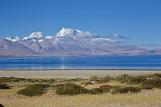
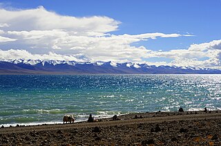
Ngari Prefecture is a prefecture of China's Tibet Autonomous Region. Its capital is Gar County. Its administrative centre and largest settlement is Shiquanhe.
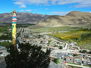
Shannan, also transliterated from Tibetan as Lhoka, is a prefecture-level city in the southeastern Tibet Autonomous Region, China. Shannan includes Gonggar County within its jurisdiction with Gongkar Chö Monastery, Gonggar Dzong, and Gonggar Airport all located near Gonggar town.

Burang County, also called Purang, is an administrative division of Ngari Prefecture in the Tibet Autonomous Region (TAR) of China. The county seat is Burang Town, known as Taklakot in Nepali. The county covers an area of 12,539 square kilometres (4,841 sq mi), and has a population of 9,657 as of 2010.

Xainza County, also Shantsa, Shentsa, is a county within Nagqu of the Tibet Autonomous Region of China. In 1999 the county had a population of 16,190.

Lhorong County is a county of the Qamdo Prefecture in the Tibet Autonomous Region. The county covers an area of 8,108 km2 (3,131 sq mi) and has a population of around 40,000 as of 2003. The word Lhorong means "valley in the south" or "river in the south" in Tibetan.
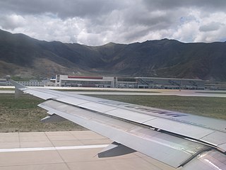
Gonggar County, also Gongkar, is a county of Shannan in the Tibet Autonomous Region, one of the 12 counties of the prefecture. It has under its jurisdiction five towns, three townships, 43 administrative villages and 168 village development committees and contains notable landmarks such as the Gonggar Choide Monastery, the Zhug Dêqên Qoikor Monastery, Gangdoi Town, the Gonggar Dzong at Xoi, the Lhasa Gonggar Airport at Gyazhugling, the Tubdain Ramai Monastery and the county seat of Gyixung.
Barma, or Pama, Pamaxiang, also spelled Parma or Jarma) is a small town and township-level division in Zhongba County in the Shigatse Prefecture of the Tibet Autonomous Region of China. It is located roughly 500 kilometres (310 mi) northwest of Lhasa next to Chabyer Co lake, north of Taro Co. The township was established in 1961 and covers an area of 4,098 square kilometres (1,582 sq mi).
Raka is a village in Dênggar Township in Saga County in the Shigatse Prefecture of the Tibet Autonomous Region of China. It lies along the G219 road near the junction with the northern heading S206 road on the road to Qierexiang, roughly 50 kilometres (31 mi) east of Saga at an altitude of 5,565 metres (18,258 ft). Historically it lay in the province of Tsang. Raka is very well connected, connected by provincial highway 206 to Coqen in the north, Saga in the southwest and Lhatse, Shigatse and Lhasa to the east. Several kilometres to the east is the village of Kyêrdo. An "enormous tributary" called the Raka Tsanpo flows nearby and the saline lake of Raka Lake is also located in the vicinity.
Jiaqiong or Jakhyung Town, also known as Jongnag is a small town and township-level division in Baingoin County, Nagqu in the Tibet Autonomous Region of the People's Republic of China. It covers an area of 2,993 square kilometres (1,156 sq mi) and as of 2010 it had a population of 2926 people. Jiaqiong lies to the northwest of Beila, to the east of Amdo County, and south of Shuanghu County.

Tangra Yumco is a salt lake in Tibet, China. It is in the southwest of Nyima County. Tangra Yumco is 835.8 square kilometres (322.7 sq mi), with a drainage area of 8,219.7 square kilometres (3,173.6 sq mi), an elevation of 4,528 metres (14,856 ft), length 71.7 kilometres (44.6 mi) and mean width 11.65 kilometres (7.24 mi). It is the holy lake of the Bön believers.
Dawa, or Dawacuo, is a lake in Coqên County in the Ngari Prefecture of the Tibet Autonomous Region of China. It is located several kilometres northwest of Coqên Town. Daxiong is a village located beyond its northeastern bank. The name of lake means "Moon Lake" in Tibetan language.

Taruo Lake or Taruocuo, also known as Taro Tso is a lake in Zhongba County in the Shigatse Prefecture of the Tibet Autonomous Region of China. It is located about 70 kilometres west of Coqên Town. It is 38.1 km long and 17.2 km wide and has an area of 486.6 square km.
Cuoma, or Cuomaxiang is a village and township-level division of Amdo County in the Nagqu Prefecture of the Tibet Autonomous Region, in China. It is located roughly 30 kilometres (19 mi) southwest of Amdo Town near the northern bank of Cona Lake. It covers an area of 5,098 square kilometres (1,968 sq mi) and as of 2004 had a population of about 3,100. Cuoma township of Amdo County has existed since 1960 and was further expanded in 1987, but Cuoma has also been listed under the jurisdiction of Seqing Township of Nyainrong County. The principal economic activity is animal husbandry, pastoral yak, goat, sheep, and so on.
Qiangma, also Qangma or Qiangmazhen is a small town and township-level division of Amdo County in the Nagqu Prefecture of the Tibet Autonomous Region, in China. It is located just south of Zi Getangcuo Lake, 90.7 kilometres (56.4 mi) southwest of Amdo Town. It covers an area of 5,467 square kilometres (2,111 sq mi) and as of 2004 it had a population of about 1700. The principal economic activity is animal husbandry, pastoral yak, goat, sheep, and so on.

Lhasa is a prefecture-level city, one of the main administrative divisions of the Tibet Autonomous Region of China. It covers an area of 29,274 square kilometres (11,303 sq mi) of rugged and sparsely populated terrain. Its capital and largest city is Lhasa, with around 300,000 residents, which mostly corresponds with the administrative Chengguan District, while its suburbs extend into Doilungdêqên District and Dagzê District. The consolidated prefecture-level city contains additional five, mostly rural, counties.


