Banner, Kansas | |
|---|---|
 | |
 Banner  Banner | |
| Coordinates: 38°53′51″N100°06′46″W / 38.89750°N 100.11278°W | |
| Country | United States |
| State | Kansas |
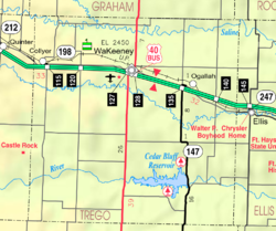
| County | Trego |
| Elevation | 2,408 ft (734 m) |
| Population | |
• Total | 0 |
| Time zone | UTC-6 (CST) |
| • Summer (DST) | UTC-5 (CDT) |
| Area code | 785 |
| GNIS ID | 482667 [1] |
Banner is a ghost town in Collyer Township of Trego County, Kansas, United States.
