Riga, Kansas | |
|---|---|
 | |
 Riga  Riga | |
| Coordinates: 38°57′2″N99°39′1″W / 38.95056°N 99.65028°W [1] | |
| Country | United States |
| State | Kansas |
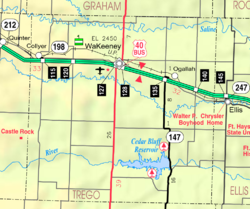
| County | Trego |
| Township | Glencoe |
| Elevation | 2,221 ft (677 m) |
| Time zone | UTC-6 (CST) |
| • Summer (DST) | UTC-5 (CDT) |
| ZIP code | 67656 [2] |
| Area code | 785 |
| FIPS code | 20-59850 [1] |
| GNIS ID | 484721 [1] |
Riga is an unincorporated community in Trego County, Kansas, United States. [1]
