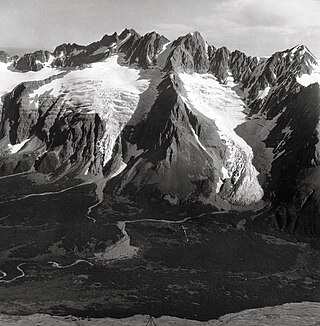
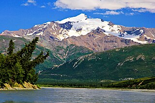
Castle Mountain is a remote 8,620-foot (2,630-meter) mountain summit located at the southeastern edge of the Wrangell Mountains, in the U.S. state of Alaska. The peak is situated 35 mi (56 km) northeast of McCarthy at Skolai Pass in Wrangell-St. Elias National Park and Preserve. Although modest in elevation, relief is significant as the south face rises 4,000 feet above the terminus of the Russell Glacier in less than one mile. Precipitation runoff from the peak drains east via the White River, and west to the Nizina River via Skolai Creek. The mountain's descriptive name was reported in 1914 by the United States Geological Survey.
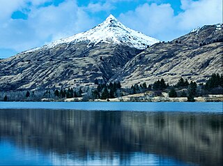
Pyramid Mountain is a 2,395-foot (730-meter) elevation mountain summit located on Kodiak Island in the US state of Alaska. The mountain is situated 7.5 mi (12 km) west of Kodiak. Although modest in elevation, relief is significant since the peak rises over 2,300 feet above Buskin Lake in only 1.5 mi (2 km). This peak's descriptive name was first published in 1943 by the United States Coast and Geodetic Survey.

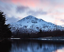
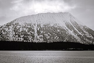
Mount Carmack is a prominent 6,808-foot-elevation (2,075-meter) mountain summit located in the Boundary Ranges of the Coast Mountains, in the U.S. state of Alaska. The peak is situated 7 mi (11 km) north-northeast of Skagway, and 3.5 mi (6 km) south of Mount Cleveland, on land managed by Tongass National Forest. As the highpoint on the divide between the Taiya River and the Skagway River, precipitation runoff from the mountain drains east into the Skagway River and west into Taiya River, both of which empty into Taiya Inlet. Although modest in elevation, relief is significant since Mount Carmack rises 6,800 feet above the Taiya valley in less than 2 mi (3 km), and 5,800 feet above Skagway valley in about 2 miles. Mount Carmack has a lower subsidiary summit, elevation 6,621 ft (2,020 m), about 0.5 mi (1 km) to the northeast of the true summit. The USGS topographic map has this lower northeast peak labelled as Mount Carmack.
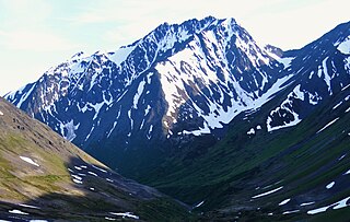
Awesome Peak is an 8,645-foot-elevation (2,635-meter) mountain summit located 35 miles (56 km) east-northeast of Palmer, in the northern Chugach Mountains of Alaska. This peak of the Matanuska Valley is set midway between Anchorage and Glennallen, near mile 90 of the Glenn Highway. It is situated 15 miles (24 km) west of Matanuska Glacier and 3.7 mi (6 km) southwest of Amulet Peak. Precipitation runoff from the mountain drains into Monument and Coal creeks, which are tributaries of the Matanuska River. Topographic relief is significant as the summit rises 5,650 feet above Coal Creek in 3.75 miles (6 km) and 4,650 feet above Monument Creek in 1.9 mile (3 km). This mountain's toponym has not been officially adopted by the United States Board on Geographic Names, so it is only marked as "8645" on USGS maps.

Birds Eye Peak is a 4,970-foot-elevation (1,515-meter) mountain summit in the U.S. state of Alaska. This mountain is located 15 miles (24 km) southeast of Anchorage in the Chugach Mountains and Chugach State Park. Precipitation runoff from the mountain drains north to Knik Arm via Ship Creek and south to Turnagain Arm via Bird Creek. Topographic relief is significant as the summit rises 3,970 feet (1,210 m) above Bird Creek in less than two miles (3.2 km). This mountain's toponym has not been officially adopted by the U.S. Board on Geographic Names.

Temptation Peak is a 5,383-foot (1,641 m) mountain summit in the U.S. state of Alaska.
Icy Peak is a 4,550-foot-elevation (1,390-meter) mountain summit in Alaska, United States.

Mount Becharof is a 3,146-foot-elevation (959-meter) mountain summit in Alaska.

Cope Mountain is a 2,496-foot-elevation (761-meter) summit in Alaska.
Devils Prongs is a 2,175-foot-elevation (663-meter) mountain in Alaska.
Kupreanof Mountain is a 2,440-foot-elevation (744-meter) summit in Alaska.

West Saint Peak is a 3,337-foot-elevation (1,017-meter) summit in Alaska.
Mount Silvertip is a 9,400-foot-elevation (2,865-meter) mountain summit in Alaska.
Raggedtop Mountain is a 5,215-foot-elevation (1,590-meter) mountain summit in Alaska, United States.
Jewel Mountain is a 4,885-foot-elevation (1,489-meter) mountain summit in Alaska, United States.

Tiehacker Mountain is a 4,435-foot-elevation (1,352-meter) mountain summit in Alaska, United States.

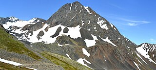
Alabaster Peak is an 8,065-foot-elevation (2,458-meter) mountain summit located 35 miles (56 km) east of Palmer, in the northern Chugach Mountains of Alaska. This peak of the Matanuska Valley is set midway between Anchorage and Glennallen, and can be seen from the Glenn Highway. It is situated 15 miles (24 km) west of Matanuska Glacier and 1.8 miles (2.9 km) south of Awesome Peak. Precipitation runoff from the mountain drains into Coal, Monument, and Gravel creeks, which are tributaries of the Matanuska River. Topographic relief is significant as the summit rises 3,065 feet along the west slope in one mile (1.6 km). The first ascent of the summit was made on July 4, 1970, by Robert Spurr, Bob Pelz, and Royce Purinton via the Spectrum Glacier and North Ridge. This mountain's toponym has not been officially adopted by the United States Board on Geographic Names, so it is only marked as "8065" on USGS maps.

Igloo Mountain is a 4,800 ft (1,460 m) summit in Alaska, United States.

Sugarloaf Mountain is an 11,051-foot-elevation (3,368-meter) summit on the boundary that Salt Lake County shares with Utah County, in Utah, United States.

Lynx Peak is a 6,536-foot-elevation (1,992-meter) summit in Alaska, United States.