Bartenshagen-Parkentin

Last updated
Bartenshagen-Parkentin
Location of Bartenshagen-Parkentin within Rostock district
Bartenshagen-Parkentin in LRO.svg
Germany adm location map.svg
Red pog.svg
Bartenshagen-Parkentin
Mecklenburg-Vorpommern location map.svg
Red pog.svg
Bartenshagen-Parkentin
Coordinates: 54°5′N11°59′E / 54.083°N 11.983°E / 54.083; 11.983 Coordinates: 54°5′N11°59′E / 54.083°N 11.983°E / 54.083; 11.983
Country Germany
State Mecklenburg-Vorpommern
District Rostock
Municipal assoc. Bad Doberan-Land
Government
   Mayor Gabriele Kalweit
Area
  Total15.20 km2 (5.87 sq mi)
Elevation
22 m (72 ft)
Population
 (2020-12-31) [1]
  Total1,339
  Density88/km2 (230/sq mi)
Time zone UTC+01:00 (CET)
  Summer (DST) UTC+02:00 (CEST)
Postal codes
18209
Dialling codes 038203
Vehicle registration LRO
Website www.doberan-land.de

Bartenshagen-Parkentin is a municipality in the Rostock district, in Mecklenburg-Vorpommern, Germany.

Contents

Geography

The municipality comprises the villages of Bartenshagen, Parkentin, Huetten, Neuhof and Bollbruecke.

Bartenshagen-Parkentin lies between Bad Doberan and the Hanseatic city of Rostock. The municipality has two parts: Bartenshagen lies on the slightly raised area of basal moraine of Haegerort approximately 7 km from the Baltic See. Parkentin lies approximately 3 km south from the centre of Bartenshagen. The municipality is characterised by farmland, predominantly used for arable farming. South of Parkentin near Neuhof and north of Bollbruecke there are some areas of meadowland. The southwest of the municipality is dominated by the Huetter Wohld, containing many artificial fish-ponds, of which approx. 180 Hectares lie within the municipality. The highest point of the municipality (80m above mean sea level) lies in Huetter Wohld, on the boundary to Ivendorf. The terrain falls northeast from this point over Huetten (35m) to the mouth of the Waidbach at 22m. The largest tarn in the municipality, resulting from peat extraction is to be found here. The terrain then rises to Parkentin (26m) and then falls in a northerly direction. The lowest point (6m) is to be found on the northeast municipality boundary to Bargeshagen on the B105. The Rotbach also traverses the municipality at this point. At the western edge, on the boundary to Bad Doberan there is a 78 Hectare part of the Walkmueller Holz. The Stege, which is formed by the Waidbach south of Parkentin, flows in a northerly direction through the 3.3 km-long linear village of Bartenhagen.

In the south of the municipality lies the former landfill site belonging to the city of Rostock, which was closed in 2000 and presents a noticeable hill covering around 26 Hectares.

History

Parkentin was first recorded in 1177 and until 1552 belonged to the monastery at Bad Doberan. The church was built in multiple stages, beginning in the 13th Century. The oldest part is the Choir. Frescos from the 15th Century were discovered in 1899 and have been restored. A late addition is the tower with four gables. The pulpit is from 1615.

Parkentin parish church Kirche Parkentin.jpg
Parkentin parish church

Around 1300 Rabenhorst (Rethwisch) also belonged for a time to the parish. In 1333 Duke Albrecht the 2nd gave the control over Parkentin to the cloister. After the secularisation and the disbandment of the monastery control over the parish returned to the dukedom. The first evangelical pastor appointed by the duke and not the monastery was Brand Meseke in 1557.

The hamlet of Huetten was first recorded in 1268. In Huetter Wohld, an extensive beech wood, the monks from Bad Doberan found ideal conditions for fish ponds and created a string of many reservoirs, which are still in use today. Due to the local availability of quartz sand and the forest for fuel, a glassworks (Glashuette in German, leading to the name Huetten) was operated by the monks from 1268.

The hamlet of Neuhof was first recorded in 1383 and added to the parish of Parkentin in 1927.

Transport

The northern end of Bartenshagen adjoins the Bundesstrasse 105 between Rostock and Bad Doberan. Parkentin lies on the railway line from Tessin/Rostock to Wismar. Bus routes link the municipality to Bad Doberan and Rostock.

Related Research Articles

Bad Doberan Town in Mecklenburg-Vorpommern, Germany

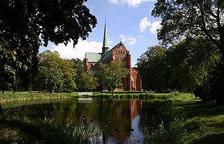
Bad Doberan is a town in the district of Rostock, Mecklenburg-Vorpommern, Germany. It was the capital of the former district of Bad Doberan. In 2012, its population was 11,427.

Kröpelin Town in Mecklenburg-Vorpommern, Germany

Kröpelin is a town in the Rostock district, in Mecklenburg-Western Pomerania, Germany. It is situated 9 km southwest of Bad Doberan, and 23 km west of Rostock.

Neubukow Town in Mecklenburg-Vorpommern, Germany

Neubukow is a town in the Rostock district, in Mecklenburg-Western Pomerania, Germany. It is situated 18 km southwest of Bad Doberan, and 21 km northeast of Wismar. The archeologist Heinrich Schliemann was born in Neubukow. The "Heinrich Schliemann-Gedenkstätte" is a small museum dedicated to his life and work.

Rerik Town in Mecklenburg-Vorpommern, Germany

Rerik is a town in the Rostock district, in Mecklenburg-Western Pomerania, Germany. It is situated on the Baltic Sea coast, 19 km west of Bad Doberan, and 27 km northeast of Wismar. In 1938, Rerik was named after the old Slavic-Scandinavian settlement Reric, that was believed to have been situated near present Rerik.

Poppendorf Municipality in Mecklenburg-Vorpommern, Germany

Poppendorf is a municipality in the Rostock district, in Mecklenburg-Vorpommern, Germany.

Börgerende-Rethwisch Municipality in Mecklenburg-Vorpommern, Germany

Börgerende-Rethwisch is a municipality in the Rostock district, in Mecklenburg-Vorpommern, Germany.

Elmenhorst/Lichtenhagen Municipality in Mecklenburg-Vorpommern, Germany

Elmenhorst/Lichtenhagen is a municipality in the Rostock district, in Mecklenburg-Vorpommern, Germany.

Mönchhagen Municipality in Mecklenburg-Vorpommern, Germany

Mönchhagen is a municipality in the Rostock district, in Mecklenburg-Vorpommern, Germany.

Nienhagen, Mecklenburg-Vorpommern Municipality in Mecklenburg-Vorpommern, Germany

Nienhagen is a municipality in the Rostock district, in Mecklenburg-Vorpommern, Germany.

Pölchow Municipality in Mecklenburg-Vorpommern, Germany

Pölchow is a municipality in the Rostock district, in Mecklenburg-Vorpommern, Germany. The commune is administered by the Amt Warnow-West, which is located in the municipality of Kritzmow.

Sanitz Municipality in Mecklenburg-Vorpommern, Germany

Sanitz is a municipality in the Rostock district, in Mecklenburg-Vorpommern, Germany.

Gnevkow Municipality in Mecklenburg-Vorpommern, Germany

Gnevkow is a municipality in the Mecklenburgische Seenplatte district, in Mecklenburg-Vorpommern, Germany.

Ventschow Municipality in Mecklenburg-Vorpommern, Germany

Ventschow is a municipality in the Nordwestmecklenburg district, in Mecklenburg-Vorpommern, Germany.

Dettmannsdorf Municipality in Mecklenburg-Vorpommern, Germany

Dettmannsdorf is a municipality in the Vorpommern-Rügen district, in Mecklenburg-Vorpommern, Germany. The municipality is located south-west of Ribnitz-Damgarten in the Recknitz valley. Until January 1, 1999, it belonged to Amt Trebeltal and now belongs to Amt Recknitz-Trebeltal.

Zirkow Municipality in Mecklenburg-Vorpommern, Germany

Zirkow is a municipality on the German Baltic Sea island of Rügen in the county of Vorpommern-Rügen in the state of Mecklenburg-Western Pomerania.

Glowe Municipality in Mecklenburg-Vorpommern, Germany

Glowe is a municipality in the Vorpommern-Rügen district, in Mecklenburg-Vorpommern, Germany. It is a state-recognised resort.

Dreschvitz Municipality in Mecklenburg-Vorpommern, Germany

Dreschvitz is a municipality in southwest Vorpommern-Rügen, a district on the island of Rügen in Mecklenburg-Vorpommern, Germany. It is managed from the Amt of West-Rügen with its head offices in the village of Samtens.

Bad Doberan-Land Amt in Mecklenburg-Vorpommern, Germany

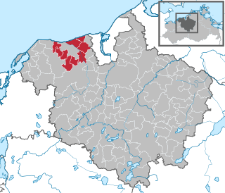
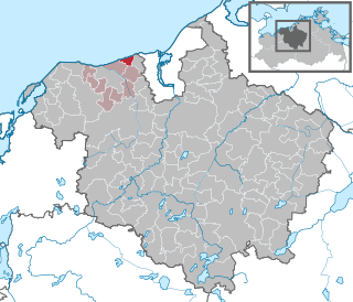
Bad Doberan-Land is an Amt in the district of Rostock, in Mecklenburg-Vorpommern, Germany. The seat of the Amt is in Bad Doberan, itself not part of the Amt.

Rostock is a district in the north of Mecklenburg-Vorpommern, Germany. It is bounded by the district Nordwestmecklenburg, the Baltic Sea, the district-free city Rostock and the districts Vorpommern-Rügen, Mecklenburgische Seenplatte and Ludwigslust-Parchim. The district seat is the town Güstrow.

Kühlung

The Kühlung is a forested ridge, up to 129.8 m above sea level (NHN), in the north German state of Mecklenburg-Vorpommern. The name is derived from the word Kuhlen.

References

  1. "Statistisches Amt M-V – Bevölkerungsstand der Kreise, Ämter und Gemeinden 2020". Statistisches Amt Mecklenburg-Vorpommern (in German). July 2021.