
Trail riding is riding outdoors on trails, bridle paths, and forest roads, but not on roads regularly used by motorised traffic. A trail ride can be of any length, including a long distance, multi-day trip. It originated with horse riding, and in North America, the equestrian form is usually called "trail riding," or, less often "hacking." In the UK and Europe, the practice is usually called horse or pony trekking.

Ashdown Forest is an ancient area of open heathland occupying the highest sandy ridge-top of the High Weald National Landscape. It is situated 30 miles (48 km) south of London in the county East Sussex, England. Rising to an elevation of 732 feet (223 m) above sea level, its heights provide expansive vistas across the heavily wooded hills of the Weald to the chalk escarpments of the North Downs and South Downs on the horizon.

The Weald is an area of South East England between the parallel chalk escarpments of the North and the South Downs. It crosses the counties of Hampshire, Surrey, West Sussex, East Sussex, and Kent. It has three parts, the sandstone "High Weald" in the centre, the clay "Low Weald" periphery and the Greensand Ridge, which stretches around the north and west of the Weald and includes its highest points. The Weald once was covered with forest and its name, Old English in origin, signifies "woodland". The term is still used, as scattered farms and villages sometimes refer to the Weald in their names.

Bedgebury National Pinetum at Bedgebury, Kent, in the United Kingdom, is a recreational and conservational arboretum managed by Forestry England that was established as the National Conifer Collection in 1925 and is now recognised as the most complete collection of conifers on one site anywhere in the world. The collection has over 10,000 trees growing across 320 acres (1.3 km2), including rare, endangered and historically important specimens. Bedgebury National Pinetum conducts conservation work, is home to some 56 vulnerable or critically endangered species, and houses five National Plant Collections.
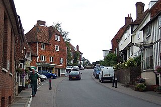
Goudhurst is a village and civil parish in the borough of Tunbridge Wells in Kent, England. It lies in the Weald, around 12 miles (19 km) south of Maidstone, on the crossroads of the A262 and B2079.

The Afan Forest Park is a 48-square-mile (120 km2) forest park in Britain. It is set in the Afan Valley in Neath Port Talbot, in south Wales. It is well known for its mountain biking and hiking or hillwalking trails. It is situated seven miles (11 km) from Junction 40 of the M4.

The High Weald National Landscape is in south-east England. Covering an area of 1,450 square kilometres (560 sq mi), it takes up parts of Kent, Surrey, East Sussex, and West Sussex. It is the fourth largest Area of Outstanding Natural Beauty (AONB) in England and Wales. It has an attractive landscape with a mosaic of small farms and woodlands, historic parks, sunken lanes and ridge-top villages.

Delamere Forest is a large wood in the village of Delamere in Cheshire, England. The woodland, which is managed by Forestry England, covers an area of 972 hectares making it the largest area of woodland in the county. It contains a mixture of deciduous and evergreen trees.

The 7stanes are seven mountain biking centres spanning the south of Scotland, from the heart of the Scottish Borders to Dumfries and Galloway. They are all in Forestry and Land Scotland forests and are known as the 7stanes because each venue features a 'stane', created by artist Gordon Young, somewhere along the forest trails.

The Greensand Ridge, also known as the Wealden Greensand, is an extensive, prominent, often wooded, mixed greensand/sandstone escarpment in south-east England. Forming part of the Weald, a former dense forest in Sussex, Surrey and Kent, it runs to and from the East Sussex coast, wrapping around the High Weald and Low Weald. It reaches its highest elevation, 294 metres (965 ft), at Leith Hill in Surrey—the second highest point in south-east England, while another hill in its range, Blackdown, is the highest point in Sussex at 280 metres (919 ft). The eastern end of the ridge forms the northern boundary of Romney Marsh.

Dalby Forest is a forest located on the southern slopes of the North York Moors National Park in North Yorkshire, England. It is maintained by Forestry England. Dalby Forest, along with Langdale Forest and Cropton Forest, forms part of the North Riding Forest Park, found within the North York Moors National Park.

Tilgate Park is a large recreational park situated south of Tilgate, South-East Crawley.
The western Weald is an area of undulating countryside in Hampshire and West Sussex containing a mixture of woodland and heathland areas.

Mountain bike orienteering is an orienteering endurance racing sport on a mountain bike where navigation is done along trails and tracks. Compared with foot orienteering, competitors usually are not permitted to leave the trail and track network. Navigation tactics are similar to ski-orienteering, where the major focus is route choice while navigating. The main difference compared to ski-orienteering is that navigation is done at a higher pace, because the bike can reach higher speeds. As the biker reaches higher speeds, map reading becomes more challenging.
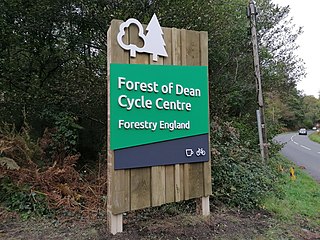
Forest of Dean Cycle Centre is a small woodland cycling centre, comprising mountain bike trails, a visitor centre, car parks and uplift service. It is located on the former site of Cannop Colliery in the Cannop Valley, Forest of Dean, Gloucestershire. The nearest village is Parkend, 3 miles (5 km) away.
The Great Divide Mountain Bike Route (GDMBR) is a 3,083.8 mi (4,962.9 km), off-road bicycle touring route between Jasper, Alberta, Canada and Antelope Wells, New Mexico, USA. Completed in 1997, the GDMBR was developed by Adventure Cycling Association, who continue to maintain highly detailed route maps and a guidebook.

Dyfnant Forest is a remote forest in northeastern-central Powys, Wales.

Mountain biking in Australia is a mix of dedicated mountain bike parks, ski resorts with mountain bike facilities, and other parks that have become popular with mountain bikers despite lacking dedicated facilities. The peak body for the sport is Mountain Bike Australia (MTBA).
Forestry England is a division of the Forestry Commission, responsible for managing and promoting publicly owned forests in England. It was formed as Forest Enterprise in 1996, before devolving to Forest Enterprise England on 31 March 2003 and then being rebranded to Forestry England on 1 April 2019.

Sherwood Pines Forest Park is a forest park located near the village of Kings Clipstone, Nottinghamshire, England. Originally called Clipstone Heath, it was acquired by Forestry England in 1925 and planted with trees in response to a wood shortage after World War I. The park offers activities such as walking, bushcraft, mountain biking and there is a visitor centre. It is the largest park in the East Midlands of England. The forest is also home to the average point between the geographical centres and population centres of Great Britain.


