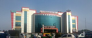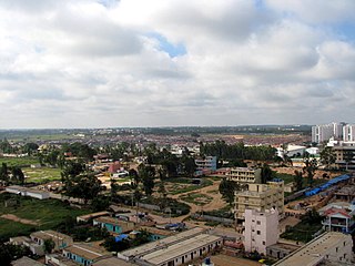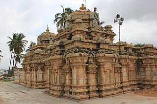
Domlur is a small township located in the eastern part of Bangalore city in India. Domlur was included in the erstwhile Bangalore Civil and Military Station under the British Madras Presidency till it was transferred to the Mysore State in 1949.

Kempe Gowda I locally venerated as Nadaprabhu Kempe Gowda, or commonly known as Kempe Gowda, was a governor under the Vijayanagara Empire in early-modern India. He is famous for the development of Bengaluru Pete in the 16th century. Kempegowda erected many Kannada inscriptions across the region.

Hebbal, is a neighbourhood in Bengaluru, Karnataka, India, which was once indicative of the north endpoint of the city. Though originally famous for Hebbal Lake, it is now better known for the serpentine maze of flyovers that network the Outer Ring Road and Airport Road on NH 44. The flyover spans a length of 5.23 kilometres (3.2 mi) over all the loops combined. The flyover was built by Gammon India. The lake area in Hebbal is well-known for its picnic spots, a well-maintained park, boating facilities and for the bird watching opportunities.

Bengaluru is the capital city of the state of Karnataka. Bengaluru, as a city, was founded by Kempe Gowda I, who built a mud fort at the site in 1537. But the earliest evidence for the existence of a place called Bengaluru dates back to c. 890.

Yelahanka is a premium locality in north Bangalore and also a Taluk of Bangalore Urban district in the Indian state of Karnataka. One of the zones of BBMP. It is the oldest part of present Municipal Bengaluru (Bangalore) city and the northern end of the city. It is Nadaprabhu Kempegowda I, of the Yelahanka Prabhu clans, who laid the foundation of present-day Bengaluru through the creation of a "mud fort town" in 1537 CE

Kengeri is a western suburb of Bangalore city, located along Mysore Road.It is bordered by Nagarbhavi and Ullal to the north, Rajarajeshwari Nagar to the east, Kumbalgodu to the west and Uttarahalli to the south.

Kodigehalli is a suburb of Bangalore(B.B.M.P. Ward 8). Historic temples and modern constructions are cheek by jowl. Kodigehalli is to the south of Sahakarnagar. The new airport road to Kodigehalli main road via Kodigehalli circle connects the Kodigehalli area.

Shri Dharmaraya Swamy Temple is one of the oldest and most famous Hindu temples of the city of Bangalore, in Karnataka, India.

Kadugodi is a suburb located in Whitefield, Bangalore in the state of Karnataka, India. The area is said to have been founded over 1000 years ago by the Chola dynasty.

Bellandur is a suburb in south-east Bangalore, Karnataka, India. It is bounded by HSR Layout to the west, Devarabisanahalli to the east, Sarjapur Road to the south, and the Bellandur Lake to the north. The Bellandur Lake is the largest lake in Bangalore, and separates Bellandur from the HAL Airport. The Outer Ring Road passes through Bellandur, making the area an important transit point between east and south Bangalore.

The Nageshvara temple complex is located in Begur, a small town within the Bangalore urban district of Karnataka state, India. Two shrines within the temple complex, the Nageshvara swamy main deity was consecrated by Rishi’s and temple were commissioned during the rule of Western Ganga dynasty kings Nitimarga I and Ereyappa Nitimarga II. The remaining shrines are considered a later day legacy of the rule of the Chola dynasty, Hoysala dynasty, Vijayanagara Empire over the region. Ravana villain in Ramayana lost his atma linga in Gokarna and while returning to Sri Lanka he worshiped Nageshwara. An Old Kannada inscription, dated c. 890, that describes a "Bengaluru war" was discovered in this temple complex by the epigraphist R. Narasimhachar. The inscription is recorded in "Epigraphia Carnatica". This is the earliest evidence of the existence of a place called Bengaluru.
Old Madiwala Sri Someshwara Temple located in Bangalore city, Karnataka, India is dedicated to the deity Someshwara. It is one among the oldest temples in the city and dates back to the Chola Empire period. The temple belongs to the early 12th century.(1247 AD).

Bengaluru, formerly called Bangalore in English, is the capital and largest city of the southern Indian state of Karnataka. It has a population of more than 8 million and a metropolitan population of around 15 million, making it India's third most populous city and fourth most populous urban agglomeration. It is the most populous city and largest urban agglomeration in South India, and is the 27th largest city in the world. Located on the Deccan Plateau, at a height of over 900 m (3,000 ft) above sea level, Bengaluru has a pleasant climate throughout the year, with its parks and green spaces earning it the reputation of India's "Garden City". Its elevation is the highest of India's major cities.
There are nearly a thousand inscriptions in Tamil in the Southern Karnataka districts of Bangalore, Mysore, Kolar and Mandya in India. Nearly one third of these inscriptions are found in the Kolar District. Of all the inscriptions collected and published in the Epigraphia Carnatica Vol X for Kolar district, a fourth are in Tamil. The Tamil inscriptions start to appear around 1000 AD, after the conquest of the region by the Chola dynasty king Rajaraja I. Even after the Cholas left the area, the Hoysala and later the Vijaynagar kingdoms continued to use Tamil in the inscriptions.

Kalasipalya is a locality in the central part of Bangalore, Karnataka, India, and one of the older and most congested places in the city. The locality is home to landmarks such as Bangalore Fort and Tipu Sultan's Summer Palace. The area is known for its high traffic congestion and unhygienic conditions of roads.
Transport in Bengaluru consists of several intracity commute modes such as BMTC buses, Namma Metro rail services, taxis and auto rickshaws, as well as several intercity forms of transport: Government operated KSRTC, NWKRTC, KKRTC, other states RTC buses, Private bus operators, trains, and flights.
Akshay Nagar is a neighbourhood in Begur ward in Southeast Bangalore. It is surrounded by Hulimavu to the west and Begur to the east. The area has undergone rapid residential and commercial development since the early 2010s, including several high-rise apartment complexes. The locality is in close proximity to the Bannerghatta National Park, thus leading to occasional sightings of wild animals from the forest reserve. The area has a lake spread over 5 acres. It also features a wide mix of modern architecture and buildings.

Begur is a locality in Bengaluru South which stands as a testament to ancient Bengaluru, with historical evidence dating back to c. 6th century CE. It was formerly known as Bempur, Veppur, and Behur, and served as a significant administrative center, playing a vital role in the evolution of Bengaluru to a modern global metropolis.


