Belafike

Last updated
Belafike
Madagascar location map.svg
Red pog.svg
Belafike
Location in Madagascar
Coordinates: 24°17′S44°10′E / 24.283°S 44.167°E / -24.283; 44.167
CountryFlag of Madagascar.svg  Madagascar
Region Atsimo-Andrefana
District Ampanihy
Elevation [1] 267 m (876 ft)
Population (2001) [2]
  Total 10,000
Time zone EAT (UTC3)

Belafike is a town and commune (Malagasy : kaominina) in southwestern Madagascar. It belongs to the district of Ampanihy, which is a part of Atsimo-Andrefana Region. The population of the commune was estimated to be approximately 10,000 in 2001 commune census. [2]

Malagasy is an Austronesian language and the national language of Madagascar. Most people in Madagascar speak it as a first language as do some people of Malagasy descent elsewhere.

Madagascar island nation off the coast of Southeast Africa, in the Indian Ocean

Madagascar, officially the Republic of Madagascar, and previously known as the Malagasy Republic, is an island country in the Indian Ocean, approximately 400 kilometres off the coast of East Africa. The nation comprises the island of Madagascar and numerous smaller peripheral islands. Following the prehistoric breakup of the supercontinent Gondwana, Madagascar split from the Indian subcontinent around 88 million years ago, allowing native plants and animals to evolve in relative isolation. Consequently, Madagascar is a biodiversity hotspot; over 90% of its wildlife is found nowhere else on Earth. The island's diverse ecosystems and unique wildlife are threatened by the encroachment of the rapidly growing human population and other environmental threats.

Districts of Madagascar

Districts are second-level administrative divisions of Madagascar below the regions. There are 114 districts in Madagascar. Districts are in their turn divided into communes; while some of the districts in urban areas and offshore islands each consist of only one commune, most of the districts are divided typically into 5–20 communes.

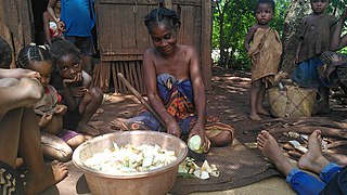
Only primary schooling is available. The majority 80% of the population of the commune are farmers, while an additional 19.5% receives their livelihood from raising livestock. The most important crop is cassava, while other important products are peanuts, maize and sweet potatoes. Services provide employment for 0.5% of the population. [2]

Cassava Species of plant

Manihot esculenta, commonly called cassava, manioc, yuca, macaxeira, mandioca, aipim and Brazilian arrowroot, is a woody shrub native to South America of the spurge family, Euphorbiaceae. It is extensively cultivated as an annual crop in tropical and subtropical regions for its edible starchy tuberous root, a major source of carbohydrates. Though it is often called yuca in Spanish and in the United States, it is not related to yucca, a shrub in the family Asparagaceae. Cassava, when dried to a powdery extract, is called tapioca; its fried, granular form is named garri.

Peanut A legume cultivated for its seeds

The peanut, also known as the groundnut, goober, or monkey nut (UK), and taxonomically classified as Arachis hypogaea, is a legume crop grown mainly for its edible seeds. It is widely grown in the tropics and subtropics, being important to both small and large commercial producers. It is classified as both a grain legume and, due to its high oil content, an oil crop. World annual production of shelled peanuts was 44 million tonnes in 2016, led by China with 38% of the world total. Atypically among legume crop plants, peanut pods develop underground (geocarpy) rather than aboveground. With this characteristic in mind, the botanist Linnaeus named the species hypogaea, which means "under the earth."

Maize Cereal grain

Maize, also known as corn, is a cereal grain first domesticated by indigenous peoples in southern Mexico about 10,000 years ago. The leafy stalk of the plant produces pollen inflorescences and separate ovuliferous inflorescences called ears that yield kernels or seeds, which are fruits.

References and notes

  1. Estimated based on DEM data from Shuttle Radar Topography Mission
  2. 1 2 3 "ILO census data". Cornell University. 2002. Retrieved 2008-03-11.

Coordinates: 24°17′S44°10′E / 24.283°S 44.167°E / -24.283; 44.167

Geographic coordinate system Coordinate system

A geographic coordinate system is a coordinate system that enables every location on Earth to be specified by a set of numbers, letters or symbols. The coordinates are often chosen such that one of the numbers represents a vertical position and two or three of the numbers represent a horizontal position; alternatively, a geographic position may be expressed in a combined three-dimensional Cartesian vector. A common choice of coordinates is latitude, longitude and elevation. To specify a location on a plane requires a map projection.


Related Research Articles

Berevo-Ranobe Place in Melaky, Madagascar

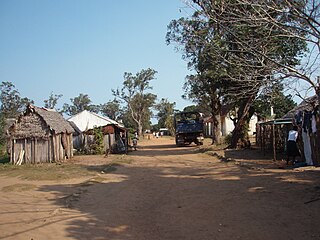
Berevo-Ranobe or Berevo-sur-Ranobe is a town and commune in western Madagascar. It belongs to the district of Maintirano, which is a part of Melaky Region. The population of the commune was estimated to be approximately 8,000 in 2001 commune census.

Ankilivalo Place in Menabe, Madagascar

Ankilivalo is a town and commune in Madagascar. It belongs to the district of Mahabo, which is a part of Menabe Region. The population of the commune was estimated to be approximately 13,000 in 2001 commune census.

Andranopasy Place in Menabe, Madagascar

Andranopasy is a town and commune in Madagascar. It belongs to the district of Manja, which is a part of Menabe Region. The population of the commune was estimated to be approximately 10,000 in 2001 commune census.

Bemanonga Place in Menabe, Madagascar

Bemanonga is a town and commune in Madagascar. It belongs to the district of Morondava, which is a part of Menabe Region. The population of the commune was estimated to be approximately 22,000 in 2001 commune census.

Beahitse Place in Atsimo-Andrefana, Madagascar

Beahitse is a town and commune in southwestern Madagascar. It belongs to the district of Ampanihy, which is a part of Atsimo-Andrefana Region. The population of the commune was estimated to be approximately 17,000 in 2001 commune census.

Vodiriana Place in Alaotra-Mangoro, Madagascar

Vodiriana is a town and commune in Madagascar. It belongs to the district of Moramanga, which is a part of Alaotra-Mangoro Region. The population of the commune was estimated to be approximately 10,000 in 2001 commune census.

Ambatolahy, Antanifotsy Place in Vakinankaratra, Madagascar

Ambatolahy is a town and commune in Madagascar. It belongs to the district of Antanifotsy, which is a part of Vakinankaratra Region. The population of the commune was estimated to be approximately 9,000 in 2001 commune census.

Ambalakely Place in Haute Matsiatra, Madagascar

Ambalakely is a town and commune in Madagascar. It belongs to the district of Fianarantsoa II, which is a part of Haute Matsiatra Region. The population of the commune was estimated to be approximately 6,000 in 2001 commune census.

Ivoamba Place in Haute Matsiatra, Madagascar

Ivoamba is a town and commune in Madagascar. It belongs to the district of Fianarantsoaii, which is a part of Haute Matsiatra Region. The population of the commune was estimated to be approximately 12,000 in 2001 commune census.

Kiranomena Place in Bongolava, Madagascar

Kiranomena is a town and commune in Madagascar. It belongs to the district of Fenoarivobe, which is a part of Bongolava Region. The population of the commune was estimated to be approximately 24,000 in 2001 commune census.

Maroharana Place in Bongolava, Madagascar

Maroharana is a town and commune in Madagascar. It belongs to the district of Tsiroanomandidy, which is a part of Bongolava Region. The population of the commune was estimated to be approximately 5,000 in 2001 commune census.

Ankaranabo Nord Place in Androy, Madagascar

Ankaranabo Nord is a town and commune in Madagascar. It belongs to the district of Bekily, which is a part of Androy Region. The population of the commune was estimated to be approximately 5,000 in 2001 commune census.

Mangatsiotra Place in Vatovavy-Fitovinany, Madagascar

Mangatsiotra is a town and commune in Madagascar. It belongs to the district of Manakara, which is a part of Vatovavy-Fitovinany Region. The population of the commune was estimated to be approximately 4,000 in 2001 commune census.

Mahaly Place in Anosy, Madagascar

Mahaly is a town and commune in Madagascar. It belongs to the district of Amboasary Sud, which is a part of Anosy Region. The population of the commune was estimated to be approximately 11,000 in 2001 commune census.

Marotsiraka Place in Anosy, Madagascar

Marotsiraka is a town and commune in Madagascar. It belongs to the district of Amboasary Sud, which is a part of Anosy Region. The population of the commune was estimated to be approximately 14,000 in 2001 commune census.

Ampasimena Place in Anosy, Madagascar

Ampasimena is a town and commune in Madagascar. It belongs to the district of Taolanaro, which is a part of Anosy Region. The population of the commune was estimated to be approximately 20,000 in 2001 commune census.

Manantenina Place in Anosy, Madagascar

Manantenina is a town and commune in Madagascar. It belongs to the district of Taolanaro, which is a part of Anosy Region.

Mahazoarivo, Vondrozo Place in Atsimo-Atsinanana, Madagascar

Mahazoarivo is a town and commune in Madagascar. It belongs to the district of Vondrozo, which is a part of Atsimo-Atsinanana Region. The population of the commune was estimated to be approximately 7,000 in 2001 commune census.

Vohiboreka Place in Atsimo-Atsinanana, Madagascar

Vohiboreka is a town and commune in Madagascar. It belongs to the district of Vondrozo, which is a part of Atsimo-Atsinanana Region. The population of the commune was estimated to be approximately 4,000 in 2001 commune census.

Vohimary Place in Atsimo-Atsinanana, Madagascar

Vohimary is a town and commune in Madagascar. It belongs to the district of Vondrozo, which is a part of Atsimo-Atsinanana Region. The population of the commune was estimated to be approximately 5,000 in 2001 commune census.