Amboaboa is a town and commune in Madagascar. It belongs to the district of Mandritsara, which is a part of Sofia Region. The population of the commune was estimated to be approximately 13,000 in 2001 commune census.
Manompana is a town and commune in Madagascar. It belongs to the district of Soanierana Ivongo, which is a part of Analanjirofo Region. The population of the commune was estimated to be approximately 16,000 in 2001 commune census.

Tsimafana is a rural municipality in Madagascar. It belongs to the district of Belo sur Tsiribihina, which is a part of Menabe Region. The population of the commune was estimated to be approximately 9,000 in 2001 commune census.
Analamitsivala is a town and commune in Madagascar. It belongs to the district of Mahabo, which is a part of Menabe Region. The population of the commune was estimated to be approximately 11,000 in 2001 commune census.

Itampolo is a town and commune in southwestern Madagascar. It belongs to the district of Ampanihy, which is a part of Atsimo-Andrefana Region. The population of the commune was estimated to be approximately 32,000 in 2001 commune census.
Fenoandala is a town and commune in southwest Madagascar. It belongs to the district of Betioky Sud, which is a part of Atsimo-Andrefana Region. The population of the commune was estimated to be approximately 4,000 in 2001 commune census.
Salobe is a town and commune in southwest Madagascar. It belongs to the district of Betioky Sud, which is a part of Atsimo-Andrefana Region. The population of the commune was estimated to be approximately 9,000 in 2001 commune census.
Ambatomainty is a town and commune in Madagascar. It belongs to the district of Amparafaravola, which is a part of Alaotra-Mangoro Region. The population of the commune was estimated to be approximately 39,000 in 2001 commune census.
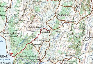
Andranolava is a rural municipality in Madagascar. It belongs to the district of Sakaraha, which is a part of Atsimo-Andrefana Region. The population of the commune was estimated to be approximately 3,000 in 2001 commune census.
Ampamata is a town and commune in Madagascar. It belongs to the district of Ambovombe, which is a part of Androy Region. The population of the commune was estimated to be approximately 6,000 in 2001 commune census.
Beraketa is a town and commune in Madagascar. It belongs to the district of Bekily, which is a part of Androy Region.
Ambahive is a town and commune in Madagascar. It belongs to the district of Manakara, which is a part of Vatovavy-Fitovinany Region. The population of the commune was estimated to be approximately 15,000 in 2001 commune census.
Saharefo is a town and commune in Madagascar. It belongs to the district of Manakara, which is a part of Vatovavy-Fitovinany Region. The population of the commune was estimated to be approximately 12,000 in 2001 commune census.
Ambatoabo is a town and commune in Madagascar. It belongs to the district of Taolanaro, which is a part of Anosy Region. The population of the commune was estimated to be approximately 8,000 in 2001 commune census.
Fenoevo is a rural municipality in Madagascar. It belongs to the district of Taolanaro, which is a part of Anosy Region. The population of the commune was estimated to be approximately 5,000 in 2001 commune census.
Vohimalaza is a town and commune in Madagascar. It belongs to the district of Vangaindrano, which is a part of Atsimo-Atsinanana Region. The population of the commune was estimated to be approximately 7,000 in 2001 commune census.
Iamonta is a town and commune in Madagascar. It belongs to the district of Vondrozo, which is a part of Atsimo-Atsinanana Region. The population of the commune was estimated to be approximately 6,000 in the 2001 commune census.
Anjepy is a town and commune in Madagascar. It belongs to the district of Manjakandriana, which is a part of Analamanga Region. The population of the commune was estimated to be approximately 6,000 in 2001 commune census.
Anjoma Betoho is a town and commune in Madagascar. It belongs to the district of Manjakandriana, which is a part of Analamanga Region. The population of the commune was estimated to be approximately 3,000 in 2001 commune census.
Ankazondandy is a town and commune in Madagascar. It belongs to the district of Manjakandriana, which is a part of Analamanga Region. The population of the commune was estimated to be approximately 16,000 in 2001 commune census.

