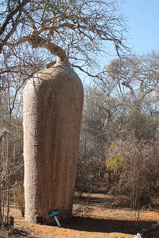
Isalo is a rural municipality in Madagascar. It belongs to the district of Miandrivazo, which is a part of Menabe Region. The population of the commune was estimated to be approximately 12,930 in 2009.
Manja is a town and commune in Madagascar. It belongs to the district of Manja, which is a part of Menabe Region. The population of the commune was estimated to be approximately 30,000 as of 2015 commune census.

Saint Augustin is a town and commune in Madagascar. It belongs to the district of Toliara II, which is a part of Atsimo-Andrefana Region. The population of the commune was estimated to be approximately 15,000 in 2001 commune census. The mouth of the Onilahy River is near the town.
Andranovory is a town and commune in Madagascar. It belongs to the district of Toliara II, which is a part of Atsimo-Andrefana Region. The population of the commune was estimated to be approximately 31,000 in 2001 commune census.
Ankililoake is a rural municipality in Madagascar. It belongs to the district of Toliara II, which is a part of Atsimo-Andrefana Region. The population of the commune was estimated to be approximately 21,000 in 2001 commune census.
Ankilimalinike is a rural municipality in Madagascar. It belongs to the district of Toliara II, which is a part of Atsimo-Andrefana Region. The population of the commune was estimated to be approximately 13,000 in 2001 commune census.
Behompy is a rural municipality in Madagascar. It belongs to the district of Toliara II, which is a part of Atsimo-Andrefana Region. The population of the commune was estimated to be approximately 7,000 in 2001 commune census.

Belalanda is a rural municipality in Madagascar. It belongs to the district of Toliara II, which is a part of Atsimo-Andrefana Region. The population of the commune was estimated to be approximately 7,000 in 2001 commune census.

Manombo Sud is a rural municipality in Madagascar. It belongs to the district of Toliara II, which is a part of Atsimo-Andrefana Region. The population of the commune was estimated to be approximately 17,000 in the 2001 commune census.
Marofoty is a town and commune in Madagascar. It belongs to the district of Toliara II, which is a part of Atsimo-Andrefana Region. The population of the commune was estimated to be approximately 17,000 in the 2001 commune census.
Milenaka is a rural municipality in Madagascar. It belongs to the district of Toliara II, which is a part of Atsimo-Andrefana Region. The population of this municipality was estimated to be approximately 15,000 in 2001 commune census.
Tsianisiha is a town and commune in Madagascar. It belongs to the district of Toliara II, which is a part of Atsimo-Andrefana Region. The population of the commune was estimated to be approximately 18,000 in 2001 commune census.
Ankazomiriotra is a rural municipality in Madagascar. It belongs to the district of Mandoto, which is a part of Vakinankaratra Region. The population of the commune was estimated to be approximately 34,000 in 2001 commune census.
Mananasy is a rural municipality in Madagascar. It belongs to the district of Soavinandriana, which is a part of Itasy Region. The population of the commune was estimated 29,763 in 2016.
Antanimeva is a town and commune in Madagascar. It belongs to the district of Morombe, which is a part of Atsimo-Andrefana Region. The population of the commune was estimated to be approximately 24,000 in 2001 commune census.
Befandriana Sud or Befandriana Atsimo is a town and commune in Madagascar. It belongs to the district of Morombe, which is a part of Atsimo-Andrefana Region. The population of the commune was estimated to be approximately 19,000 in 2001 commune census.
Ikalalao is a rural municipality in Madagascar. It belongs to the district of Ambohimahasoa, which is a part of Haute Matsiatra Region. The population of the commune was estimated to be 14.950 in 2018.
Ambovombe Afovoany is a municipality in Madagascar. It belongs to the district of Manandriana, which is a part of Amoron'i Mania Region. The population of the commune was estimated to be approximately 18,000 in 2001 commune census.
Sahatsiho Ambohimanjaka is a rural municipality in Madagascar. It belongs to the district of Ambositra, which is a part of Amoron'i Mania Region. The population of the commune was estimated to be approximately 9,000 in 2001 commune census.
Mitsinjo Betanimena is a municipality and a quarter of Toliara (Tuléar) in Madagascar. It belongs to the district of Toliara II, which is a part of Atsimo-Andrefana Region. The population of this municipality was estimated to be approximately 15,000 in 2001 census.


