
Harden–Murrumburrah is a township and community in the Hilltops Region and is located in the South West Slopes of New South Wales in Australia. Harden is adjacent to both the Canberra region of the Australian Capital Territory and the Riverina Region in the southwest area of NSW. The town is a twin town between Harden and Murrumburrah.
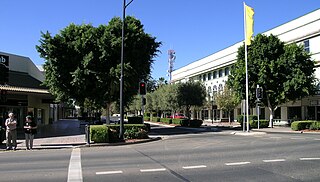
Moree is a town in Moree Plains Shire in northern New South Wales, Australia. It is located on the banks of the Mehi River, in the centre of the rich black-soil plains. The town is located at the junction of the Newell Highway and Gwydir Highway and can be reached by daily train and air services from Sydney.

Newell Highway is a national highway in New South Wales (NSW), Australia. It provides the major road link between southeastern Queensland and Victoria via central NSW and as such carries large amounts of freight. At 1,058 kilometres (657 mi) in length, the Newell is the longest highway in NSW, and passes through fifteen local government areas.

Gunnedah is a town in north-eastern New South Wales, Australia and is the seat of the Gunnedah Shire local government area. In the 2021 census the town recorded a population of 8,338. Gunnedah is situated within the Liverpool Plains, a fertile agricultural region, with 80% of the surrounding shire area devoted to farming. The Namoi River flows west then north-west through the town providing water beneficial to agricultural operations in the area.

CountryLink was a passenger rail and road service brand that operated in regional areas of New South Wales, and to and from Canberra, Brisbane and Melbourne. Originally created as a business unit of the State Rail Authority of New South Wales, it later became a subsidiary of RailCorp. CountryLink operated rail services using XPT and Xplorer rolling stock, with connecting coach services operated under contract by private operators.

Boggabri is a small town in north-eastern New South Wales, Australia. It is part of Narrabri Shire and lies between Gunnedah and Narrabri on the Kamilaroi Highway. At the 2016 census, the town had a population of 856 people.

Narrabri is a locality and seat of Narrabri Shire local government area in the North West Slopes, New South Wales, Australia on the Namoi River, 521 kilometres (324 mi) northwest of Sydney. It sits on the junction of the Kamilaroi Highway and the Newell Highway. At the 2021 census, the town of Narrabri had a population of 12,703.

Mungindi is a town and locality on the border of New South Wales (NSW) and Queensland, Australia. The town is within Moree Plains Shire in New South Wales. Within Queensland, the locality is split between the Shire of Balonne and the Goondiwindi Region with the town in the Shire of Balonne. It possesses a New South Wales postcode. Mungindi sits on the Carnarvon Highway and straddles the Barwon River which is the border between New South Wales and Queensland. At the 2016 census, Mungindi had a population of 601 on the New South Wales side, while the population on the Queensland side was 146.

Quirindi is a small town on the North West Slopes region of New South Wales, Australia, in Liverpool Plains Shire. At the 2016 census, Quirindi had a population of 3,444. It is the nearest link to Gunnedah to the northwest and Tamworth to the north. The local economy is based on agriculture, with broadacre farming dominant on the black soil plains to the west and livestock grazing in the hilly eastern part of the district.

Werris Creek is a small town in New South Wales, Australia, near Tamworth, in Liverpool Plains Shire. It is north of Quirindi and is at the junction of the Main North railway line to Armidale and Moree. At the 2011 census, Werris Creek had a population of 1,437.

Willow Tree is a village composed of about 308 people, located in New South Wales, Australia. It is situated in the Liverpool Plains, 14 kilometres south of Quirindi near the junction of the Kamilaroi and New England Highways. The town itself is small but the farms extend southwest out to the township of Warrah. It is a service centre to the rural areas of Warrah and Mount Parry.
The North West Slopes region of New South Wales, Australia, refers generally to the area west of the Northern Tablelands, to the north of the Central West region and to the east of the Far West region. Despite its name, the region is in north-central New South Wales, corresponding generally to the Australian Bureau of Meteorology's forecast area of North West Slopes and Plains. The administrative areas of the region include the city of Tamworth, Gunnedah, Moree, Narrabri and Inverell.
The Mungindi railway line is a railway line in northern New South Wales, Australia. It branches from the Main North line at Werris Creek station and heads north-west through the towns of Gunnedah and Narrabri before reaching Moree which for many years was the railhead before the extension to Mungindi was constructed. The line is currently truncated to Weemelah between Moree and Mungindi. Passenger trains still operate to Moree, and goods trains operate to Camurra. As of 1 September 2009, services have been suspended between Camurra and Weemelah. The line between Werris Creek and Moree is also known as the North-West line.
Gwabegar is a town in North Eastern New South Wales, Australia. The town is in the Narrabri Shire local government area, 625 kilometres (388 mi) north west of the state capital, Sydney. At the 2011 census, Gwabegar had a population of 344.

Jennings is a town on the Northern Tablelands region of New South Wales, Australia. The town is located in the Tenterfield Shire local government area, 718 kilometres (446 mi) from the state capital, Sydney and 256 kilometres (159 mi) from Brisbane. It is separated by the state border from its neighbouring town of Wallangarra in Queensland. At the 2011 census, Jennings had a population of 211. The New England Highway and the Main North railway line cross the state border at Jennings. The town was named for Sir Patrick Jennings, the first Roman Catholic Premier of New South Wales.

Gurley is a small town in the northwest of New South Wales, Australia between Narrabri and Moree. The Newell Highway and the North-West railway line pass through the township. A now-closed railway station opened in 1897.
Bellata railway station is located on the Mungindi line in New South Wales, Australia. It serves the village of Bellata, opening on 1 April 1897 as Woolabra when the line was extended from Boggabri to Moree. It was renamed Bellata on 1 March 1909.

Narrabri railway station is located on the Mungindi line in New South Wales, Australia. It serves the town of Narrabri, opening on 1 April 1897 when the line was extended from Boggabri to Moree. Improvements were made to the station in 1920, with the shunting yard increased in size and the platform lengthened by sixty feet.

NSW TrainLink is a train and coach operator in Australia, providing services throughout New South Wales and the Australian Capital Territory, along with limited interstate services into Victoria, Queensland and South Australia. Its primary intercity and regional services are spread throughout five major rail lines, operating out of Sydney's Central railway station.

Moree railway station is located on the Mungindi line in New South Wales, Australia. It serves the town of Moree.

