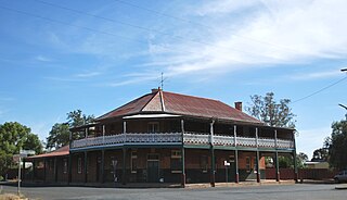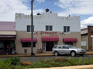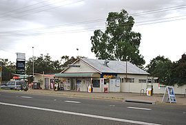
Coonabarabran is a town in Warrumbungle Shire that sits on the divide between the Central West and North West Slopes regions of New South Wales, Australia. At the 2016 census, the town had a population of 2,537. The town's nickname is "Coona".

Narrabri is a town and seat of Narrabri Shire local government area in the North West Slopes, New South Wales, Australia on the Namoi River, 521 kilometres (324 mi) northwest of Sydney. It sits on the junction of the Kamilaroi Highway and the Newell Highway. At the 2016 census, the town of Narrabri had a population of 5,903.

Werris Creek is a small town in New South Wales, Australia, near Tamworth, in Liverpool Plains Shire. It is north of Quirindi and is at the junction of the Main North railway line to Armidale and Moree. At the 2011 census, Werris Creek had a population of 1,437.

Ariah Park is a small town in the Riverina region of New South Wales, Australia, 35 kilometres (22 mi) west of Temora and 65 kilometres (40 mi) south of West Wyalong. The town is within the Temora Shire near Burley Griffin Way. On Census night 2011, Ariah Park had a population of 268 people. The town is listed by the National Trust as a Conservation Area.

Bellata is a small village in north-central New South Wales, Australia, in Narrabri Shire. At the 2006 census, Bellata had a population of 529. The place name Bellata could be derived from the local Aboriginal word meaning "kangaroo" or possibly "home of belar trees".

Baan Baa, pronounced "barn-bar", is a village located in northern inland New South Wales, Australia in Narrabri Shire local government area and Pottinger County. It is approximately 38 kilometres south-east of Narrabri and 58 km north-west of Gunnedah on the Kamilaroi Highway. In the 2006 census, Baan Baa had a population of 211.

Boree Creek is a town in the Riverina district of New South Wales, Australia. The town is located 539 kilometres (335 mi) south west of the state capital, Sydney and 82 kilometres (51 mi) west of the regional centre, Wagga Wagga. Boree Creek is situated in the Federation Council local government area but is closer to the town of Lockhart. At the 2016 census, Boree Creek had a population of 64.

Rankins Springs is a village in the Riverina region of New South Wales, Australia in Carrathool Shire and on the Mid-Western Highway. At the census, Rankins Springs had a population of 299. The settlement of Rankins Springs is strung out along the Mid-Western Highway and adjacent railway line.

Yerong Creek is a town in the Riverina area of southern New South Wales, Australia. It is about 46 kilometres (29 mi) south-west of Wagga Wagga on the Olympic Highway. At the 2016 census, Yerong Creek had a population of 173.

Mirrool is a town in the northern part of the Riverina region of south-west New South Wales, Australia. The town is in the Bland Shire local government area and adjacent to the Newell Highway, 473 kilometres (294 mi) south west of the state capital, Sydney. At the 2011 census, Mirrool and the surrounding area had a population of 234.

Merriwagga is a town in the northern part of the Riverina region of the Australian state of New South Wales. It is situated by road, about 20 kilometres (12 mi) north west of Goolgowi and 42 kilometres (26 mi) south of Hillston on the Kidman Way in NSW. At the 2011 census, it has a population of 169. The main industry is agriculture.

Springdale is a village community in the central north part of the Riverina region of the Australian state of New South Wales. It is situated by road, about 3 kilometres east of Combaning and 23 kilometres north west of Stockinbingal. At the 2016 census, it had a population of 150.

Walpeup is a town in the Mallee region of north west Victoria. The town is in the Rural City of Mildura local government area and on the Mallee Highway and Pinnaroo railway line between Ouyen and the South Australian border, 458 kilometres (285 mi) north west of the state capital, Melbourne and 130 kilometres (81 mi) south west of the regional centre of Mildura. At the 2016 census, Walpeup had a population of 158.

Gwabegar is a town in North Eastern New South Wales, Australia. The town is in the Narrabri Shire local government area, 625 kilometres (388 mi) north west of the state capital, Sydney. At the 2011 census, Gwabegar had a population of 344.

Baradine is a small town in north western New South Wales, Australia. At the 2006 census, Baradine had a population of 593.

Marinna is a locality in Junee Shire in southern New South Wales, Australia. Its main feature is a grain silo on the Main South railway line. A station was opened in the locality between 1897 and 1975.

Gurley is a small town in the northwest of New South Wales, Australia between Narrabri and Moree. The Newell Highway and the North-West railway line pass through the township. A now-closed railway station opened in 1897.

Merrygoen is a small township in north-western New South Wales, Australia. The town is a junction point between railway lines to Troy Junction on the Coonamble railway line, and the Gwabegar railway line. The railway station is now closed, however wheat silos and several sidings remain in use. Merrygoen is in the Gap to Dubbo section of the Intrastate Network managed by the Australian Rail Track Corporation.

Long Plains is a rural locality and small township on the northern Adelaide Plains in South Australia, 73 km north of Adelaide. It is divided between the Wakefield Regional Council and the Adelaide Plains Council. The formal boundaries were established in 1997 for the long established local name with respect of the section in the Adelaide Plains Council; the portion in the Wakefield Council was added in January 2000.

Narrabri Post Office is a heritage-listed post office at 138-140 Maitland Street, Narrabri, New South Wales, Australia. It is also known as Narrabri Post Office and former Telegraph Office. It was designed by the NSW Colonial Architect's Office under James Barnet and built by FA King in 1888. It was added to the Australian Commonwealth Heritage List on 08 November 2011.


