Related Research Articles

Almora is a district in the Kumaon Division of Uttarakhand state, India. The headquarters is at Almora. It is 1,638 meters above sea level. The neighbouring regions are Pithoragarh district to the east, Chamoli district to the west, Bageshwar district to the north and Nainital district to the south.

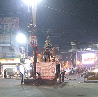
Haldwani is the largest city of Kumaon. It is also the second most populous city in the Indian state of Uttarakhand. Haldwani is said to be the financial capital of Uttarakhand, having the most commercial, economic and industrial activities of the state. Haldwani is located in the Nainital District, and is one of its thirteen Subdivisions. The Haldwani Urban agglomeration has 656,000 people as of 2021, and is the third most populous UA in Uttarakhand, after Dehradun and Haridwar. Being situated in the immediate foothills of Kumaon Himalayas, the Kathgodam neighbourhood of Haldwani is known as the "Gateway to Kumaon".

Mukteshwar is a village and tourist destination in the Nainital district of Uttarakhand, India. It sits high in the Kumaon Hills at an altitude of 2171 meters (7500 feet), 51 km from Nainital, 72 km from Haldwani, and 343 km from Delhi.

Pantnagar is a town and a university campus in Udham Singh Nagar District, Uttarakhand. Nainital, Kashipur, Rudrapur, Kiccha and Haldwani are the major cities surrounding Pantnagar.
Kashipur is a city of Udham Singh Nagar district in the Indian state of Uttarakhand, and one of its seven subdivisions. Located in the western part of Udham Singh Nagar district, it is Kumaun's third most populous city and the sixth most populous in Uttarakhand. According to the 2011 Census of India, the population is 121,623 for the city of Kashipur and 283,136 for Kashipur Tehsil. Kashipur also has IIM Kashipur, one of the thirteen Indian Institutes of Managements the government has set up during the Eleventh Five-year Plan.

Bhowali is a town and a municipal board in Nainital District in the state of Uttarakhand, India. It is situated at a distance of 11 km (6.8 mi) from the city of Nainital, the district headquarters; at an average elevation of 1,654 m (5,427 ft) from sea level. It is the seat of Bhowali tehsil, one of the eight subdivisions of Nainital district.

Gadarpur is a post independence city and a municipal board in Udham Singh Nagar district in the state of Uttarakhand, India. This city was formed with the arrival of the refugees from Pakistan at the time of partition of 1947. The refugees settled here and started living here. The refugees are Punjabi which makes up a majority in the city.

Kaladhungi is a town and a nagar palika in Nainital district in the Indian state of Uttarakhand.
Kelakhera is a Municipality Town in Tehsil Bajpur of Udham Singh Nagar district in the Indian state of Uttarakhand.

Tanakpur is a city and a municipal board in Champawat district of Uttarakhand state of India. Located in the plains area in the northern part of India. The town is the gateway for Purnagiri Temple as well as the 'Gateway to the Kumaon Himalayas'.

Ramnagar is a town and municipal board in the Nainital district of Kumaon in the state of Uttarakhand, India. It is located approximately 65 kilometres (40 mi) from Nainital, the headquarters of the district.

Pantnagar Airport is a domestic airport serving Pantnagar and its adjoining regions, located in the Udham Singh Nagar district in of Uttarakhand, India. It is operated by the Airports Authority of India. It is the nearest airport to the Kumaon division and is located in the middle of Haldwani and Rudrapur, the two largest cities of Kumaon. It is 26 km from Haldwani and from the Kumaon hill stations of Nainital (65 km), Bhimtal (50 km), Ranikhet (110 km) and Almora (120 km), Bareilly (65 km) and the Jim Corbett National Park (120 km).
Amgarhi is a village located in the periphery of Corbett National Park, Uttarakhand, India.
Simalkha is a village in Betalghat Mandal in Nainital district in Uttarakhand State in India. It has 67.63700 hectare land. Simalkha is 23.9 km distance from its District main city Nainital and 153 km distance from its State Main City Dehradun.
Maldhan chaur is situated 19 km from Ramnagar and 23 km from Kashipur, having an area of around 15 to 20 villages in Ramnagar Block in 'Nainital' District of Uttarakhand, also called 'Devbhumi'. It has more than 20,000 of population, most of the population belongs to the Kumauni and Garhwali communities. The literacy rate is moderate. Most of the employed people work for government sector or near by Companies. The primary languages are Pahari, Garwali, Hindi and English. Here is very famous dam named as 'Tumariya Dam' which is used for irrigation of crops and for fishing and also a Tourist Attaraction.
Katarmal is a remote village located in Kumaon Division, in Almora District, Uttarakhand, India.
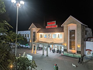
Kathgodam railway station is railway station located in Kathgodam town near Haldwani, just 35 km from Nainital Town in Nainital district of Uttarakhand State of India.
Ramnagar railway station is a small railway station in Nainital district, Uttarakhand. Its code is RMR. It serves Ramnagar city. The station consists of four platforms. The nearest airport is Pantnagar Airport at the distance of 55 km.
Sani Udiyar is a village situated in Kanda Tehsil in Bageshwar district in the State of Uttarakhand, India. It is located at a distance of 15 kilometres (9.3 mi) from Kanda and 36 kilometres (22 mi) from Bageshwar. Sani Udiyar is a medium-sized village with total 88 families residing. It has substantial population of people belonging to Schedule Caste.
Aampokhra, or Aam Pokhra, is a village in Uttarakhand, northern India. It is located in Ramnagar tehsil of Nainital district, approximately 81 kilometers from Nainital, the headquarters of the district.
References
- ↑ "Census of India 2011: Search results for Betalghat". Census of India 2011. Ministry of Home Affairs, Government of India. Archived from the original on 28 March 2015. Retrieved 28 March 2015.
- ↑ "Betalghat S.O. Post Office". uttarakhandonline.in Pincode Search. Pan India Internet Pvt. Ltd. (PIIPL). Retrieved 29 March 2015.
29°33′N79°21′E / 29.550°N 79.350°E
| | This article related to a location in the Indian state of Uttarakhand is a stub. You can help Wikipedia by expanding it. |