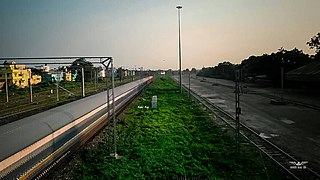
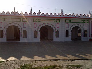
Madhepura is a municipality in Madhepura district in the Indian state of Bihar. It stands at the centre of Kosi ravine, It was called Madhyapura- a place centrally situated which was subsequently transformed as Madhipura into present Madhepura. It is surrounded by Araria and Supaul districts in the north, Khagaria and Bhagalpur districts in the south, Purnia district in the east and Saharsa district in the West.

Saharsa is a city and municipal corporation in the Saharsa District in the eastern part of the state of Bihar, India. It is situated near the eastern banks of the Kosi River. It serves as the administrative headquarters for Saharsa District and is also the Divisional headquarters of the Kosi Division.
Supaul is a town and a municipality that is headquarters of Supaul district in the Indian state of Bihar. Supaul is the administrative headquarters of this district. There Are 11 block under the Supaul district Supaul, Kishanpur, Saraigarh-Bhaptiyahi, Pipra, Triveniganj, Raghopur, chhatapur, Nirmali, Marauna, Basantpur and pratapganj.

Saharsa is one of the thirty-eight districts of Bihar, India. Saharsa city is the administrative headquarters of this district. Saharsa district is a part of the Kosi Division and it became a district on 1 April 1954 and has subsequently become smaller with other districts being carved from it, most notably Madhepura in 1981.

Kosi division is an administrative geographical unit of Bihar state of India. Saharsa is the administrative headquarters of the division. Currently (2022), the division consists of Saharsa district, Madhepura district, and Supaul district.
Banmankhi Bazar is a town and a notified area in Purnia district in the state of Bihar, India.

Bhupendra Narayan Mandal University is the state government university situated at district headquarters, Madhepura. B. N. Mandal University, Madhepura came into existence on the 10th of January, 1992. It acts as an affiliating institution and offers undergraduate,post graduate and PhD programs through its constituents, affiliated colleges, and institutes in Madhepura and nearby cities. The university conducts various vocational [BBA Honors,BCA,MBA,MCA] and technical courses in Science, commerce, arts and also in engineering and Medical science.
Dhabouli is a village located in Saharsa district of Bihar state, India.The total geographical area of village is 2555.92 hectares. Madhepura is nearest town to Dhabauli which is approximately 10 km away. The primary occupation is farming, but now many people have migrated to places like Delhi and Mumbai for work. A number of people of this village are also working in offices of the state, central governments of India and Private sector. More than 25000 people have been living here since the origin of this area. The village has three panchayats and a population of more than 25,000. The village has good telecom connectivity. The village has also a branch of State Bank of India.

Saharsa Assembly constituency is an assembly constituency in Saharsa district in the Indian state of Bihar.

The Barauni–Katihar, Saharsa and Purnia sections of the Barauni–Guwahati line connects Barauni, Saharsa, Purnia and Katihar in the Indian state of Bihar.
Mahishi is a village situated in the Saharsa district of northern Bihar. It is 16 kilometers west of the Saharsa district headquarters and 8 kilometers west of Bangaon, Bihar. It is place of utmost religious importance due to Shaktipeeth of Goddess Ugratara. People of the village speak Maithili. The western Kosi embankment is only a few hundred meters away.
Baghwa is a village situated in the south west corner of Saharsa district in the north Indian state of Bihar. It is a small village by population, but its area is not that small. This village is also known as IAS/IPS officer village. It is surrounded by two water channels, being Sathrath and Balwa dhar (koshi) which part it from Khagaria.

Uttar Bihar Gramin Bank is a regional rural bank (RRB) in the State of Bihar, India. It is under the ownership of Ministry of Finance, Government of India. It is one of the largest regional rural banks in India in terms of branch network, staff strength and area of operation.

Purnea Junction railway station, is the railway station serving the city of Purnea in the Purnea district in the Indian state of Bihar. It is a A category railway station of Katihar railway division in Northeast Frontier Railway.
National Highway 231 is a National Highway in India.It connects Maheshkhunt, Saharsa, Madhepura, Purnia and Kora.

Majhaul is a large Village in Nauhatta Block in Saharsa District of Bihar State of India, with total 700-800 families residing. It belongs to Kosi Division.
Nauhatta is a large village in Nauhatta Block in Saharsa District of Bihar state, India. It belongs to Kosi Division. It is located 20 km towards North from District headquarters Saharsa. 165 km from State capital Patna. It comes under Mahisi constituency. The village had a population of 25,347 of which 13,124 were male while 12,223 were females as per Population Census 2011.
Saharsa Junction railway station is a main railway station in Saharsa district, Bihar. Its code is SHC. It serves Kosi Division area. The station consists of 5 platforms.This railway junction has been certified by ISO:14001:2015 for environmental management. Due to less railway facility, less expansion of rail network in Supaul & Madhepura district's people used to catch trains from Saharsa instead of their own stations. It is the main railway junction of Kosi division.

Saharsa College of Engineering is a government engineering college managed by the Department of Science, Technology and Technical Education, Bihar. It is affiliated with Bihar Engineering University, Patna and approved by All India Council for Technical Education. College was established in the year 2017. It is situated in Saharsa district of Bihar.


