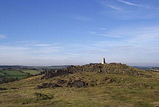
Upper Bacombe and Lower Bacombe are two hamlets in the parish of Wendover, in Buckinghamshire, England. They are located to the south east of the main town, on and at the foot of Bacombe Hill, which is a Local Nature Reserve, and part of the Bacombe and Coombe Hills Site of Special Scientific Interest.

Charnwood Forest is a hilly tract in north-western Leicestershire, England, bounded by Leicester, Loughborough and Coalville. The area is undulating, rocky and picturesque, with barren areas. It also has some extensive tracts of woodland, and significant Precambrian geology. Its elevation is generally 600 feet (180 m)and upwards, the area exceeding this height being about 6,100 acres (25 km2). The highest point, Bardon Hill, is 912 feet (278 m). On its western flank lies an abandoned coalfield, with Coalville and other former mining villages, now being regenerated and replanted as part of the National Forest. The M1 motorway, between junctions 22 and 23, cuts through Charnwood Forest.

Cooper's Hill is an 18.1-hectare (45-acre) biological Site of Special Scientific Interest in Ampthill in Bedfordshire. It was notified under Section 28 of the Wildlife and Countryside Act 1981 in 1984, and the planning authority is Central Bedfordshire Council. A smaller area of 12.7 hectares is also a Local Nature Reserve, Part of the site is managed by the Wildlife Trust for Bedfordshire, Cambridgeshire and Northamptonshire.

Charnwood Lodge is a 134.2-hectare (332-acre) biological and geological Site of Special Scientific Interest in Charnwood Forest, east of Coalville in Leicestershire. It is a national nature reserve, and contains two Geological Conservation Review sites. It is managed by the Leicestershire and Rutland Wildlife Trust.

Maulden Church Meadow is a 4.1-hectare (10-acre) biological Site of Special Scientific Interest in Maulden in Bedfordshire. It was notified in 1987 under section 28 of the Wildlife and Countryside Act 1981, and the local planning authority is Central Bedfordshire Council. Most of it is also a Local Nature Reserve, owned and managed by Central Bedfordshire Council.

Mowsbury Hill is a 2.8 hectare Local Nature Reserve and Scheduled Monument in north Bedford. It is owned and managed by Bedford Borough Council with the assistance of the Friends of Putnoe Wood and Mowsbury Hillfort.

Hill Rise is a 0.9 hectare Local Nature Reserve (LNR) located in the Harpur area of Bedford. It is owned and managed by Bedford Borough Council.

Greens Norton Pocket Park is a 2-hectare (4.9-acre) Local Nature Reserve in Greens Norton in Northamptonshire. It is owned and managed by Green Norton Parish Council.

Bradlaugh Fields is a 60-hectare (150-acre) open space in Northampton. The site is a former golf course. In 1987 it was proposed to build housing on the site, but after a campaign by local residents it was acquired by Northampton Borough Council and opened as a wildlife park in 1998. It was named after Charles Bradlaugh, a leading nineteenth century radical and atheist who was MP for Northampton. Three fields with a total area of 17.5 hectares are managed by the Wildlife Trust for Bedfordshire, Cambridgeshire and Northamptonshire as a nature reserve also called Bradlaugh Fields. Hills and Holes is at the southern end and two adjoining meadows, Scrub Field and Quarry Field, are at the northern end. Hills and Holes is an 8.3 hectare Local Nature Reserve (LNR) and Scrub Field is a 5.1-hectare (13-acre) LNR.

Maidscross Hill is a 44.8-hectare (111-acre) biological Site of Special Scientific Interest on the eastern outskirts of Lakenheath in Suffolk. It is a Nature Conservation Review site, Grade I, and larger area of 49.8 hectares is a Local Nature Reserve.

Broom Hill, Hadleigh is a 9.6 hectares Local Nature Reserve in Hadleigh in Suffolk. It is owned and managed by Babergh District Council.

Lucas Marsh is a 1.5 hectare Local Nature Reserve in Oadby in Leicestershire. It is part of Brock's Hill Country Park, and is owned by Oadby and Wigston Borough Council and managed by the Leicestershire and Rutland Wildlife Trust.

Breedon Cloud Wood and Quarry is a 63.3 hectares biological and geological Site of Special Scientific Interest north-east of Worthington in Leicestershire. It is a Geological Conservation Review site. An area of 33 hectares is managed as a nature reserve by the Leicestershire and Rutland Wildlife Trust.

Glen Parva or Glen Hills is an 11.9 hectares Local Nature Reserve in Glen Parva on the south-western outskirts of Leicester. It is owned and managed by Blaby District Council, Leicestershire County Council and Glen Parva Parish Council

Kirby Frith is a 2.1-hectare (5.2-acre) Local Nature Reserve on the western outskirts of Leicester. It is owned and managed by Leicester City Council.


