Harborough is a local government district in Leicestershire, England. It is named after its main town, Market Harborough, which is where the council is based. The district also includes the town of Lutterworth and numerous villages and surrounding rural areas. In the north of the district it includes parts of the Leicester Urban Area, notably at Thurnby, Bushby and Scraptoft. Covering 230 square miles (600 km2), the district is the largest by area of the eight districts in Leicestershire and covers almost a quarter of the county.

The Leicestershire and Rutland Wildlife Trust (LRWT) is one of 46 wildlife trusts across the United Kingdom. It manages nature reserves in Leicestershire and Rutland, and was founded in 1956 as the Leicestershire and Rutland Trust for Nature Conservation. As of January 2018, it has over 16,000 members, a staff of about 25 and more than 500 volunteers. It is based in Leicester, and is managed by a Council of Trustees which is elected by the members. It is a charity which covers all aspects of nature conservation, and works to protect wild places and wildlife.

Scraptoft is a village in Leicestershire, England. It has a population of about 1,500, measured at the 2011 census as 1,804. It lies north of the A47 road east of Leicester, and runs directly into the built up area of Thurnby and Bushby to the south. For local government the village forms part of the district of Harborough, and constitutes a civil parish.
Thurnby Lodge is an estate in eastern Leicester, Leicestershire, England. Roughly, it consists of the area inside the city boundary which is north of the Uppingham Road, east of the A563 outer ringroad, and south of the Scraptoft Lane.

The Watermead Country Park is a network of artificial lakes in the valley of the River Soar and the old Grand Union Canal, in and to the north of Leicester and in and to the south of the Borough of Charnwood in Leicestershire. The southern part of the park, which includes the Hill and the Mammoth is located in Rushey Mead. It runs north to south along the path of the watercourses, with Birstall to the west and Thurmaston to the east. The parks provide bird watching, fishing and watersports facilities, and are managed by a partnership of Leicestershire County Council, Leicester City Council and Charnwood Borough Council.
Thurnby and Scraptoft railway station was a railway station in Thurnby, Leicestershire on the Great Northern Railway Leicester branch. Thurnby & Scraptoft railway station was situated approximately four miles east of Leicester Belgrave Road station.

Launde Big Wood is a 41.1 hectares biological Site of Special Scientific Interest east of Leicester. It is part of Launde Woods nature reserve, which is owned by the Leicester Diocesan Board of Finance and managed by the Leicestershire and Rutland Wildlife Trust.

Thurncourt is an electoral ward and administrative division of the city of Leicester, England. The population of the ward at the 2011 census was 10,596. It comprises the suburb and housing estate of Thurnby Lodge in eastern Leicester.

Aylestone Meadows is an 8.8-hectare (22-acre) Local Nature Reserve in Leicester, England, United Kingdom. It is owned and managed by Leicester City Council.

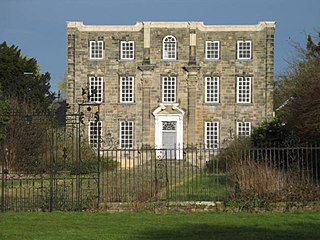
Scraptoft Hall is a former Georgian country house in the village of Scraptoft, Leicestershire, England. A Grade II* listed building, it has since been converted to apartments.

Sutherland Grange is a 3.2-hectare (7.9-acre) Local Nature Reserve on the northern outskirts of Dedworth, a suburb of Windsor in Berkshire. It is owned and managed by the Royal Borough of Windsor and Maidenhead.

Burbage Wood and Aston Firs is a 51.1-hectare (126-acre) biological Site of Special Scientific Interest in Leicestershire.

Humberstone Park LNR is a 2.4 hectare Local Nature Reserve in Leicester. It is owned and managed by Leicester City Council.

Glen Parva or Glen Hills is an 11.9 hectares Local Nature Reserve in Glen Parva on the south-western outskirts of Leicester. It is owned and managed by Blaby District Council, Leicestershire County Council and Glen Parva Parish Council

Birstall Meadows is a 15.6 hectares Local Nature Reserve east of Birstall in Leicestershire. It is part of Watermead Country Park, and is owned and managed by Leicester City Council.

Goss Meadows is a 2.8 hectares Local Nature Reserve on the north-western outskirts of Leicester. It is owned and managed by Leicester City Council.

The Orchards is a 6.6 hectares Local Nature Reserve in Leicester. It is owned by Leicester City Council and managed by Groundwork and volunteers.

Kirby Frith is a 2.1-hectare (5.2-acre) Local Nature Reserve on the western outskirts of Leicester. It is owned and managed by Leicester City Council.

Knighton Spinney is a 2.9-hectare (7.2-acre) Local Nature Reserve in Leicester. It is owned by Leicester City Council and managed by Environ for the council.


