Derbyshire Wildlife Trust is one of 46 local Wildlife Trusts around the UK working to promote and protect local wildlife. It covers the whole of Derbyshire and was founded in 1962 in response to environmental threats to the local countryside, since when it has continued to grow. The Trust is now based at East Mill on the River Derwent in the town of Belper, Derbyshire. It is a Registered Charity, supported by more than 14,000 members and over 500 volunteers.
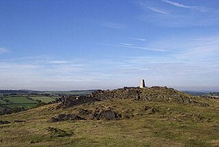
Charnwood Forest is a hilly tract in north-western Leicestershire, England, bounded by Leicester, Loughborough and Coalville. The area is undulating, rocky and picturesque, with barren areas. It also has some extensive tracts of woodland; its elevation is generally 600 feet (180 m) and upwards, the area exceeding this height being about 6,100 acres (25 km2). The highest point, Bardon Hill, is 912 feet (278 m). On its western flank lies an abandoned coalfield, with Coalville and other former mining villages, now being regenerated and replanted as part of the National Forest. The M1 motorway, between junctions 22 and 23, cuts through Charnwood Forest.
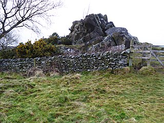
The Leicestershire and Rutland Wildlife Trust (LRWT) is one of 46 wildlife trusts across the United Kingdom. It manages nature reserves in Leicestershire and Rutland, and was founded in 1956 as the Leicestershire and Rutland Trust for Nature Conservation. As of January 2018, it has over 16,000 members, a staff of about 25 and more than 500 volunteers. It is based in Leicester, and is managed by a Council of Trustees which is elected by the members. It is a charity which covers all aspects of nature conservation, and works to protect wild places and wildlife.

Cherry Hinton Pit is a 12.8-hectare (32-acre) biological Site of Special Scientific Interest (SSSI) on the south-eastern outskirts of Cambridge. The site consists of East Pit and most of the smaller West Pit. East Pit is part of the Limekiln Close and East Pit Local Nature Reserve, which is managed by the Wildlife Trust for Bedfordshire, Cambridgeshire and Northamptonshire under the name Cherry Hinton Chalk Pits. West Pit is a separate Local Nature Reserve (LNR).

Warton Crag is a limestone hill in north west Lancashire, England. It lies to the north west of Warton village, in City of Lancaster district. At 163 metres (535 ft) it is the highest point in the Arnside and Silverdale Area of Outstanding Natural Beauty, and is listed as a "HuMP" or "Hundred Metre Prominence", having a "drop" or "prominence" of 126 metres (413 ft) with its parent being Hutton Roof Crags. Two areas are Local Nature Reserves, called Warton Crag and Warton Crag Quarry. Different sections are owned by Lancashire County Council, the Wildlife Trust for Lancashire, Manchester and North Merseyside, Lancaster City Council and the Royal Society for the Protection of Birds.
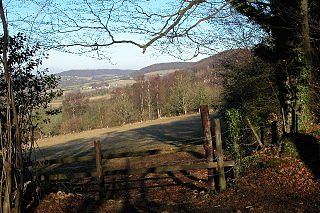
Bull Cross, The Frith and Juniper Hill is a 42.33-hectare (104.6-acre) biological and geological Site of Special Scientific Interest in Gloucestershire, notified in 1954. The site is listed in the ‘Stroud District’ Local Plan, adopted November 2005, Appendix 6 as an SSSI and Regionally Important Geological Site (RIGS).

Newbold Quarry Park is a nature reserve in Newbold-on-Avon, around 1½ miles north-west of Rugby town centre, Warwickshire, England. It consists of a former water-filled quarry surrounded by woodlands and covers an area of 10.50 hectares. It is managed by the Warwickshire Wildlife Trust on behalf of Rugby Borough Council.

Ashwell Quarry and Quarry Springs is a three hectare nature reserve managed by the Herts and Middlesex Wildlife Trust near Ashwell in Hertfordshire. Ashwell Quarry is owned by a local farmer, and Quarry Springs by Hertfordshire County Council. It is a Regionally Important Geological Site.

Limekiln Close and East Pit is a 10 hectare Local Nature Reserve (LNR) in Cherry Hinton, on the south-eastern outskirts of Cambridge. It is managed by the Wildlife Trust for Bedfordshire, Cambridgeshire and Northamptonshire as Cherry Hinton Chalk Pits. East Pit is part of the Cherry Hinton Pit biological Site of Special Scientific Interest, which excludes Limekiln Close but includes the neighbouring West Pit.
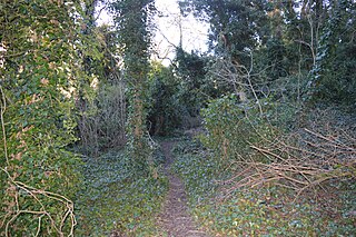
West Pit is a 4.3 hectare Local Nature Reserve in Cherry Hinton, on the south-eastern outskirts of Cambridge. It is part of the Cherry Hinton Pit biological Site of Special Scientific Interest (SSSI), which includes the neighbouring East Pit.

Bradlaugh Fields is a 60-hectare (150-acre) open space in Northampton. The site is a former golf course. In 1987 it was proposed to build housing on the site, but after a campaign by local residents it was acquired by Northampton Borough Council and opened as a wildlife park in 1998. It was named after Charles Bradlaugh, a leading nineteenth century radical and atheist who was MP for Northampton. Three fields with a total area of 17.5 hectares are managed by the Wildlife Trust for Bedfordshire, Cambridgeshire and Northamptonshire as a nature reserve also called Bradlaugh Fields. Hills and Holes is at the southern end and two adjoining meadows, Scrub Field and Quarry Field, are at the northern end. Hills and Holes is an 8.3 hectare Local Nature Reserve (LNR) and Scrub Field is a 5.1-hectare (13-acre) LNR.

Stonesby Quarry is a 3.2 hectares biological Site of Special Scientific Interest between Stonesby and Waltham on the Wolds in Leicestershire. It is part of a 4 hectare nature reserve managed by the Leicestershire and Rutland Wildlife Trust.

Breedon Cloud Wood and Quarry is a 63.3 hectares biological and geological Site of Special Scientific Interest north-east of Worthington in Leicestershire. It is a Geological Conservation Review site. An area of 33 hectares is managed as a nature reserve by the Leicestershire and Rutland Wildlife Trust.
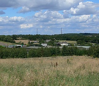
Billa Barra Hill is a 20.7 hectares Local Nature Reserve north of Stanton under Bardon in Leicestershire. It is owned and managed by Hinckley and Bosworth Borough Council.

Kirtlington Quarry is a 3.1-hectare (7.7-acre) geological Site of Special Scientific Interest west of Kirtlington in Oxfordshire. It is a Geological Conservation Review site, and it is part of the 7.4-hectare (18-acre) Kirtlington Quarry Local Nature Reserve.


