
North West Leicestershire is a local government district in Leicestershire, England. The towns in the district include of Ashby-de-la-Zouch, Castle Donington, Coalville and Ibstock. Notable villages in the district include Donington le Heath, Ellistown, Hugglescote, Kegworth, Measham, Shackerstone, Thringstone and Whitwick.

Coalville is a town in the district of North West Leicestershire, Leicestershire in the East Midlands of England. In 2011, it had a population of 34,575. It lies on the A511 between Leicester and Burton upon Trent, close to junction 22 of the M1 motorway where the A511 meets the A50 between Ashby-de-la-Zouch and Leicester. It borders the upland area of Charnwood Forest to the east of the town.
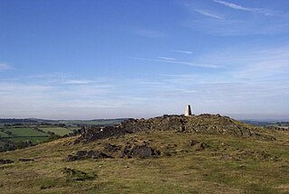
Charnwood Forest is a hilly tract in north-western Leicestershire, England, bounded by Leicester, Loughborough and Coalville. The area is undulating, rocky and picturesque, with barren areas. It also has some extensive tracts of woodland, and significant Precambrian geology. Its elevation is generally 600 feet (180 m)and upwards, the area exceeding this height being about 6,100 acres (25 km2). The highest point, Bardon Hill, is 912 feet (278 m). On its western flank lies an abandoned coalfield, with Coalville and other former mining villages, now being regenerated and replanted as part of the National Forest. The M1 motorway, between junctions 22 and 23, cuts through Charnwood Forest.
Snibston Colliery Ground was a cricket ground in Coalville, Leicestershire. The land for the cricket ground was originally set aside for the miners at Snibston Colliery. Snibston Colliery was used as an outground by Leicestershire following the Second World War, with the county first playing there against Glamorgan in 1957 County Championship. Leicestershire player there intermittently until 1982, playing eight first-class matches there, plus a single List A one-day match against Glamorgan in the 1970 John Player League. The loss of first-class cricket at Snibston Colliery coincided with a downturn in fortune of the colliery. Snibston Grange Cricket Club continued to play at and maintain the ground, with Coalville Town F.C. moving to part of the ground in 1995 and establishing their Owen Street Sports Ground there. The cricket club folded in 2013, leaving Coalville Town F.C. as the sole tenant of the site.

Snibston is an area and former civil parish east of Ravenstone, now in the parish of Ravenstone with Snibstone, in the North West Leicestershire district, in the county of Leicestershire, England. Originally rural, part of Snibston was transformed into a coal mining village by the opening of coal mines by the Snibston Colliery Company in the early 1830s. This industrial part of Snibston was subsequently subsumed into the developing town of Coalville, though small rural areas of Snibston survive within the civil parishes of Ravenstone with Snibston and Hugglescote and Donington le Heath. In the part of Snibston within the latter civil parish stands the 13th-century church of St Mary, noted as the smallest church still in use for regular worship in England. The main Snibston Colliery was sunk in 1831, and after its closure the Snibston Country Park with the Snibston Discovery Museum was built on part of the colliery site. Part of the park is Snibston Grange Local Nature Reserve.

Swannington is a former mining village situated between Coalville and Ashby-de-la-Zouch, Leicestershire, England. A document of 1520 mentions five pits at Swannington. It was a terminus of the early (1832) Leicester and Swannington Railway that was built to serve the townships of Swannington and Thringstone and is built on a spot reputedly chosen by William Wordsworth, a frequent guest of Sir George Beaumont of nearby Coleorton Hall. It is possible that the dedication of the church to Saint George is derived from its association with this George Beaumont.
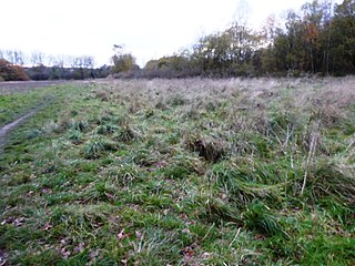
Coalville Meadows is a 6.0 hectares biological Site of Special Scientific Interest between Whitwick and Coalville in Leicestershire. It is managed by the Friends of Holly Hayes Wood.

Charnwood Lodge is a 134.2-hectare (332-acre) biological and geological Site of Special Scientific Interest in Charnwood Forest, east of Coalville in Leicestershire. It is a national nature reserve, and contains two Geological Conservation Review sites. It is managed by the Leicestershire and Rutland Wildlife Trust.
Hugglescote and Donington le Heath is a civil parish in North West Leicestershire, England. It includes the villages of Hugglescote and Donington le Heath, each of which is about 1 mile (1.6 km) south of the centre of Coalville. The population of the civil parish at the 2011 census was 4,446.

Bardon Hill Quarry is a 58.2-hectare (144-acre) geological Site of Special Scientific Interest east of Coalville in Leicestershire. It is a Geological Conservation Review site.
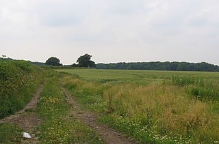
Burbage Wood and Aston Firs is a 51.1-hectare (126-acre) biological Site of Special Scientific Interest in Leicestershire.
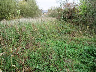
Lucas Marsh is a 1.5 hectare Local Nature Reserve in Oadby in Leicestershire. It is part of Brock's Hill Country Park, and is owned by Oadby and Wigston Borough Council and managed by the Leicestershire and Rutland Wildlife Trust.

Grace Dieu and High Sharpley is an 86 hectare biological and geological Site of Special Scientific Interest between Coalville and Shepshed in Leicestershire. Grace Dieu Quarry is a Geological Conservation Review site.

Nature Alive is a 5.7 hectares Local Nature Reserve in northern outskirts of Coalville in Leicestershire. It is owned and managed by North West Leicestershire District Council.

New Lount is a 21.3 hectares Local Nature Reserve north-east of Ashby-de-la-Zouch in Leicestershire. It is owned and managed by Leicestershire County Council.
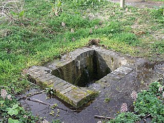
North Kilworth Nature Reserve is a 2.0 hectares Local Nature Reserve in North Kilworth Leicestershire. It is owned and managed by Harborough District Council, Millennium Green Trustee Management Group and Leicestershire County Council.
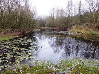
Moira Junction is a 3.5-hectare (8.6-acre) Local Nature Reserve north of Moira in Leicestershire. It is owned and managed by Leicestershire County Council.

Saltersford Wood or Saltersford Valley is a 5.7-hectare (14-acre) Local Nature Reserve north-west of Measham in Leicestershire. It is owned and managed by Leicestershire County Council, and it part of The National Forest. The wood is situated 1 km (0.62 mi) South East of the Saltersford Valley Picnic Area, a twinned Local Nature Reserve also administered by Leicestershire County Council. The two are now separated by Ashby Road and the Donisthorpe Cemetery.

Halstead Road Centenary Pasture is a 3.2-hectare (7.9-acre) local nature reserve in Mountsorrel, Leicestershire. It is owned and managed by Charnwood Borough Council.


