Broxtowe is a local government district with borough status in Nottinghamshire, England, west of the City of Nottingham. The population of the district as taken at the 2011 Census was 109,487. It is part of the Nottingham Urban Area. Broxtowe's neighbour to the west is the borough of Erewash, which is in Derbyshire.

The Leicestershire and Rutland Wildlife Trust (LRWT) is one of 46 wildlife trusts across the United Kingdom. It manages nature reserves in Leicestershire and Rutland, and was founded in 1956 as the Leicestershire and Rutland Trust for Nature Conservation. As of January 2018, it has over 16,000 members, a staff of about 25 and more than 500 volunteers. It is based in Leicester, and is managed by a Council of Trustees which is elected by the members. It is a charity which covers all aspects of nature conservation, and works to protect wild places and wildlife.

Knighton is a residential suburban area of Leicester, in the Leicester district, in the ceremonial county of Leicestershire, England. It situated between Clarendon Park to the north, Stoneygate to the east, Oadby and Wigston to the south and the Saffron Lane estate to the west.

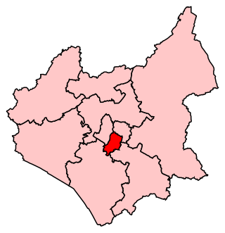
Leicester South is a constituency, recreated in 1974, represented in the House of Commons of the UK Parliament since 2011 by Jonathan Ashworth of the Labour Co-op Party. A previous version of the seat existed between 1918 and 1950. Except for a 2004 by-election when it was won by the Liberal Democrats, Leicester South has been held by the Labour Party since 1987.

The Watermead Country Park is a network of artificial lakes in the valley of the River Soar and the old Grand Union Canal, in and to the north of Leicester and in and to the south of the Borough of Charnwood in Leicestershire. The southern part of the park, which includes the Hill and the Mammoth is located in Rushey Mead. It runs north to south along the path of the watercourses, with Birstall to the west and Thurmaston to the east. The parks provide bird watching, fishing and watersports facilities, and are managed by a partnership of Leicestershire County Council, Leicester City Council and Charnwood Borough Council.

Leicester City Council is a unitary authority responsible for local government in the city of Leicester, England. It consists of 54 councillors, representing 22 wards in the city, overseen by a directly elected mayor. It is currently controlled by the Labour Party and has been led by Mayor Sir Peter Soulsby since his election on 6 May 2011. The main council building is City Hall on Charles Street, but council meetings are held in the 19th-century Town Hall.

Spinney Hills is an inner city area of Leicester, England. It is situated to the north of the core Highfields area, around Spinney Hill Park. To the north is Northfields, to the east North Evington, to the west is the railway line, and to the south is the main part of Highfields. It is also a ward of the City of Leicester whose population at the 2011 census was 25,561.

Aylestone Meadows is an 8.8-hectare (22-acre) Local Nature Reserve in Leicester, England, United Kingdom. It is owned and managed by Leicester City Council.

The Spinney, Carshalton is a 0.4 hectare local nature reserve in Carshalton in the London Borough of Sutton, England. It is owned by Sutton Council and managed by the council and Sutton Nature Conservation Volunteers. It used to be managed by the London Wildlife Trust.

Bradlaugh Fields is a 60-hectare (150-acre) open space in Northampton. The site is a former golf course. In 1987 it was proposed to build housing on the site, but after a campaign by local residents it was acquired by Northampton Borough Council and opened as a wildlife park in 1998. It was named after Charles Bradlaugh, a leading nineteenth century radical and atheist who was MP for Northampton. Three fields with a total area of 17.5 hectares are managed by the Wildlife Trust for Bedfordshire, Cambridgeshire and Northamptonshire as a nature reserve also called Bradlaugh Fields. Hills and Holes is at the southern end and two adjoining meadows, Scrub Field and Quarry Field, are at the northern end. Hills and Holes is an 8.3 hectare Local Nature Reserve (LNR) and Scrub Field is a 5.1-hectare (13-acre) LNR.

Burbage Wood and Aston Firs is a 51.1-hectare (126-acre) biological Site of Special Scientific Interest Leicestershire.

Humberstone Park LNR is a 2.4 hectare Local Nature Reserve in Leicester. It is owned and managed by Leicester City Council.

Glen Parva or Glen Hills is an 11.9 hectares Local Nature Reserve in Glen Parva on the south-western outskirts of Leicester. It is owned and managed by Blaby District Council, Leicestershire County Council and Glen Parva Parish Council

Birstall Meadows is a 15.6 hectares Local Nature Reserve east of Birstall in Leicestershire. It is part of Watermead Country Park, and is owned and managed by Leicester City Council.

Goss Meadows is a 2.8 hectares Local Nature Reserve on the north-western outskirts of Leicester. It is owned and managed by Leicester City Council.

The Orchards is a 6.6 hectares Local Nature Reserve in Leicester. It is owned by Leicester City Council and managed by Groundwork and volunteers.

Scraptoft Nature Reserve is a 14.3 hectares Local Nature Reserve in Scraptoft, on the eastern outskirts of Leicester. It is owned and managed by Leicester City Council.

Kirby Frith is a 2.1-hectare (5.2-acre) Local Nature Reserve on the western outskirts of Leicester. It is owned and managed by Leicester City Council.


