
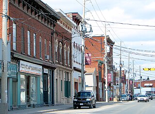
Actinolite is a compact rural community within geographic Elzevir Township in the Municipality of Tweed, Hastings County in Central Ontario, Canada. It is on Ontario Highway 37, just south of Ontario Highway 7 and north of the village of Tweed. The community also lies on the Skootamatta River just north of that river's mouth at the Moira River.

Hastings County is located in the province of Ontario, Canada. Geographically, it is located on the border of Eastern Ontario and Central Ontario. Hastings County is the second-largest county in Ontario, after Renfrew County, and its county seat is Belleville, which is independent of Hastings County. Hastings County has trademarked the moniker "Cheese Capital of Canada".
Tweed is a municipality located in central-eastern Ontario, Canada, in Hastings County.
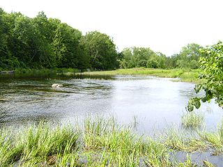
The Moira River is a river in Hastings County in eastern Ontario, Canada. It travels from its source in the centre of the county to the Bay of Quinte at the county seat Belleville.
Marmora is the largest community in the Municipality of Marmora and Lake in Hastings County, Ontario, Canada. It is located on the Crowe River and along Highway 7 between Havelock to the west and Madoc to the east, about the halfway point between Ottawa and Toronto.
Hastings was a federal electoral district represented in the House of Commons of Canada from 1968 to 1979. It was located in the province of Ontario. This riding was created in 1966 from parts of Hastings South and Hastings—Frontenac ridings.

Wollaston is an incorporated township in Hastings County, Ontario, Canada. The township had a population of 670 in the Canada 2016 Census.
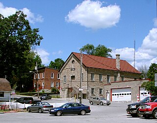
Deloro is a community in geographic Marmora Township in the Municipality of Marmora and Lake, Hastings County in Central Ontario, Canada. Deloro is about 200 kilometres (120 mi) southwest of Ottawa and 65 kilometres (40 mi) east of Peterborough. The Deloro Mine site sits along the banks of the Moira River, along the east side of the community. During the gold rush days, after striking gold in Eldorado in 1866, prospectors built at least 25 shafts on the area now known as the Deloro Mine Site.

Queensborough is an unincorporated community in the municipality of Tweed, Hastings County, in Central Ontario, Canada. It is located north of Ontario Highway 7 on the Black River, about 20 kilometres (12 mi) north-west of the village of Tweed and 15 kilometres (9.3 mi) north-east of the town of Madoc.
The Coldwater River is a river in the Unorganized North Part of Algoma District in Northeastern Ontario, Canada. It is in the Great Lakes Basin, is a tributary of Lake Superior, and its entire course lies within Lake Superior Provincial Park.
The Black River is a river in the municipality of Sioux Narrows-Nestor Falls, Kenora District in Northwestern Ontario, Canada. It is part of the Hudson Bay drainage basin, and is a tributary of the Lake of the Woods.

The Black River is a river in Cochrane District and Timiskaming District in Northeastern Ontario, Canada. It is part of the James Bay drainage basin, and is a right tributary of the Abitibi River. The municipality of Black River-Matheson is named after the river.
The Black River is a river in Thunder Bay District in Northwestern Ontario, Canada. It is part of the Great Lakes Basin, and is a left tributary of the Pic River.
The North River is a river in the municipality of Havelock-Belmont-Methuen, Peterborough County in Central Ontario, Canada. It is part of the Great Lakes Basin, and is a right tributary of the Crowe River.
The Dunrankin River is a river in Algoma District and Sudbury District in northeastern Ontario, Canada. It is in the James Bay drainage basin, begins at Upper Dunrankin Lake and is a left tributary of the Kapuskasing River.
The Shawmere River is a river in Sudbury District in northeastern Ontario, Canada. It is in the James Bay drainage basin, and is a left tributary of the Ivanhoe River.
The Fire River is a river in Algoma District in northeastern Ontario, Canada. It is in the James Bay drainage basin, and is a left tributary of the Missinaibi River.
The Makobe River is a river in northeastern Ontario, Canada. It is in the Saint Lawrence River drainage basin, and is a left tributary of the Montreal River.
The Jocko River is a river in Nipissing District in Northeastern Ontario, Canada. It is in the Saint Lawrence River drainage basin, is a right tributary of the Ottawa River, and lies entirely within Jocko Rivers Provincial Park.
Riley Creek is a stream in the Great Lakes Basin in Central Ontario, Canada. It flows south from its source at Riley Lake in geographic Ryde Township in the municipality of Gravenhurst, District Municipality of Muskoka, to its mouth as a right tributary of the Black River in geographic Dalton Township in the city of Kawartha Lakes. The Black River flows via the Severn River to Georgian Bay on Lake Huron.

