Moira River

Last updated
Moira River
Moira River.jpg
Moira River on a warm afternoon
Canada Southern Ontario relief location map.jpg
Red pog.svg
Location of the mouth of the Moira River in southern Ontario.
EtymologyNamed after Francis Rawdon-Hastings, Earl of Moira
Location
Country Canada
Province Ontario
Region Central Ontario
County Hastings
Physical characteristics
SourceGunter
  location Tudor and Cashel
  coordinates 44°52′58″N77°31′50″W / 44.88278°N 77.53056°W / 44.88278; -77.53056
  elevation360 m (1,180 ft)
Mouth Bay of Quinte
  location
Belleville
  coordinates
44°09′36″N77°23′02″W / 44.16000°N 77.38389°W / 44.16000; -77.38389
  elevation
74.1 m (243 ft)
Length98 km (61 mi)
Basin features
River system Lake Ontario drainage basin
Tributaries 
  leftPalliser Creek, Chrysal Creek, Parks Creek, Clare River, Sulphide Creek, Skootamatta River, Black River, Madoc Creek
  rightGawley Creek, Jordan River

The Moira River is a river in Hastings County in eastern Ontario, Canada. It travels from its source in the centre of the county to the Bay of Quinte at the county seat Belleville .

Contents

Name

Originally named the Sagonaska River by the indigenous peoples of the area, the river was renamed in 1807 by the British colonial government (Upper Canada) after Francis Rawdon-Hastings, Earl of Moira. [1] Rawdon-Hastings fought in the American Revolutionary War and had a political career in England, but has no connection with the site. [1] The name Sagonaska continues to be used in the Belleville area, as the name of a bridge over the Moira, and the name of a public school.

Course

The Moira River begins at an unnamed lake in the more northern Tudor geographic township portion of the municipality of Tudor and Cashel at an elevation of 303 metres (994 ft). It flows south into the township of Madoc, passes through Wolf Lake at an elevation of 276 metres (906 ft), is crossed by Highway 62, and takes in the right tributary Jordan River at the settlement of Bannockburn, before heading south. The river loops east then back west under the highway at Keller Bridge and continues south to the west of Eldorado. The river takes a sharp turn west, before taking in the right tributary Gawley Creek and heading south again at Malone in the municipality of Marmora and Lake. It passes through Deloro Lake and over the Deloro Dam at Deloro at an elevation of 200 metres (656 ft), and is crossed by Highway 7. The Moira then heads east, enters the township of Stirling-Rawdon, and empties into Bend Bay on Moira Lake at an elevation of 154 metres (505 ft), south of the community of Madoc, where it takes in the left tributary Madoc Creek. The river continues east from the lake, enters the municipality of Tweed and takes in the left tributaries Black River and Skootamatta River. It then heads south through the village of Tweed, Ontario into Stoco Lake at an elevation of 138 metres (453 ft), where it takes in the left tributaries Sulphide Creek and Clare River. The river leaves the lake via two channels, an eastern channel Moira River and the named West Channel, which enclose Sugar Island. It heads southwest, and is paralleled by Highway 37 from Tweed all the way to Belleville. The river flows past Chisholm's lumber Mills, [2] through the northwest corner of the township of Tyendinaga and enters the city of Belleville, continuing southeast. It takes in the right tributaries Chrysal Creek and Palliser Creek, flows over the Belleville Yardmen Dam through the former Laziers Dam Site, the McLeod Dam and the Lott Dam and reaches its mouth at the Bay of Quinte, Lake Ontario.

Watershed

While the Moira river itself is entirely within Hastings County, the watershed includes parts of the next two counties to the east, Lennox and Addington (one east) and Frontenac (two east). Tributaries of the Clare River extend into the township of Central Frontenac in Frontenac County. The Clare River also is in the townships of Stone Mills and Addington Highlands in Lennox and Addington County. The Skootamatta River and tributitaries flow through Addington Highlands as well. The tributaries also extend further north in Hastings County than the Moira itself. For example, Partridge Creek in the Skootamatta system extends past Upper Partridge Lake to 44° 57′ 28″ North in the more northerly Cashel portion of the township of Tudor and Cashel.

Spring run-off on the Moira River, March 1975 Moira River Spring Runoff.jpg
Spring run-off on the Moira River, March 1975

Tributaries

See also

Related Research Articles

<span class="mw-page-title-main">Hastings County</span> County in Ontario, Canada

Hastings County is located in the province of Ontario, Canada. Geographically, it is located on the border of Eastern Ontario and Central Ontario. Hastings County is the second-largest county in Ontario, after Renfrew County, and its county seat is Belleville, which is independent of Hastings County. Hastings County has trademarked the moniker "Cheese Capital of Canada".

<span class="mw-page-title-main">Skootamatta River</span> River in Ontario, Canada

The Skootamatta River is a river in the Lake Ontario drainage basin in Hastings and Lennox and Addington Counties in Ontario, Canada. It flows from Joeperry Lake to join the Moira River in Tweed. The river's name is thought to come from Ojibwa words meaning "burnt shoreline".

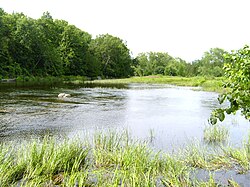
Partridge Creek is a creek in the Moira River and Lake Ontario drainage basins in Hastings and Lennox and Addington Counties, Ontario, Canada.

The Clare River is a river that is part of the Moira River system in the Lake Ontario drainage basin in Hastings and Lennox and Addington Counties, Ontario, Canada.

Flinton Creek is a creek in the Moira River and Lake Ontario drainage basins in Hastings and Lennox and Addington Counties in Ontario, Canada.

Elzevir Creek is a creek in the Moira River and Lake Ontario drainage basins in Tweed, Hastings County in Central Ontario, Canada.

Elzevir Lake is a lake in the Moira River and Lake Ontario drainage basins in Tweed, Hastings County, Ontario, Canada.

Grimsthorpe Lake is a lake in the Moira River and Lake Ontario drainage basins that straddles the border between Tweed, Hastings County and Addington Highlands, Lennox and Addington County in Ontario, Canada.

Deerock Lake is a lake in the Moira River in Tweed, Hastings County and Addington Highlands, Lennox and Addington County in Ontario, Canada.

Merrill Creek is a creek in the Moira River and Lake Ontario drainage basins in Hastings and Lennox and Addington Counties, Ontario, Canada.

Merrill Lake is a lake in the Moira River and Lake Ontario drainage basins that straddles the border between the Cashel portion of Tudor and Cashel, Hastings County and Addington Highlands, Lennox and Addington County in Ontario, Canada.

Whitefish Lake is a lake in the Moira River and Lake Ontario drainage basins on the border between the Cashel portion of Tudor and Cashel, Hastings County and Addington Highlands, Lennox and Addington County in Ontario, Canada.

Rainy Creek is a creek in the Moira River and Lake Ontario drainage basins in Addington Highlands, Lennox and Addington County, Ontario, Canada.

Killer Creek is a creek in the Moira River and Lake Ontario drainage basins in Addington Highlands, Lennox and Addington County, Ontario, Canada.

Little Skootamatta Creek is a creek in the Moira River and Lake Ontario drainage basins in Hastings and Lennox and Addington Counties in Ontario, Canada. The river's name is thought to come from Ojibwa words meaning "burnt shoreline".

Jacksons Lake is a small lake in the Moira River and Lake Ontario drainage basins in Addington Highlands, Lennox and Addington County, Ontario, Canada.

Chrysal Creek is a creek in the Moira River and Lake Ontario drainage basins in Belleville and Quinte West, Hastings County, Ontario, Canada.

Number Ten Creek is a creek in the Moira River and Lake Ontario drainage basins in Belleville, Hastings County, Ontario, Canada.

Sulphide Creek is a creek in the Moira River and Lake Ontario drainage basins in Tweed, Hastings County and Addington Highlands, Lennox and Addington County in Ontario, Canada.

<span class="mw-page-title-main">Black River (Hastings County)</span> River in Ontario, Canada

The Black River is a river in Hastings County in Central Ontario, Canada. It is part of the Great Lakes Basin, and is a left tributary of the Moira River.

References

  1. 1 2 Smith 2013, p. 217.
  2. French, Orland. "Chisholm's just lumbers on and on". hastingshistory.ca. Retrieved 2022-07-04.

Sources