Windsor Forest and Great Park is a 1,778.9-hectare (4,396-acre) biological Site of Special Scientific Interest in Berkshire and Surrey, located south of Windsor. It is a Special Area of Conservation and Windsor Forest is a Nature Conservation Review site, Grade I. Landscaped woodland gardens are Grade I listed on the Register of Historic Parks and Gardens of Special Historic Interest. Windsor Great Park is a Royal Park of 2,020 hectares, including a deer park,
Charterhouse to Eashing is a 68.4-hectare (169-acre) biological Site of Special Scientific Interest west of Godalming in Surrey.

Chiddingfold Forest is a 542.5-hectare (1,341-acre) biological Site of Special Scientific Interest in Chiddingfold in Surrey and West Sussex. One part of it, Fir Tree Copse, is a nature reserve which is managed by the Surrey Wildlife Trust

Colony Bog and Bagshot Heath is a 1,130.5-hectare (2,794-acre) biological Site of Special Scientific Interest between Camberley and Woking in Surrey. Part of it is a Nature Conservation Review site, Grade I. It is part of the Thames Basin Heaths Special Protection Area and the Thursley, Ash, Pirbright and Chobham Special Area of Conservation. It includes Brentmoor Heath, a Local Nature Reserve which is managed by the Surrey Wildlife Trust

Combe Bottom is a 42.1-hectare (104-acre) biological Site of Special Scientific Interest north of Shere in Surrey. It is designated a Local Nature Reserve called Shere Woodlands, and is managed by the Surrey Wildlife Trust.
Esher Commons is a 360.1-hectare (890-acre) biological Site of Special Scientific Interest south-west of Esher in Surrey. It includes Esher Common, Fairmile Common, West End Common and Oxshott Heath. Esher Common and West End Common are Local Nature Reserves.

Glover's Wood is a 74.5-hectare (184-acre) biological Site of Special Scientific Interest east of Charlwood in Surrey. It is a Nature Conservation Review site, Grade 2.

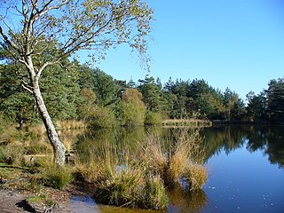
Moor Park is a 6.7-hectare (17-acre) biological Site of Special Scientific Interest east of Farnham in Surrey.

Ockham and Wisley Commons is a 266-hectare (660-acre) biological Site of Special Scientific Interest east of Woking in Surrey. It is also a Local Nature Reserve and part of the Thames Basin Heaths Special Protection Area. It is part of the slightly larger area of 297-hectare (730-acre) Wisley & Ockham Commons & Chatley Heath nature reserve, which is owned by Surrey County Council and managed by the Surrey Wildlife Trust.

Sheepleas is a 99.9-hectare (247-acre) biological and geological Site of Special Scientific Interest east of Guildford in Surrey. It is a Geological Conservation Review site and a Local Nature Reserve. It is owned by Surrey County Council and managed by the Surrey Wildlife Trust.

Vann Lake and Ockley Woods is a 57.8-hectare (143-acre) biological Site of Special Scientific Interest south of Ockley in Surrey. Vann Lake is part of Vann Lake and Candy's Copse, a nature reserve managed by the Surrey Wildlife Trust.

Redwell Wood is a 52.8 hectare biological Site of Special Scientific Interest near South Mimms in Hertfordshire. The local planning authority is Welwyn Hatfield District Council.
Quendon Wood is a 32.1 hectare biological Site of Special Scientific Interest in Quendon in Essex.

Farningham Wood is a 74.2-hectare (183-acre) biological Site of Special Scientific Interest east of Swanley in Kent. It is also a Local Nature Reserve. It is owned and managed by Sevenoaks District Council and Farningham Parish Council.

Blindley Heath SSSI is a 26.3-hectare (65-acre) biological Site of Special Scientific Interest in the hamlet Blindley Heath, on the southern outskirts of Godstone in Surrey. It is also a Local Nature Reserve. It is owned by Godstone Parish Council and managed by the Surrey Wildlife Trust

Leith Hill SSSI is a 337.9-hectare (835-acre) biological Site of Special Scientific Interest south-east of Dorking in Surrey. The SSSI consists of four wooded areas surrounding Leith Hill.
Thursley, Hankley and Frensham Commons is a 1,878.5-hectare (4,642-acre) biological Site of Special Scientific Interest west of Godalming in Surrey. Thursley and Hankley Commons are Nature Conservation Review sites, Grade I. An area of 115.1 hectares is a Local Nature Reserve called The Flashes and an area of 180 hectares is the Elstead Group of Commons, a nature reserve managed by the Surrey Wildlife Trust. Thursley Common is a National Nature Reserve. An area of 265.7 hectares is the Thursley & Ockley Bogs Ramsar site. The site is a Special Protection Area and part of the Thursley, Ash, Pirbright & Chobham Special Area of Conservation.

The Flashes is a 115.1-hectare (284-acre) Local Nature Reserve west of Godalming in Surrey. It is owned by the National Trust and managed by Waverley Borough Council. It is part of Thursley, Hankley and Frensham Commons Sites of Special Scientific Interest, Thursley, Ash, Pirbright & Chobham Special Area of Conservation and Thursley, Hankley & Frensham Commons Special Protection Area,

West End Common is a 70.3-hectare (174-acre) Local Nature Reserve on the north-western outskirts of Esher in Surrey. It is owned and managed by Elmbridge Borough Council. It is part of Esher Commons, which is a Site of Special Scientific Interest.

St Martha's Hill and Colyer's Hanger is a 38-hectare (94-acre) nature reserve north of Chilworth in Surrey. It is owned by the Albury Estate and managed by the Surrey Wildlife Trust on behalf of Surrey County Council. Colyers Hanger is a Site of Special Scientific Interest and a Nature Conservation Review site, Grade 2. Earth circles, which are probably associated with tree planting for Chilworth Manor, are a Scheduled Monument.