Blacksyke Tower

Last updated

Blacksyke Tower Engine House
Riccarton, East Ayrshire, Scotland
UK grid reference NS415352
Blacksyke Tower. An old engine house, Caprington, East Ayrshire - detailed view from the west.jpg
Remnants of Blacksyke Tower
Scotland relief location map.jpg
Red pog.svg
Blacksyke Tower Engine House
Coordinates 55°35′06″N4°30′54″W / 55.5851°N 4.5151°W / 55.5851; -4.5151
TypeA mock Scottish Tower house or castle
Site information
OwnerCaprington Golf Club
Open to
the public
Yes
ConditionA ruin
Site history
Built18th century
Built byCunninghames of Caprington Castle
In use18th and 19th centuries
MaterialsStone

The Blacksyke Tower, Blacksyke Engine House, Caprington Colliery Engine House or even Lusk's Folly [1] is a Scheduled Monument associated with a double lime kiln complex in the Parish of Riccarton and is a building of national importance. The Blacksyke site is a significant survival of early coal and lime industries. The engine house's mock Gothic tower house style is very unusual and rare survival of its type. This late-18th-century engine house would be one of the oldest surviving examples of its kind in the United Kingdom. The track bed of the wagonway and several sidings that linked the complex with the Kilmarnock and Troon Railway can still be clearly made out. [2]

Contents

History

In Scots a 'syke' is a small stream, often drying up in summer, that meanders through a hollow or across flat or boggy ground and the 'black' component may suggest peaty ground. A fair description of this low-lying area prone to flooding. [3]

The Blacksyke Tower

The ground floor and access arch Blacksyke Tower south access, old engine house, Caprington, East Ayrshire.jpg
The ground floor and access arch

A Newcomen atmospheric pumping engine may have been installed here, used to remove water that entered the workings in this low-lying area [4] and owing to its prominent location in the Caprington Castle estate grounds it was camouflaged to look like a folly of a typical Scottish tower house although the wooded nature of the estate and its distance from Caprington Castle would not have necessarily interfered with the view from the home of the estate owners. [5] The upper part of the building is thought to have been added to add the effect of a romantic ruin and the change in stone can be seen at the two gable ends. [6]

The Carron Iron Works supplied the engine at a time when the more efficient Boulton and Watt steam engines were available however coal was plentiful on site and an annual patent payment was not required for Newcomen engines. [2] The Newcomen engine drained the mine to a depth of around 50 metres which was sufficient to allow the miners to work the Blind Coal seam. [4]

The engine house ruins show that a considerable amount of attention to detail was undertaken to build the tower house with an authentic appearance, although the walls are not unduly thick, with a reportedly vaulted ground level, a water spout; randomly placed windows; a corbelled parapet on the east and south side; crow-stepped gables and on the north-east a turret that was once a chimney as evidenced by soot within and two access flue, one from within the main building. The four walls of this rectangular structure (6.0 by 8.0m and only 0.7m thick) were rubble-built and the corners have dressed stone quoins. [7] The south-facing gable end has a crow-step feature which is slightly offset from the main wall and has the roof angle trace marked upon it. The stone type and quality of the crow-step feature and the side building to the west suggest that they were later structures and that the castle-features were a later addition to a previously normal engine house. The iron supports for a drainpipe are located on the south-facing gable end.

A similarly built lower lean-to building, with corbels, adjoins the western side of the tower, which may have later housed the supply of coal or a boiler and furnace. The lean-to building to the west shows evidence of being a later addition as it encloses has a blocked up window in the main tower. An entry to the soot-stained chimney flu is also present here indicating the presence of a fire producing waste gases. A more powerful replacement James Watt steam engine would require a much larger boiler and this would require the later addition of a new building with a connection to the chimney as is found here. James Watt's patent expired in the year 1800.

A substantial arch gives access to the south-facing ground floor level, typical of many engine houses. A lean-to building is shown on the east side in the 1850s and two rectangular water bodies with a path running from the intersection of the engine house and the supposed farm building to a detached small square roofed building. [8]

It is recorded that a flag pole on the tower was used to signal that coal was waiting to be uplifted and wagons would be hauled to the colliery along the railway, making it an early form of signal box and it is also suggested that tokens were given in at the tower for each wagon as a way of keeping a tally of the number of loads of coal produced. [9] A coal pit lay just to the east of the tower. [10]

A number of alterations have taken place over the years with several windows and a door blocked up with stone [2] and it was used as a store. The tower stands close to a set of buildings that included a school, later becoming a Sunday school and the changes it exhibits suggest that a later use was found for the building. The building is stated to have served as a workshop for the coalfield and the nearby buildings were offices. The remains of a flag pole are still present on the north-east turret. [1] The school may have also been used for pupils from Earlston that is located near by and easily reached via the trackbed of the old railway. [11]

The Earlston Newcomen Atmospheric Beam engine

The added side building with castellated features Blacksyke Tower side building, Caprington, East Ayrshire.jpg
The added side building with castellated features

The location of the site from which the 1770s Newcomen Atmospheric Beam engine now housed in the National Museum of Scotland originally came was the 'Caprington Colliery' with its numerous pits and the pumping engine located in Earlston and an old photograph of that engine house that does not resemble the Blacksyke Tower. This engine was donated by Colonel Cunninghame of Caprington to the town of Kilmarnock in 1901 after it had worked for 95 years and after some restoration work by Glenfield and Kennedy it was housed in the Dick Institute for many years until it was considered unsafe and donated to the National Museum of Scotland in 1958. In 1998 it was restored and placed on display with a partial replica engine house and powered by electricity (see videos). [9]

The engine had its wooden beam replaced by a cast-iron one in 1837 and the 96-inch-long cast iron cylinder had a 30-inch bore and a stroke of 54 to 60 inches. [9] It is not clear where the water was pumped to as no streams are shown in the immediate area although two artificial water bodies or tanks are shown near by.

The Lime Kilns

The kiln eye, metal box and bars Blacksyke Lime Kilns, Caprington, East Ayrshire - one of the kiln eyes - west side.jpg
The kiln eye, metal box and bars

The twin lime kiln is shown on the first 1860 OS map, but was disused and the wagonways lifted by the time of the OS Second Edition map of 1897. [2] An inclined embankment runs up to the top of the lime kilns up which wagons would have carried coal and limestone to charge the kilns. The kiln eyes are still in good condition and unusually the rectangular iron box and grate bars from which the quicklime was removed, a hazardous procedure, especially in wet weather. A railway line ran to the north-west and north-east so that the lime kiln sat in a V-shaped area between them. [12]

Poor-quality coal was often used, and the smoke from the kilns was very polluting, a constant hazard as the kilns were operational continuously for a week or so at a time. Water was added and the resultant slaked lime was used for lime-washing walls or for spreading on acid ground to reduce acidity and improve soil structure. Quicklime could also spread directly on the ground and in the eighteenth century, its use was often a requirement set down in farm leases. [13]

The rail network

The route of the old railway running west from the tower. Blacksyke Tower waggonway, view to the west. Caprington, East Ayrshire.jpg
The route of the old railway running west from the tower.

Sir William Cunninghame of Caprington Castle opened the 4-km or 2.5-mile long horse drawn mineral Fairlie Branch off the Kilmarnock and Troon Railway that ran across the River Irvine to the collieries in the Fairlie area in 1818. [14] The tower was built before this time although it may have undergone alterations. This line became the standard gauge Fairlie Branch of the Glasgow and South-Western Railway with an extensive network of lines serving a number of coal pits, at least nine, one line running on through Earlston to Blacksyke and beyond. [14]

By 1896 the rail network had been lifted on the 'Earlston' branch although it remained in use as far as the Earlston sawmill. Part of the old line is a public footpath and its course is marked by single or double hedgerows. [1]

Blacksyke and the miners Rows

The north-western end wall of the lime kilns Blacksyke Lime Kilns, Caprington, East Ayrshire - end walling - view from the east.jpg
The north-western end wall of the lime kilns

The ruins of a fairly substantial and basically U-shaped building, probably once a farm, survives at Blacksyke, located close by and slightly to the south-east of the tower and once connected by a lane to the nearby Ayr Road. An attached building is recorded on the 1896 OS maps as a school for the children of the colliers, estate workers, etc. [15] and in 1908 [16] it is shown as a Sunday School as by this time the local pits had closed. The OS Name Book of 1855-57 records that the old farm was occupied by labourers employed by the then proprietor Thomas Smith Cunningham Esq. of Caprington Castle. [17]

The Burnbank miners or colliers row known as the 'Peace and Plenty' stood on the Ayr Road opposite Loreny. Blacksyke is shown on the 1832 map by Thomson. [18] The small miners' row at Laputa once lay further down on the west side of the road to Ayr. [18] This unusual name may relate to the flying island of Laputa in the 1726 book Gulliver's Travels by Jonathan Swift.

See also

Related Research Articles

<span class="mw-page-title-main">Kilmarnock</span> Burgh in East Ayrshire, Scotland

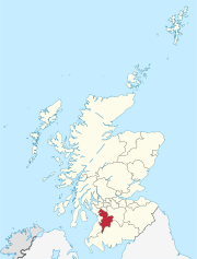
Kilmarnock is a town, former burgh, and administrative centre of East Ayrshire Council, in East Ayrshire, Scotland.

<span class="mw-page-title-main">Troon</span> Town and sea port in Scotland

Troon is a town and sea port in South Ayrshire, situated on the west coast of Ayrshire in Scotland, about eight miles north of Ayr and three miles northwest of Glasgow Prestwick Airport.

The Kilmarnock and Troon Railway was an early railway line in Ayrshire, Scotland. It was constructed to bring coal from pits around Kilmarnock to coastal shipping at Troon Harbour, and passengers were carried.

Thorntoun School was opened by Barnardo's in September 1971 for children with emotional difficulties aged 11 to 16 years. The school closed in 1990 and Thorntoun is now a nursing home. The complex lies between the villages of Springside and Crosshouse, Kilmarnock in East Ayrshire, Scotland. The old Thorntoun mansion house was demolished in the late 1960s, leaving the West Lodge, some of the home farm outbuildings, the stables and the walled garden as 'memorials' to the ancient history of the site. Many fine trees remain from the estate policies and the surviving gardens are very well maintained (2007). An entrance with a slight deviation from the old course has been created to serve the large modern buildings which house the nursing home.

<span class="mw-page-title-main">Laigh Milton Viaduct</span> Bridge in Laigh Milton mill at Gatehead in East Ayrshire, Scotland

Laigh Milton Viaduct is a railway viaduct near Laigh Milton mill to the west of Gatehead in East Ayrshire, Scotland, about five miles west of Kilmarnock. It is probably the world's earliest surviving railway viaduct on a public railway, and the earliest known survivor of a type of multi-span railway structure subsequently adopted universally.

The village or hamlet of Gatehead is lin East Ayrshire, Kilmaurs, Scotland. It is one and a quarter miles from Crosshouse and one and a half miles from Kilmarnock. In the 18th and 19th centuries the locality was a busy coal mining district. The settlement runs down to the River Irvine where a ford and later a bridge was located.

<span class="mw-page-title-main">Springside, North Ayrshire</span> Village in North Ayrshire, Scotland, UK

Springside is a village in the parish of Dreghorn, in the council area of North Ayrshire, Scotland. It is three miles from Irvine, 1+12 miles west of Crosshouse, and four miles from Kilmarnock. In the 18th, 19th and mid-20th centuries, the locality was a highly industrialised coal mining district. The settlement is on the Garrier Burn, which forms the boundary with East Ayrshire. Springside had a population of around 1364 in 1991. The A71 now bypasses the village, 14 mile to the south.

Knockentiber is a village in East Ayrshire, Parish of Kilmaurs, Scotland. Knockentiber is two miles west-northwest of Kilmarnock and 12 mile northeast of Crosshouse. Latitude:55.6193°N Longitude:4.5455°W and grid reference NS397392. The population was 359 in 1991, however the population is much higher following the construction of several housing estates (2007). In the 18th and 19th and mid 20th centuries the locality was a highly industrialised coal mining district. The settlement is on the Carmel Burn, which runs into the River Irvine, around one mile to the south.

Riccarton is a village and parish in East Ayrshire, Scotland. It lies across the River Irvine from Kilmarnock, this river forming the boundary between Riccarton and Kilmarnock parishes, and also between the historical districts of Kyle and Cunningham. The name is a corruption of 'Richard's town', traditionally said to refer to Richard Wallace, the uncle of Sir William Wallace. The parish also contains the village of Hurlford.

Fergushill is a small community in North Ayrshire, Parish of Kilwinning, Scotland. The Barony of Fergushill was held by the Fergushill family of that Ilk and the area has a complex history.

<span class="mw-page-title-main">Industry and the Eglinton Castle estate</span>

The Eglinton Castle estate was situated at Irvine, on the outskirts of Kilwinning, North Ayrshire, Scotland in the former district of Cunninghame. Eglinton Castle, was once home to the Montgomeries, Earls of Eglinton and chiefs of the Clan Montgomery. Eglinton Country Park now occupies part of the site.

<span class="mw-page-title-main">Symington, South Ayrshire</span> Human settlement in Scotland

Symington is a conservation village in South Ayrshire, Scotland. It is located in Symington parish, covering 0.41 square kilometres, and lies close to the A77 road from Ayr to Glasgow. Its church, built in 1160, remains one of the finest examples of a Norman church in Scotland.

<span class="mw-page-title-main">Shewalton House and estate</span> Human settlement in Scotland

Shewalton House and estate were composed of the 'Lands of Shewalton' and the laird's dwelling, originally a tower castle and later a mansion house on the River Irvine in the Shewalton area, two miles from Irvine and west of Drybridge village, East Ayrshire, Dundonald Parish, Scotland. In 1883 the Boyle's estate of Shewalton was 2,358 acres in extent in Ayrshire and was worth at that time £2,708 a year.

The old village or hamlet of Old Rome, Rome or Old Rome Ford is located in South Ayrshire, Parish of Dundonald, Scotland. It is one and a half miles from Crosshouse and one and less than a quarter of a mile from Gatehead. In the 18th and 19th centuries the locality was a busy coal mining district and many of the houses have been demolished. The settlement is situated near the River Irvine.

<span class="mw-page-title-main">Towerlands Tram Road</span>

The Towerlands Tram Road was a 19th-century mineral railway or 'Bogey line' that transported coal, running from the old Towerlands Colliery and associated coal pits near Bourtreehill to Irvine in one direction and to Dreghorn in the other direction. Both towns are located in North Ayrshire, Scotland.

The Glasgow and South Western Railway operated a number of cross-country lines in Ayrshire.

<span class="mw-page-title-main">Earlston, East Ayrshire</span> Human settlement in Scotland

Earlston is a hamlet in Riccarton, East Ayrshire, Scotland. The habitation dates from at least the early 18th century and is near Caprington Castle and Todrigs Mill. It was for many years the site of a large sawmill and a mine pumping engine, and had sidings of the Glasgow and South-Western Railway's Fairlie Branch.

<span class="mw-page-title-main">Wanlockhead beam engine</span>

The Wanlockhead beam engine is located close to the Wanlock Water below Church Street on the B797 in the village of Wanlockhead, Parish of Sanquhar, Dumfries and Galloway, Scotland. The site is in the Lowther Hills above the Mennock Pass, a mile south of Leadhills in the Southern Uplands. This is the only remaining original water powered beam engine in the United Kingdom and still stands at its original location. It ceased working circa 1910 after installation circa 1870.

What now survives of the old Caprington Loch (NS402352) is situated near Earlston, Riccarton, East Ayrshire, Scotland. The loch was a natural feature, sitting in a hollow on the old Caprington Castle estate. The loch waters drain via the Todrigs Burn that flows into the River Irvine to the east of Gatehead village. It was partly drained, probably sometime after the 1820s, as were so many other lochs, as part of 18th and 19th centuries extensive agricultural improvements and the only area of open water that remains does so as it was once used as a curling pond for the Caprington Castle Estate owners and their employees or tenants.

<span class="mw-page-title-main">Bickering Bush</span> Scottish thorn near Caprington, linked to legend of Sir William Wallace

The Bickering bush (NS41863635) thorn grew near Caprington on the lands of Monksholm or Maxholm, Riccarton, East Ayrshire, Scotland. The old farm house at Maxholm sat in hollow on the old Caprington Castle estate and to the north and west its fields bordered the River Irvine. The thorn was located, as recorded on the OS map, near to the confluence of the Kilmarnock Water and the River Irvine, downstream of the Simon's Burn's confluence on the south bank of the river.

References

Notes
  1. 1 2 3 Aladair Wham (2013). Ayrshire's Forgotten Railways. The Oakwood Press. p. 136.
  2. 1 2 3 4 "Blacksyke, Engine House" . Retrieved 9 May 2018.
  3. "Dictionary of Scots" . Retrieved 5 June 2018.
  4. 1 2 "Newcomen Engine" . Retrieved 9 May 2018.
  5. Dane Love (2003). Ayrshire:Discovering a County. Fort Publishing Ltd. p. 121.
  6. John R Hume (2004). Vernacular Building in Ayrshire. Ayrshire Archaeological and Natural History Society. p. 55.
  7. "Kilmarnock, Ayr Road, Blacksyke Colliery, Limekiln and Tower" . Retrieved 9 May 2018.
  8. "OS 1843-82" . Retrieved 9 May 2018.
  9. 1 2 3 Aladair Wham (2013). Ayrshire's Forgotten Railways. The Oakwood Press. p. 137.
  10. "OS 1843-82" . Retrieved 9 May 2018.
  11. Graham Kirkpatrick (1992). The Kilmarnock and Troon Railway. An Early Scottish Railway Considered. Back Track. p. 46.
  12. "OS 1843-82" . Retrieved 9 May 2018.
  13. "The Manufacture of Quicklime in Lime Kilns" . Retrieved 9 May 2018.
  14. 1 2 "The Kilmarnock and Troon Railway" . Retrieved 10 May 2018.
  15. "Ayrshire XXIII.5 (Riccarton; Symington) Publication date:1896. Revised:1895" . Retrieved 10 May 2018.
  16. "Ayrshire XXIII.5 (Riccarton; Symington)Publication date:1910. Revised:1908" . Retrieved 13 May 2018.
  17. "Ordnance Survey Name Books of Ayrshire 1855-1857, volume-53/39" . Retrieved 1 August 2018.
  18. 1 2 "John Thomson's Map of Scotland" . Retrieved 10 May 2018.
Sources & further reading