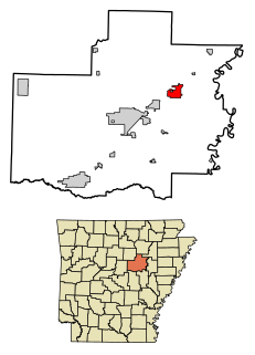
Bald Knob is a city in White County, Arkansas, United States. The population was 2,897 at the 2010 census. Located at the intersection of two of the state's natural regions, Bald Knob is often promoted as "where the Ozarks meet the Delta". Bald Knob is known for its yearly Home Fest held during Mother's Day weekend. It was once known as the leading strawberry producer in the world in the 1950s. Bald Knob was established in 1881.

Porongurup is a small village on the northern slopes of the mountain range in the Shire of Plantagenet in Western Australia. At the 2006 census, Porongurup had a population of 370.
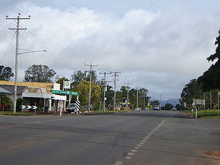
Tolga is a rural town and locality in the Tablelands Region, Queensland, Australia. In the 2016 census, Tolga had a population of 2,718 people.

The City of Rockingham is a council and local government area, comprising the south coastal suburbs of the Western Australian capital city of Perth.
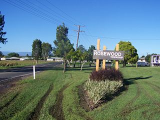
Rosewood is a rural town and locality in the City of Ipswich, Queensland, Australia. In the 2021 census, the locality of Rosewood had a population of 3,263 people.
Irvinebank is a rural town and locality in the Shire of Mareeba, Queensland, Australia. In the 2016 census, the locality of Irvinebank had a population of 125 people.
Gilbert River is a rural locality in the Shire of Etheridge, Queensland, Australia. In the 2016 census Gilbert River had a population of 38 people.
Gilberton is a rural locality in the Shire of Etheridge, Queensland, Australia. In the 2016 census, Gilberton had a population of 4 people.

Miva is a locality split between the Gympie Region and the Fraser Coast Region in Queensland, Australia. > In the 2016 census Miva had a population of 57 people.
Bald Knob is a rural locality in the Sunshine Coast Region, Queensland, Australia. At the 2021 census, Bald Knob had a population of 280 people.
Bracewell is a rural locality in the Gladstone Region, Queensland, Australia. In the 2016 census, Bracewell had a population of 196 people.
Undullah is a rural locality split between the City of Logan and the Scenic Rim Region, Queensland, Australia. In the 2016 census, Undullah had a population of 45 people.
Cultana is a locality on the northeastern part of Eyre Peninsula in South Australia. It is much larger than the original locality, and includes the Australian Army's Cultana Training Area. It includes the former Baxter Detention Centre which operated from 2002 to 2007. It spans the Lincoln Highway and Iron Knob to Whyalla Road, as well as being bordered by the Eyre Highway east of Iron Knob.
Coolabine is a rural locality in the Sunshine Coast Region, Queensland, Australia. In the 2016 census Coolabine had a population of 71 people.
Townson is a rural locality in the Lockyer Valley Region, Queensland, Australia. In the 2016 census, Townson had a population of 38 people.
Woleebee is a locality in the Western Downs Region, Queensland, Australia. In the 2016 census, Woleebee had a population of 95 people.

Moorang is a rural locality in the Scenic Rim Region, Queensland, Australia. In the 2016 census, Moorang had a population of 46 people.
Amber is a rural locality in the Shire of Mareeba, Queensland, Australia. In the 2016 census, Amber had a population of 0 people.
Blue Knob is an unincorporated community and census-designated place (CDP) in Blair County, Pennsylvania, United States. It was first listed as a CDP prior to the 2020 census.
Booerie Creek is a locality in the Northern Rivers region of New South Wales, Australia. In 2021 census, Blue Knob had a population of 130 people.
