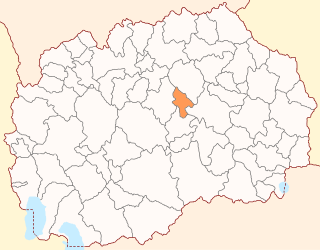
Lozovo is a municipality in eastern Republic of North Macedonia. Lozovo is also the name of the village where the municipal seat is found. Lozovo Municipality is part of the Vardar Statistical Region.

Ambala Division is one of the six divisions of Haryana State of India. The division comprises the districts of Ambala, Kurukshetra, Panchkula and Yamuna Nagar.
Nowy Zbrachlin is a village in the administrative district of Gmina Waganiec, within Aleksandrów County, Kuyavian-Pomeranian Voivodeship, in north-central Poland.

Opielanka is a village in the administrative district of Gmina Topólka, within Radziejów County, Kuyavian-Pomeranian Voivodeship, in north-central Poland. It lies approximately 4 kilometres (2 mi) west of Topólka, 17 km (11 mi) south-east of Radziejów, and 58 km (36 mi) south of Toruń.

Cicimli is a village in the Lachin Rayon of Azerbaijan.
Nəcəflər is a village in the Zangilan Rayon of Azerbaijan.
İkinci Yaşma is a village in the Khizi Rayon of Azerbaijan.
Brudzew is a village in the administrative district of Gmina Błaszki, within Sieradz County, Łódź Voivodeship, in central Poland. It lies approximately 7 kilometres (4 mi) south-east of Błaszki, 17 km (11 mi) west of Sieradz, and 69 km (43 mi) west of the regional capital Łódź.
Gromada is a village in the administrative district of Gmina Tarnawatka, within Tomaszów Lubelski County, Lublin Voivodeship, in eastern Poland.
Mękarzowice is a village in the administrative district of Gmina Czarnocin, within Kazimierza County, Świętokrzyskie Voivodeship, in south-central Poland. It lies approximately 3 kilometres (2 mi) north of Czarnocin, 11 km (7 mi) north of Kazimierza Wielka, and 58 km (36 mi) south of the regional capital Kielce.
Kontrewers is a village in the administrative district of Gmina Mniów, within Kielce County, Świętokrzyskie Voivodeship, in south-central Poland. It lies approximately 5 kilometres (3 mi) north of Mniów and 21 km (13 mi) north of the regional capital Kielce.
Pajewo-Rżyski is a village in the administrative district of Gmina Gołymin-Ośrodek, within Ciechanów County, Masovian Voivodeship, in east-central Poland.
Laryszów is a village in the administrative district of Gmina Zbrosławice, within Tarnowskie Góry County, Silesian Voivodeship, in southern Poland. It lies approximately 4 kilometres (2 mi) north-east of Zbrosławice, 7 km (4 mi) west of Tarnowskie Góry, and 27 km (17 mi) north-west of the regional capital Katowice.
Słuchowo is a village in the administrative district of Gmina Krokowa, within Puck County, Pomeranian Voivodeship, in northern Poland. It lies approximately 13 kilometres (8 mi) west of Krokowa, 30 km (19 mi) west of Puck, and 63 km (39 mi) north-west of the regional capital Gdańsk.
Mielno is a village in the administrative district of Gmina Grunwald, within Ostróda County, Warmian-Masurian Voivodeship, in northern Poland. It lies approximately 26 kilometres (16 mi) south-east of Ostróda and 37 km (23 mi) south-west of the regional capital Olsztyn.
Stare Czarnowo is a village in Gryfino County, West Pomeranian Voivodeship, in north-western Poland. It is the seat of the gmina called Gmina Stare Czarnowo. It lies approximately 21 kilometres (13 mi) east of Gryfino and 20 km (12 mi) south-east of the regional capital Szczecin.
Raņķi parish is an administrative unit of the Skrunda Municipality, Latvia. The parish has a population of 507 and covers an area of 46.48 km².

Commune II (Niamey), also known as Niamey II, is an urban commune in Niger. It is a commune of the capital city of Niamey.

Commune IV (Niamey), also known as Niamey IV, is an urban commune in Niger. It is a commune of the capital city of Niamey.
Ausieniškės Manor is a former residential manor in Ausieniškės village, Elektrėnai Municipality.


